Montagnou de la Lit to Saint-Pé-de-Bigorre

Starting from the Place des Arcades in Saint-Pé-de-Bigorre, enjoy a pleasant, peaceful walk to reach one of the hills sheltering the village, the “Montagnou de la Lit”, to the east. From up there, you can easily reach the entrance to the Grotte de la Résistance and, for the more adventurous, that of the Tute Faiouias.
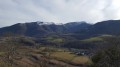
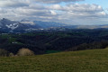
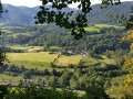
Magnificent views over the Gave de Pau valley and the ridges of the neighbouring peaks of the Saint-Pé massif.
Return via the “Montagnou”, another hill above the village.

Details

223471
Creation:
Last update:
Last review:
  • Walking
    Activity: Walking
  • ↔
    Distance: 2.56 mi
  • ◔
    Average duration: 1h 45 
  • ▲
    Difficulty: Moderate

  • ⚐
    Back to start: Yes
  • ↗
    Ascent: + 659 ft
  • ↘
    Descent: - 659 ft

  • ▲
    Highest point: 1,562 ft
  • ▼
    Lowest point: 1,155 ft

Photos

Description of the walk

Caution The going is very difficult between (2) and (3) and on the descent after (4) due to numerous ferns and thick brambles.

The route starts from the main square in Saint-Pé-de-Bigorre, the Place des Arcades, home to the Town Hall and the Tourist Office.

(S/E) Take Rue du Barry, to the right of the Town Hall, then continue along Rue Labadie (or de l’Abadie) until you reach a five-way junction. Head straight on and go up Rue des Crouzettes, signposted ‘No Through Road’, running along the right-hand side of the garden with the palm tree.
The climb is gentle at first, then becomes steeper with a few short hairpin bends, until you reach the ridge (450m), shortly after the Clotte farm (below the road).
The small tarmac road then turns into a farm track.

(1) At the 424m mark, at a fork in the road between a track and a footpath, turn right onto a descending footpath.
Pass through a livestock gate and emerge onto a path between two fields.
Continue straight on for 30 m, alongside a hedge of fairly tall shrubs.
Enter the woods. Walk for 20 metres.
On the left, below the path, the Fontaine de la Lit and its long trough stand out clearly (a place known as Cloto dé Gaüte).

(2) Leave the fountain and the main path, which skirts round it at the top, on your right.
Look for a faint track on the left, and head straight up a narrow, sometimes muddy path to reach the bypass track to the north of the Montagnou de la Lit (also known as ‘La Lit’ or ‘L’Alit’).
As soon as you join the path, you will be entering private rural land (sometimes fenced with an electric fence, sometimes not), where cattle (and occasionally bulls…) may be grazing. Take the usual precautions when encountering herds.
As soon as possible, begin the ascent of La Lit heading due south, following cattle tracks, off the beaten track and without signposting. Make your way to the modest summit at 477m, winding your way through thickets of brambles and ferns.
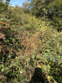
These can be particularly abundant in spring and summer, but they have never completely blocked the path to the summit or, more importantly, the remarkable view to the south. You may need to persevere here at times.
At the summit, take the time to admire the surroundings and capture the beauty of the landscape on film or in your memory (see the section ‘During the walk or nearby’ below).

Make the most of being here to visit two of its most remarkable caves.
This section requires caution and the ability to walk off-trail and on slopes.
Follow the barbed-wire fence due east, staying within the field (and on the side facing the precipice), and descend about thirty metres along the sarrat (the ridge).
Continue down in this way until the slope levels off to the point of becoming almost flat.
On the left, in the meadow, there is a huge sinkhole overgrown with vegetation.

(3) Look for a large, solitary oak tree along the fence. Cross the fence where a faint path is visible all year round.
Twenty metres to the right, on the contour line heading south, lies the entrance to the Grotte de la Résistance, partly hidden by a small vertical rock, in a small clearing 5 metres in diameter with no ferns.
It is fairly easy to spot, as several tracks left by walkers and cavers lead to it. However, this varies depending on the season and, consequently, on the height of the ferns.

NB1: the building shown on the IGN map not far from (3) no longer exists.
NB2: Please note that, as with all caves marked by IGN, the position is not (exactly) as shown on the map; in this case, the exact position is quite a distance from the marker on the map, to the north-east, at least several tens of metres away!
For further information on the cave, see the section ‘During the walk or nearby’ below.

(4) Another track, still following the contour line but much less clearly marked and with a steep gradient, leads to the Tute Faiouias or Fayouye (tute = burrow or cave where an animal lives in Bigourdan/Gascon/Occitan).
Use two trees on the slope, about fifty metres from the entrance to the ‘résistance’, as landmarks.
This final section may be tricky for less mobile walkers or children. If this applies to you, it’s best to avoid it as a precaution!

The return journey follows the same route to the summit of La Lit. Head west from the summit, off the path and unmarked, pass through a few trees and follow the steep slope down through the ferns and a few footpaths towards the foot of La Lit.

You’ll easily rejoin the bypass path (which you left earlier at the Fontaine de la Lit).
Turn left onto this well-marked path.
Don’t miss an old, ruined lime kiln on the left (with a sign from the Tourist Office) and head towards an isolated barn, facing north-south.
Follow its east wall to reach its south gable.

NB: A wide, recently dug track, created by a digger, heads across the field towards the south-west. This track leads to the summit of Montagnou and its remarkable fir tree. However, the owner of the Poueyté farm has written to Visorando asking that people do not cross onto his land, even though there is no fence. So please stay on the main path!

Take the old path, heading south, as shown on the IGN map.
You’ll come to a small tarmac road leading to the aforementioned Poueyté farm.

(5) Then leave the farm on your right without entering the grounds near the buildings, and join theGR®®78path, also marked as route No. 10 by the Saint-Pé Tourist Office or the Way of St James.
Follow this historic path back to the village centre and the Place des Arcades (S/E).

NB: On the way down, you can pass by the picturesque statue of Notre-Dame-du-Montagnou, which watches over the village, on the right just before the first house in the village. (Tourist Office signposting is sometimes missing)


Waypoints

  1. S/E : mi 0 - alt. 1,165 ft - Place des Arcades Saint-Pé-de-Bigorre
  2. 1 : mi 0.89 - alt. 1,388 ft - Leave the track – Take the path to the right
  3. 2 : mi 0.98 - alt. 1,352 ft - Fontaine de Bourdas – turn left
  4. 3 : mi 1.24 - alt. 1,427 ft - Grotte de la Résistance
  5. 4 : mi 1.28 - alt. 1,421 ft - Fayouye Cave (Faiouias)
  6. 5 : mi 2.12 - alt. 1,375 ft - Poueyté Farm – Turn right onto the GR
  7. S/E : mi 2.56 - alt. 1,165 ft - Place des Arcades Saint-Pé-de-Bigorre

Notes

Estimated time
I completed this route in 2 hours, including breaks, stops near the caves and taking photos. That’s quite a short time. Allow 2 hours 30 minutes for experienced walkers, including breaks, and 3 hours for families.

Drinking water
There are no water sources along the walk. Bring what you need.

Shelters
There are only two shelters along the route in case of heavy rain or thunderstorms: the Tute Faiouias (4) and the isolated barn after La Lit, between (4) and (5). At both the start and finish, the Place des Arcades also offers shelter all year round under its arcades and its huge white canvas marquee.

Equipment
In summer, bring the usual equipment for lowland hiking (hiking boots, suitable clothing, rainwear, water, food, etc.).
In winter when there is snow (which is rare at this altitude), you may wish to bring snowshoes for the ascent, sun cream, lip balm, gloves, suitable warm clothing, a hot drink, a hat, and sunglasses suitable for glare off the snow, etc.
In all seasons, bring a map, a GPS or the Visorando app on your smartphone.

Alternative route on the way back
At the isolated barn, head south to quickly join theGR®®78. You’ll save a quarter of an hour, but you’ll miss the view from Montagnou…

Footfall
Very low, especially from the Fontaine de la Lit onwards. Occasionally a few cavers at the Grotte de la Résistance.

Worth a visit

Along the route:
At the summit of Montagnon de la Lit: make your way to the edge of the summit plateau, following a barbed-wire fence, and admire the 180° view from east to west, and the Gave de Pau flowing through the valley. At the foot of the Lit, on the far left (to the east) of the plateau, you look down on the Bataillé farm, formerly the ‘La Grotte aux Fées’ farm campsite.
You can also see several landslides and rockfalls at the foot of the Lit. Indeed, the Lit is a veritable Swiss cheese of limestone, riddled throughout with caves, chasms, rock shelters and sinkholes.

The Grotte de la Résistance is the perfect introductory cave for cavers, offering easy progress, handrails in place, short climbs, an 11-metre shaft, and finally a last handrail leading to the bottom of the cave. Source: CDSC65.
If you don’t mind getting a bit dirty, you can enter the first chamber with no equipment other than a head torch, taking the utmost care as it is slippery and you must watch your head. You cannot proceed to the subsequent chambers without equipment.

This cave was discovered in the 1940s by Father Bernard Abadie. According to some sources, it was, or may have been, used as a weapons and ammunition depot during the Second World War.
For specialist cavers, the route here features a succession of slides, small meanders with handrails, narrow passages, climbing sections, chambers with concretions (including two remarkable quartz panels) and an 11-metre shaft, with the route ending in a gallery within a joint, then in a small chamber at the far end.
Cave-dwelling fauna is frequently found in this cave, consisting mainly of lesser horseshoe bats, troglophilic spiders (probably Meta bourneti) and other insects.

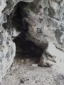
La Tute Faiouias or Fayouye is a small cave that can occasionally be used as a shelter for sheep. It overlooks the RN637 at the Rieulhès junction.
It can be entered without any special equipment or a torch.
According to Abbé Abadie, it served as a landmark for a hermit, a former soldier in Napoleon’s army, originally from the village and locally known as Fayouye. Upon entering, on the right-hand side, in the daylight, one can see a stone on the rock face, engraved with a chisel. The centre of the panel features a dedication to Napoleon I, surrounded by Latin crosses. It reads: ‘GLORY AND HONOUR TO NAPOLEON, LONG LIVE NAPOLEON’, surrounded by Latin crosses and two dates: 1811 and 1818. The names Jean Solité and Cosade have been added, with Pamphile Abadie above them.
''A short video by Jean-Claude Mengelle can be found here.
Source: Patrimoine Lourdes Gavarnie''

Nearby attractions:
- the line of sinkholes and caves scattered along the Montagnou route from Saint-Pé to Peyrouse, largely discovered by Abbé Abadie. To immerse yourself in the majesty and solitude of the Saint-Pé massif and its caverns, read: “Le Sanglier du Picharrot”
- The town of Lourdes.
- The Marian Shrine.
- The Batsurguère Valley.
- The village of Saint-Pé-de-Bigorre: the village itself, its cultural heritage, its events, and the Très Crouts forest.
- The Pibeste-Aoulhet Regional Nature Reserve, water sports.
- The Bétharram Caves
- The Gaves Valley

Always be cautious and plan ahead when you're outdoors. Visorando and the author of this route cannot be held responsible for any accidents occurring on this route.

The GR® and PR® markings are the intellectual property of the Fédération Française de Randonnée Pédestre.

Reviews and comments

3 / 5
Based on 5 reviews

Reliability of the description
3.4 / 5
Ease of following the route
2.6 / 5
Route interest
3 / 5
MCTOUL
MCTOUL

Hello Joe 35,
I’m really sorry to hear that, of course!
But I’m not in control of the plants, especially this year when rain and sunshine have combined to create a real power-boosting mix...

I can’t be any more specific than what’s already in the guidebook:
“…off the beaten track and unmarked. You’ll reach the modest 477-metre summit by making your way through thickets of brambles and ferns.
These can be particularly abundant in spring and summer, but they have never completely blocked the path to the summit or, more importantly, the remarkable view to the south. You sometimes need to persevere here.”

Good luck with your future hikes!

Machine-translated

Joe 35
Joe 35

Overall rating : 1.7 / 5

Date of your route : Jul 11, 2023
Reliability of the description : ★★☆☆☆ Disappointing
Ease of following the route : ★☆☆☆☆ Very disappointing
Route interest : ★★☆☆☆ Disappointing
Very busy route : No

I’m sorry, but I didn’t enjoy this walk at all. Nearly half the route between points 1 and 5 is completely unkempt – it’s full of brambles, stinging nettles, ferns and the like. I tried several times to get back on track, but to no avail. I kept ending up at dead ends overgrown with brambles; my arms and legs still remember it. Even the sections that are actually ‘paths’ are very poorly maintained. In short, a very bad experience.

Machine-translated

Laconut
Laconut

Overall rating : 4.3 / 5

Date of your route : Mar 18, 2021
Reliability of the description : ★★★★★ Very good
Ease of following the route : ★★★★☆ Good
Route interest : ★★★★☆ Good
Very busy route : No

Hike to the caves in March 2021.
The path to the Grotte de la Résistance isn’t very obvious, and the one to La Tute even less so, but you can find them (there are good directions in the guidebook).
However, if you’re planning to visit the caves, I think it’s best to save this walk for late winter or autumn, when the vegetation is less dense, and also when the weather is dry.

Machine-translated

MCTOUL
MCTOUL
• Edited:

What a shame, KIKIDIDA!!!
You’ve got to persevere when you choose to hike off the marked routes.
But honestly, there’s no need for signposting here – the route is so straightforward, and described in great detail by the text, the map and the app to back it up.
Four-fifths of the walk is on a perfectly marked path and one-fifth is off the marked path, though still on cattle tracks.
So, as mentioned in May, there’s no problem reaching the ‘summit’ without encountering brambles or stinging nettles up to waist height (unless you’re deliberately trying to make your way through the brambles).
As for finding the caves, there’s nothing more to say than what’s in the description. It’s not easy when you have no signposts, but in this case it’s child’s play!
Kind regards

Machine-translated

KIKIDIDA
KIKIDIDA

Overall rating : 1.3 / 5

Date of your route : Aug 04, 2017
Reliability of the description : ★★☆☆☆ Disappointing
Ease of following the route : ★☆☆☆☆ Very disappointing
Route interest : ★☆☆☆☆ Very disappointing

The signposting was rather poor; we never managed to find the caves, nor the lime kiln.
If you’re a fan of brambles and stinging nettles, head there – you’ll be in for a treat! You’ll be sinking into them up to your waist!
A lovely view of the Gave, though.

Machine-translated

MCTOUL
MCTOUL
• Edited:

I’d been told that the final stretch to the summit of La Lit had become difficult because of the brambles and ferns...
I had to go and check for myself!
This Saturday the weather isn’t brilliant, but it’s fine; my 15-month-old baby is strapped onto my back and off I go along the ‘normal’ route.
No problem at all tackling the few dozen metres of elevation gain up Montagnou. Up there, everything’s ‘business as usual’!
I can’t imagine it being any worse in spring… There’s plenty of room to get through between the brambles and near the wire fence on the north side; you can definitely see right across the valley and over to the Massif de Saint-Pé!
I set off again feeling reassured; the walk can remain as described.

NB: Since then, in March 2017, controlled burning has cleared away the ferns, grass and brambles, particularly on the north side of Montagnou, towards the two caves. This has made access to them much easier throughout the spring and summer.

Machine-translated

gazok54
gazok54 ★

Thanks, Popss

I’m posting a new walk that includes a section in the same area, trying to clarify how to get to the caves

That’s a good idea – it might help to clarify a few details about this walk.

Machine-translated

Popss
Popss

Overall rating : 3.7 / 5

Date of your route : Aug 12, 2016
Reliability of the description : ★★★★☆ Good
Ease of following the route : ★★★☆☆ Average
Route interest : ★★★★☆ Good

The description of this route is very comprehensive and very well researched – thank you!
I’d like to point out, however, that the climb to the summit at 477m is very difficult due to the dense summer vegetation (August 2016), ferns and lots of impassable brambles. When you reach the summit, there’s… nothing to see, again because of this overgrown vegetation!
What’s more, the Résistants’ Cave isn’t that easy to find, and its location on the IGN map is incorrect!! And that’s not to mention the Tute Faiouias, which is even harder to spot along this steep slope covered in very dense vegetation...
That said, you have to persevere to find these little gems and admire the view over the Gave de Pau valley!
I’m posting a new hike that includes a section in the same area, trying to clarify how to get to the caves.
Best regards.
Popss

Machine-translated

gd65
gd65

Overall rating : 4 / 5

Date of your route : May 25, 2016
Reliability of the description : ★★★★☆ Good
Ease of following the route : ★★★★☆ Good
Route interest : ★★★★☆ Good

A pleasant and well-detailed walk, estimated to take 2 hours but completed in 1 hour 45 minutes.

Machine-translated

Other walks in the area

For more walks, use our search engine .

The GPS track and description are the property of this route's author. Please do not copy them without permission.