


 Country:

 City:


The route starts at the Place des Arcades in Saint-Pé-de-Bigorre.
(S/E) Take Rue du Corps Franc Pommiès (Route de Lourdes) and, after the first junction, turn right into the narrow lane that runs between the houses – the Passage de la Baylotte. At the end, in the small square in front of the care home, turn left into Rue Marca, which leads down to Avenue des Pyrénées. Turn right until you reach a junction with several streets; there, turn right onto a grassy path (not shown on the IGN map) which leads downhill, leaving the house on your left.
Pass by the imposing Fontaine des Bains de Sembres.
Leave it on your right and carry on until you reach the bottom of the street. Continue straight ahead on the flat section of Allée des Terrasses.
(1) Cross the railway line on the left, then the bridge over the Gave (dating from 1878). This will take you to the Bout du Pont neighbourhood.
(2) Pass the Chemin des Grottes on your right and take the road that goes round the block of flats on the right (you’ll take the other route round on the way back).
Admire the wash house on the right, which has been completely renovated by the local residents.
(3) At the next junction, in a charming little square (playfully known as ‘Place de l’Apéro’ by the locals), turn left onto the Chemin des Génies.
(4) At the first Fork in the road, take a short detour to the left to admire the Pont du Diable, then return to the junction and turn onto the tarmac road known as the Chemin du Picharrot.
Follow this path as it gradually winds its way down into the valley of the Génie Longue stream; the houses become fewer and farther between.
Pass the first house on your left, then a second (the old foundry, whose bridge across the Génie has long since been swept away by the torrent…), then the path leading off to the left towards Cantilerie beach.
Finally, pass the very old Mourichi farm on your right, founded by the Saracens as early as the 8th century.
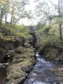
The valley becomes more steep-sided and – even if you stray from it slightly – you can still clearly hear the Génie Longue flowing below on your left.
Pass the access path to Caubole Farm on your right.
(5) At a left-hand bend just before the one by the high-voltage power line, don’t miss a path that branches off to the left, descending steeply towards the stream bed.
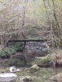
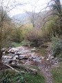
This takes you to the Génie Longue via a wide forest track, which first passes a small clearing (and a path junction on the right leading up to Peyras). You’ll follow the Génie through the undergrowth of American red oaks, chestnut trees and hazel bushes until you reach a magnificent ford and a footbridge renovated in 2016, the Pont de Pène (cross either one depending on the water level of the Génie).
(6) Continue along the wide track until you reach a sharp bend to the left.
Leave the track and cross the bridge straight ahead, which is made of a solid block of marble covered with earth and humus.
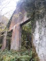
Passing through a group of four monumental columns, you then enter the site of the ruined factory of the former marble quarry. Access is completely unrestricted. You can wander amongst the immense walls of the factory buildings and imagine a whole chapter of this valley’s history, which came to a halt several decades ago.
As you leave the site, continue for a short while along the path to the right.
Pass further ruined buildings and then more monumental marble columns on the right-hand side of the path. It feels as though you’re stepping into a film set here – perhaps even the Forbidden Forest of Hogsmeade in Harry Potter… Hikers will therefore not be surprised if they come across a few magical creatures – werewolves or trolls – and closely packed trees completely covered in thick moss…
The path begins to narrow considerably but remains accessible by bike for a few hundred metres more. Then, suddenly, the path drops down to the banks of the Génie and turns into a footpath, now accessible only to walkers. You’ll have to leave your bikes there.
(7) After a few dozen metres, you’ll reach another footbridge – this is the end of the walk.
Don’t hesitate to come all the way here – it’s a charming spot and ideal for a quick snack or afternoon tea!
The return journey follows the same route, with an alternative route through the Bout du Pont neighbourhood where you can get a better view of the old square (with its tourist office information sign) and the wayside cross.
(3) As you pass the Fork in the road, take a look at the washhouse, which has been restored by local residents.
(2) Then head back along the same path you took on the way out to the Place des Arcades in Saint-Pé (S/E).


 Visorando Member
 Difficult


