Country:

 City:
City:


Park your car in the small car park (maximum 4 or 5 cars) below the entrance to the Monastery of the Sisters of Bethlehem, in Peyras.
From Peyras (S/E) to the Aülhet hut (7) via Coumo Redo (3) and the charcoal kilns
(S/E) The path, which is fairly wide, starts to the right of the entrance gate. Flanked by low walls of large dry stones, it runs horizontally for a few dozen metres and is clearly marked in yellow.
(1) At the first Fork in the road, go straight on (to the left, the path is signposted ‘Cabane d’Aoulhet’).
Choose this route over the usual path to climb up to the Cabane d’Aoulhet (see details in the ‘Practical Information’ section below).
Reach the Ruisseau de la Redo. Ford the stream. Go round the ruin and climb south-west for about a hundred metres. Just behind a tree, at stone marker no. 193, leave the path that descends into the valley and turn right, heading uphill towards the west, in the direction of Coumo Lio.
Numerous stone markers (white and red) dot the massif; they mark the boundary of the undivided Saint Pé–State state-owned forest.
The path is well-defined and fairly wide, but is not signposted at the start. However, you will soon come across some blue spray-painted markings on the trees.
(2) At thefirst Fork in the road, take the hairpin bend to the left to climb up to the Sarrat dets Castets. The path is known as a favourite spot for wild boar hunters, but its route no longer appears on any map. However, there are numerous blue markings.
This old path, though perfectly marked and well-maintained, takes you up to an altitude of around 600 m, where it turns towards the other side of the Serrat, towards the Coumo Redo ravine.
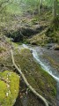
It then continues along this side of the ridge, crossing the boundary of the Saint-Pé ‘Integral Biological Reserve’ (RBI), marked by blue lines on a white background (or simply blue lines) and a signpost (unfortunately broken in March 2017), until it reaches the Redo stream and crosses it via a fine stone slab, just downstream of a modest 1.50 m waterfall (dry in September 2016, but flowing a little in March 2017).
(3) Continue due east along the clearly visible path, although it is narrower and occasionally obstructed by trees lying across the slope. Reach the very steep ravine of a tributary of the Redo, featuring several other charming little waterfalls.
Do not cross the ravine here! Head up the ravine, keeping to the left bank, following a rather uninviting path but one that is clearly marked in orange. A few dozen metres higher up, cross the ravine and continue until you reach Pla de Bers, just below the crossroads marked 824.
(4) The rest of the route is more conventional: take the historic Charbonniers path opposite, known as the Tachouères (badgers in the Bigourdan dialect), leading to Bat Séco (or the Cabane des Italiens) and the Aülhet mountain pastures.
At Pla de Bers, just after the crossroads, don’t miss the old hut and the charcoal burners’ metal vat, to the right of the path. The path is clearly marked in yellow and runs through a tall mountain beech forest. At a bend, you’ll come to another crossroads.
(5) Take the path on the right at this bend to head due west and begin the ascent of the Charbonniers, leaving the continuation of the path towards Bat Séco to your left, heading due south.
You go round the base (first south, then east) of the Puntou de las Crampes (name not shown on the map) at 1,016 m.
You’ll come across yellow markings (though they’re quite old and broad).
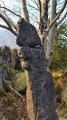
The path passes a remarkable rocky outcrop on the right. In sinkholes and even on the mountainside, you will come across several old metal charcoal kilns (of the Moreau type), abandoned there by their former owner, probably just before the Second World War. There is still charcoal in several of them. This stretch is particularly picturesque. Reach the edge of the forest, leading to a wooden signpost for the nature reserve (RNR Pibeste-Aoulhet).
(6) Continue straight ahead and you’ll soon reach the Aülhet (Aoulhet) Refuge Hut.
From Aülhet (7) to the Pics de Miquéu and d’Hourbilagous (10)
(7) Resume the route by climbing across the grassy slope behind the hut, heading towards the Col d’Espadres (signpost), also marked as Espades on maps. Pass the rock on your right, which bears a commemorative plaque marking a 1944 weapons airdrop.
Head towards the nearest summit, the Soum d’Artigue, and reach the small pass of Aülhet at 1,215 m. Before you lies the vast and beautiful summer pasture of l’Artigue (which means ‘pasture acquired by clearing’ in Occitan). Take the narrow path that winds to your right up the hillside, beneath the rocky massif.
Pass by the drinking troughs and the shelter beneath the rock, then the Fontaine de la Digitale (note as you pass that a pipe channels this spring to the drinking troughs below and to the Aülhet hut). The route is still marked in yellow, but the markings are more widely spaced. Take care not to miss a mark!
Reach the Col de Larbastan (1,350 m), beneath the peak of the same name at 1,368 m.
(8) Continue to the left of the pass, climbing towards the Soum de la Génie Braque.
Climb steeply up the slopes of the Pic de Miquéu and the Pic de Hourbilagous. Leave both of them to your left.
Please note that in winter, the snow-covered northern slopes of this peak are known avalanche zones.
This is the path towards the Cuts d’Ausèth (sinkholes or large funnels, literally ‘birds’ nests’ in Bigourdan).
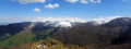
(9) As soon as you emerge from the woods, well before the Col Bosc deth Troncar (1,455 m), head off-trail up the slope towards the Pic de Miquéu. You’ll quickly reach the ridge and continue on to the nearby Pic de Miquéu (1,452 m). Unfortunately, the cairn at the summit has been significantly reduced in size over the years. But from there, the 360° view is magnificent, taking in the valleys below, the surrounding peaks and those further afield, all the way to the main border range.
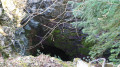
Near the summit, there are three cavities, including one inaccessible hole known as ‘Le Trou Didier’, whilst the other two can be entered safely with just a torch.
From the Pic de Miquéu (10) to Calihourc
(10) Take the return route, passing by the neighbouring Pic d’Hourbilagous (1,461 m). From there, there is nothing particularly noteworthy as the view is less impressive, except that it is slightly higher than its neighbour.
(9) Turn right and follow the route back in the opposite direction to the way out, until you reach the Alhouet Mountain Hut.
(7) Head towards Bat dé Haü, due west, along the path known as the Mesplé, following the contour line and marked in yellow. At the 1,180-metre mark, you’ll reach a beautiful, large clearing with a single tree in the middle, right by the path; this is Couret Béroy.
(11) In the clearing, leave the path and turn right towards the north, heading towards the edge of the woodland. At the edge (inthe second row), you will find a tree marked ‘BA’. Then, in the beech woodland on the ridge of the Serrat dets Castets, take a barely visible, unmarked track known as the ‘Chemin des Brioles’.
There are no official coloured markings, but there are so-called ‘cutting’ markings: from time to time, a small boxwood bush cut at hand height, or a branch, or a mark on a tree.
NB: since 2018: some markers in the form of red dots or dashes on the trees. Descend to WP2.
Make sure you stay on the ridge as you begin the descent. This is the trickiest part of the walk. There are no dangerous sections, but you may need to use your hands at times.
Avoid the first rocky outcrops – which are not particularly dangerous – by keeping them on your left.
Leave the modest rocky summit, marked at 946, on your right and continue the descent, keeping slightly to the right of the ridge; at times, no path is visible.
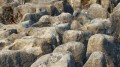
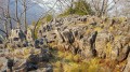
(12) You’ll reach the place known as Calihoùrc (meaning ‘dark place’ or ‘dark wood’ in the Bigourdan dialect), a vast sharp limestone pavement of light grey limestone rocks ravaged by erosion. Shrubbery has overgrown this area for over a century.
The place is truly magical.
Leave Calihoùrc on the right (to avoid the rocky outcrops on the left).
Continue along the ridge, off the beaten track through the undergrowth.
(2) This will take you back to the junction from the outward journey.
Return to the starting point via the same route you took on the way there (S/E).




 Visorando Member

 Moderate
 Tourist office