Refine your search for walks in Montagny (Savoie)
Montagny (Savoie) walks


 From the village of La Thuile to the hamlet of La Balme and back
 Visorando Member
 3.10 mi
 +1,070 ft
 -1,070 ft
 2h 20
2h 20
 Moderate
 Departure from Montagny (Savoie) (Savoie)
Set off to explore the pretty hamlet of La Balme via the forest track, enjoy the lovely views towards Méribel and Courchevel, and return via the footpaths.
Notre Dame de la Salette and the Feissons Cross
 4.20 mi
+807 ft
-801 ft
2h 40
4.20 mi
+807 ft
-801 ft
2h 40
 Easy
Departure from Feissons-sur-Salins (Savoie)
Easy
Departure from Feissons-sur-Salins (Savoie)
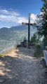
Starting from the pretty village of Feissons-sur-Salins, set off along beautiful forest paths towards the Chapel of Notre-Dame de la Salette and the Cross of Feissons and enjoy the panoramic views offered by the peaks of the Doron de Bozel valley.
An easy hike, suitable for families, snowshoeing or mountain biking.
The southern slope of Mont Jovet with a small circular path.
6.22 mi
+3,212 ft
-3,212 ft
5h 40
 Difficult
Departure from Bozel (Savoie)
Difficult
Departure from Bozel (Savoie)
This hike on the southern slope of Mont Jovet offers beautiful views of the Vanoise and beyond.
The route is well cleared and best done early in the morning or in spring after the snow has melted, or on a beautiful autumn day.
Crossing Mont Jovet via the Dou de Moutiers and the Roc du Bécoin
 12.38 mi
+4,600 ft
-4,587 ft
9h 40
Difficult
Departure from Bozel (Savoie)
12.38 mi
+4,600 ft
-4,587 ft
9h 40
Difficult
Departure from Bozel (Savoie)
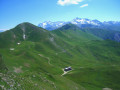
Mont Jovet is a magnificent vantage point in the heart of the Vanoise. It can be climbed fairly easily from its various sides, from Montagny, Bozel, Champagny, La Plagne or Notre-Dame du Pré. This circular route takes you across the mountain, passing through the various hills that surround it and along west-to-east ridgelines, adding a bit of challenge to the hike and offering a variety of views.
Mont Jovet as a long loop via the Belvédère de Grande Roche
 7.65 mi
+3,373 ft
-3,360 ft
6h 25
Difficult
Departure from Bozel (Savoie)
7.65 mi
+3,373 ft
-3,360 ft
6h 25
Difficult
Departure from Bozel (Savoie)
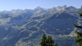
Hike on the southern slope of Mont Jovet in a fairly wide loop, passing by the Belvédère de Grande Roche. The first part is in a shaded area in the Bois de la Cour, then the Bois des Roches. The route includes a slightly exposed section on the ridge of Mont Jovet. The return journey is on the other side, along a stream where you can stop to cool off. The entire hike offers a succession of varied panoramic views between the Tarentaise and Haute-Tarentaise valleys.
Hautecour art trail (Le Breuil) - Circular Liberté
 2.82 mi
+738 ft
-738 ft
1h 55
Easy
Departure from Hautecour (Savoie) (Savoie)
2.82 mi
+738 ft
-738 ft
1h 55
Easy
Departure from Hautecour (Savoie) (Savoie)
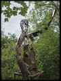
Walk with your nose in the air, your eyes wide open, and let yourself be surprised! You will discover original and ephemeral Land'art creations in an exceptional and relaxing setting. This easy trail has many surprises in store for you! Unusual and most pleasant for its setting, the view it offers and the tranquillity of the place, it is populated by around forty original artistic creations made of straw, wood and stones using the Land Art technique!
Col de Jean above Les Allues
 7.01 mi
+2,395 ft
-2,405 ft
5h 20
Moderate
Departure from Les Allues (Savoie)
7.01 mi
+2,395 ft
-2,405 ft
5h 20
Moderate
Departure from Les Allues (Savoie)
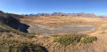
A lovely hike in the Allues Valley, best undertaken from June to October on well-maintained paths away from the ski lifts.
The Pointe du Cuchet circular
 2.89 mi
+1,037 ft
-1,010 ft
2h 15
Moderate
Departure from Fontaine-le-Puits (Savoie)
2.89 mi
+1,037 ft
-1,010 ft
2h 15
Moderate
Departure from Fontaine-le-Puits (Savoie)
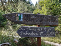
A short family hike to discover a beautiful viewpoint overlooking the Belleville Valley. There are two other beautiful viewpoints with orientation tables, as well as the Coche reservoir. This well-marked circular trail is a discovery trail dotted with information panels and quizzes on mountain flora and fauna. At the summit, you can enjoy two orientation tables and a well-equipped area, as well as a small notebook where you can leave a few words.
Circular Crève Tête via the Col de la Coche
 7.94 mi
+3,009 ft
-3,028 ft
6h 15
Difficult
Departure from Fontaine-le-Puits (Savoie)
7.94 mi
+3,009 ft
-3,028 ft
6h 15
Difficult
Departure from Fontaine-le-Puits (Savoie)
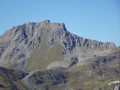
A walk above the resort of Valmorel, following the ridge from the Col de la Coche to Crève Tête, the highest point of the route with its 360° view. Return via the Pierre Larron refuge and the Coche basin.
Lacs Merlet
 10.25 mi
+2,792 ft
-2,785 ft
7h 10
Moderate
Departure from Saint-Bon-Tarentaise (Savoie)
10.25 mi
+2,792 ft
-2,785 ft
7h 10
Moderate
Departure from Saint-Bon-Tarentaise (Savoie)
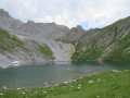
Starting from Pralin, the hike to the Merlet lakes takes you to a superb, peaceful site on the edge of the Vanoise National Park, dominated by the Aiguille du Fuit.
Markings are present but not everywhere.
Balcon de la Forêt du Miollet, starting from Champagny-en-Vanoise
5.25 mi
+2,005 ft
-1,978 ft
4h 10
Moderate
Departure from Champagny-en-Vanoise (Savoie)
A lovely summer walk in Champagny-en-Vanoise.
After a fairly steep climb through the Bois des Chapelets, you follow a ridge walk in the Forêt du Miollet with magnificent views of the Vanoise Massif, the Grand Bec and the Vanoise Glaciers.
The descent then takes you through the Bois des Genévriers and past the alpine chalets at Combes d’en Haut and La Traye.
Mont de la Guerre via the Champagny cable cars
10.13 mi
+3,537 ft
-3,530 ft
7h 45
Difficult
Departure from Champagny-en-Vanoise (Savoie)
The proposed route allows you to climb Mont de la Guerre from Champagny-en-Vanoise and descend via the ski area. The route passes by the Champagny cable cars for those who wish to shorten the descent (please note that they are not operational on Saturdays). There are many alternatives for the descent; I have suggested this version to create a loop. Instead of going through the Bois des Génévriers, it is possible to descend via the forest track.
Le Châtelard and La Croix de la Duy via La Traye
4.29 mi
+1,493 ft
-1,493 ft
3h 15
Moderate
Departure from Champagny-en-Vanoise (Savoie)
This route offers a loop around Champagny-en-Vanoise via Le Châtelard and La Duy, then descends via Les Combes d'en haut and Les Combes d'en bas, ending at La Traye. No particular difficulty.
Dents de la Portetta via the ridges of Mont Charvet
 8.11 mi
+4,304 ft
-4,301 ft
8 hrs
8.11 mi
+4,304 ft
-4,301 ft
8 hrs
 Very difficult
Departure from Saint-Bon-Tarentaise (Savoie)
Very difficult
Departure from Saint-Bon-Tarentaise (Savoie)
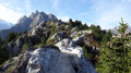
A very beautiful circular route in the Courchevel area, without being hindered by the pylons...
The route is unique and quite wild; I didn’t come across a single person that day... just the cows from the mountain pastures who came to visit me during my break, and further up, a herd of chamois that I’d clearly disturbed.
A quiet spot, except for the immediate vicinity of the car park and Lac de Rosière, and very charming.
La Dent du Villard from Courchevel
 5.32 mi
+2,569 ft
-2,579 ft
4h 40
Difficult
Departure from Saint-Bon-Tarentaise (Savoie)
5.32 mi
+2,569 ft
-2,579 ft
4h 40
Difficult
Departure from Saint-Bon-Tarentaise (Savoie)
To the east of Courchevel, 1550m above Lac de la Rosière, the Dent du Villard is a white gypsum mountain perforated with multiple dissolution craters on its summit, making for an impressive crossing.
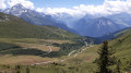
The Bozelet Chapel as seen from the Champagny cable car
 7.53 mi
+1,152 ft
-1,135 ft
4h 30
Moderate
Departure from Champagny-en-Vanoise (Savoie)
7.53 mi
+1,152 ft
-1,135 ft
4h 30
Moderate
Departure from Champagny-en-Vanoise (Savoie)
A lovely walk in very open countryside, with no major difficulties.
We did it at the end of July and it felt like we were in a flower garden.
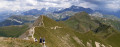
Approach Mont Jovet and the Crête des Étroits via the Pas des Brebis
 6.37 mi
+2,264 ft
-2,244 ft
4h 55
Moderate
Departure from Aime (Savoie)
6.37 mi
+2,264 ft
-2,244 ft
4h 55
Moderate
Departure from Aime (Savoie)
Heading to Mont Jovet via the Tête du Jarset then the Col du Lac and continuing along the Crête des Étroits remains a classic route in La Plagne. However, this ridge walk puts off hikers prone to vertigo due to a few steep slopes.
The suggested route avoids the difficult sections and allows everyone to admire the mountain accessible via the Pas des Brebis. The return journey offers views of the entire resort.
The length and elevation gain mean this circular route is best suited to experienced hikers.
Pointe de la Vélière circular route from Champagny-en-Vanoise
6.19 mi
+3,990 ft
-3,990 ft
6h 20
Difficult
Departure from Champagny-en-Vanoise (Savoie)
A circular ascent of the Pointe de la Vélière (ascending via the Bois des Fougères and descending via the Bois des Cabanes) from the village of Champagny-en-Vanoise. A fairly varied loop with successive sections through woodland (Bois de la Fougère, des Chapelets, des Cabannes) and high-altitude mountain pastures (towards the Plan du Bouc). Viewpoints overlooking the Vanoise, and an ascent up a wild valley (Les Arriérés). The circular route also offers numerous variations (for example, it can be extended by following the ridge line from the Sommet de la Vélière to the Col de la Bauche de Mio).
Roc de la Lune circuit
 5.90 mi
+1,936 ft
-1,919 ft
4h 25
Moderate
Departure from Saint-Martin-de-Belleville (Savoie)
5.90 mi
+1,936 ft
-1,919 ft
4h 25
Moderate
Departure from Saint-Martin-de-Belleville (Savoie)
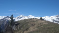
A beautiful loop on the trails of the Belleville Valley. Between mountain pastures, forests and ridges, you will discover magnificent panoramic views that unfold throughout the route. This hike is suitable for families with young hikers. There are numerous signs along the route to guide you.
La Tour du Merle via Plan Fournier from Champagny-en-Vanoise
 7.33 mi
+2,753 ft
-2,730 ft
5h 45
Difficult
Departure from Champagny-en-Vanoise (Savoie)
7.33 mi
+2,753 ft
-2,730 ft
5h 45
Difficult
Departure from Champagny-en-Vanoise (Savoie)
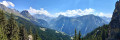
A circular route starting and finishing at Pont des Chailles in Champagny-en-Vanoise. A fairly varied route alternating between forest sections, where blueberries line the path, and unobstructed views of the Vanoise, either over the Pralognan area (Portetta, Vanoise Glaciers) or the Champagny area (Mont de la Guerre, Pointe de la Vélière, Pointe des Chardes, etc.). The second part of the descent follows a fairly wide forest track.
Crève-Tête starting from Novallay
 6.92 mi
+3,274 ft
-3,258 ft
6h 00
Difficult
Departure from Saint-Jean-de-Belleville (Savoie)
6.92 mi
+3,274 ft
-3,258 ft
6h 00
Difficult
Departure from Saint-Jean-de-Belleville (Savoie)
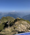
A beautiful circular hike starting from the hamlet of Novallay, climbing to the Crève-Tête (2313m).
Circular Montgirod at Le Villard
6.78 mi
+2,477 ft
-2,507 ft
5h 15
Moderate
Departure from Montgirod (Savoie)
This hike is a circular one starting from Montgirod and leading to Villard. Along the way, you will take the Water Discovery Trail, which offers an immersion in nature and enchanting panoramas while enjoying the gentle murmur of streams and sparkling waterfalls. The return journey takes you along the Tarentaise balconies, offering breathtaking views of the valley and the surrounding mountains.
Circuit of the Aiguille du Rateau via the Merlet Lakes
 10.50 mi
+2,966 ft
-2,995 ft
7h 25
Difficult
Departure from Saint-Bon-Tarentaise (Savoie)
10.50 mi
+2,966 ft
-2,995 ft
7h 25
Difficult
Departure from Saint-Bon-Tarentaise (Savoie)
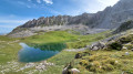
Starting from the Courchevel ski area, the suggested route heads into the Vanoise National Park to circumnavigate the Aiguille du Rateau via the Col du Rateau. On the return journey, a slight detour is suggested to visit the Merlet Lakes.
A very scenic hike through the Rosière valley in the Vanoise National Park.
There is a long stretch over scree, which explains why the hike is rated ‘Difficult’.
A circular variant compared to the other route suggested on Visorando, taking in the Merlet Lakes.
 Notre-Dame du Pré loop
13.96 mi
+2,343 ft
-2,359 ft
3 hrs
Easy
Departure from Aime (Savoie)
Mountain bike and/or electric mountain bike loop starting from the Plagne Montalbert resort, heading towards the charming little village of Notre-Dame du Pré. This ride takes you past two points of interest, including a climbing site and a waterfall.
Morel waterfall
 2.51 mi
+630 ft
-597 ft
1h 40
Easy
Departure from Savoie
2.51 mi
+630 ft
-597 ft
1h 40
Easy
Departure from Savoie
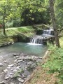
A short circuit allowing you to discover the Morel Waterfall and the educational trail on the history of the torrent.
The circuit follows the thematic trail in reverse, but the information panels explain the history of this torrent: the Morel devastated the Bellecombe plain for several centuries and was finally tamed at the beginning of the 20th century thanks to a dam, a large 80-metre waterfall and a series of small cascades.
Circuit of Mont Coua and its lakes
 14.40 mi
+3,875 ft
-3,875 ft
7 hrs
Very difficult
Departure from Les Allues (Savoie)
14.40 mi
+3,875 ft
-3,875 ft
7 hrs
Very difficult
Departure from Les Allues (Savoie)
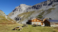
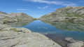
A long but scenic route passes through the Vallon du Fruit in the Plan de Tuéda Nature Reserve (Vanoise massif) between Méribel-Mottaret and the Refuge du Saut. Panoramic views of the Aiguille du Fruit ridge, a jagged massif. Below, a view of the confluence of the Doron des Allues and the Ruisseau de Chanrouge. The Mont Coua lakes are well worth the effort, and you may spot some ibex along the way as you reach the fourth lake.
Towards Lac du Mont Coua
 12.19 mi
+3,031 ft
-3,031 ft
8h 15
Difficult
Departure from Les Allues (Savoie)
12.19 mi
+3,031 ft
-3,031 ft
8h 15
Difficult
Departure from Les Allues (Savoie)
A hike in the Vanoise in search of the Lacs du Mont Coua. Mountain pastures, pastoral life, geology, torrents and glaciers add to the appeal of this outing.
Vallon du Fruit, Lac des Fées, Refuge du Saut and Lac de Tuéda in Méribel
 8.63 mi
+1,578 ft
-1,558 ft
5h 20
Moderate
Departure from Les Allues (Savoie)
8.63 mi
+1,578 ft
-1,558 ft
5h 20
Moderate
Departure from Les Allues (Savoie)
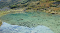
A family hike on trails in the Tuéda Nature Reserve on the edge of the Vanoise National Park. A route where you can see marmots running along the path, with a stop at Lac des Fées, ideal for a long break. Finally, pass by the Refuge du Saut and then Lac de Tuéda and its plateau.
The Col du Soufre offers a panoramic view of the Gébroulaz Glacier
 14.26 mi
+3,852 ft
-3,832 ft
9h 55
Difficult
Departure from Les Allues (Savoie)
14.26 mi
+3,852 ft
-3,832 ft
9h 55
Difficult
Departure from Les Allues (Savoie)
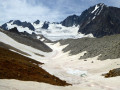
This hike offers a geological outing as it enters the Vanoise National Park, allowing you to get close to the magnificent Gébroulaz glacier.
The Col du Soufre offers a curious, rugged landscape of shapes and colours created by the presence of scree.
Chamois, ibex and marmots are also to be found here.
The hillsides of Aigueblanche as seen from Grand Cœur
 Local authority3.86 mi
+1,345 ft
-1,345 ft
2h 55
Moderate
Departure from Aigueblanche (Savoie)
Local authority3.86 mi
+1,345 ft
-1,345 ft
2h 55
Moderate
Departure from Aigueblanche (Savoie)
A route for exploring the hillsides of Aigueblanche, through woods and meadows, with no major technical difficulties.
The circuit around the Aiguille du Rateau
9.88 mi
+2,972 ft
-2,943 ft
7h 10
Difficult
Departure from Saint-Bon-Tarentaise (Savoie)
A physically demanding, off-the-beaten-track walk in a landscape that is at times very wild and rocky.
Mont Saint-Jacques and Tête des l'Arpettes from Belle Plagne
 4.16 mi
+1,450 ft
-1,470 ft
3h 10
Moderate
Departure from Mâcot-la-Plagne (Savoie)
4.16 mi
+1,450 ft
-1,470 ft
3h 10
Moderate
Departure from Mâcot-la-Plagne (Savoie)
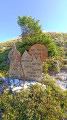
This hike is not technically difficult and can be completed in half a day. It offers beautiful views, including two lookout points. The trails are sometimes difficult to see, so a GPS device may be useful, although the terrain is clear and the waypoints are visible from a distance at all times.You will pass through mountain pastures where cows may be present in season.
Descent from Tougnète to Le Molard in summer using the ski lifts
 3.03 mi
+0 ft
-1,985 ft
1h 25
Easy
Departure from Saint-Martin-de-Belleville (Savoie)
3.03 mi
+0 ft
-1,985 ft
1h 25
Easy
Departure from Saint-Martin-de-Belleville (Savoie)
Tougnète is an easy peak to reach in summer via the ski lifts and allows you to admire magnificent panoramic views with ease. The superb meadows come into view on the descent. There are no difficulties; just take the time to admire the scenery.
From Tougnète to Les Ménuires via the ski lifts
 3.18 mi
+299 ft
-614 ft
1h 45
Easy
Departure from Saint-Martin-de-Belleville (Savoie)
3.18 mi
+299 ft
-614 ft
1h 45
Easy
Departure from Saint-Martin-de-Belleville (Savoie)
Spectacular panoramic views from the summit of Tougnète, at an altitude of 2,437 m. Magnificent panoramic views from vantage points along the entire route. Arrival at the top of the Roc 1 cable car, at 2,260 m.
This hike should be undertaken during the summer when the ski lifts are operating for hikers.
Lac des Blanchets and Roc du Diable from Belle Plagne
 3.50 mi
+1,266 ft
-1,273 ft
2h 45
Moderate
Departure from Mâcot-la-Plagne (Savoie)
3.50 mi
+1,266 ft
-1,273 ft
2h 45
Moderate
Departure from Mâcot-la-Plagne (Savoie)
This half-day hike is easy for most of the route but presents some difficulty during the (optional) ascent of the Roc du Diable. The rest of the route is mostly on paths prepared for mountain machinery, so there are no particular difficulties. There is a beautiful panoramic view from the top of the Roc du Diable (2,426 m). This hike is not signposted, so it is recommended that you use the app for certain sections.
The Frasses Circular Route via the Col du Seuchet from Belle Plagne
 4.96 mi
+1,854 ft
-1,860 ft
3h 55
Moderate
Departure from Mâcot-la-Plagne (Savoie)
4.96 mi
+1,854 ft
-1,860 ft
3h 55
Moderate
Departure from Mâcot-la-Plagne (Savoie)
This walk takes you from meadows, where cows graze peacefully, to the fir forest overlooking the Tarentaise valley. It is a circular route that skirts around Mont Saint-Jacques. A very pleasant walk through the forest section during periods of hot weather.
Discover the Montagne de l'Arc via Lac du Carroley
 4.75 mi
+1,496 ft
-1,467 ft
3h 30
Moderate
Departure from Mâcot-la-Plagne (Savoie)
4.75 mi
+1,496 ft
-1,467 ft
3h 30
Moderate
Departure from Mâcot-la-Plagne (Savoie)
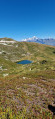
This hike is a longer version of the one suggested by the La Plagne Tourist Office. You will see Les Inversens and the summit of Bellecôte as you pass by the Carroley mountain and its small lake.
You will descend to Belle Plagne via the foot of Mont Saint-Jacques (2,407 m).
Fairy Chimneys from Villarenger
 2.47 mi
+436 ft
-446 ft
1h 25
Easy
Departure from Saint-Martin-de-Belleville (Savoie)
2.47 mi
+436 ft
-446 ft
1h 25
Easy
Departure from Saint-Martin-de-Belleville (Savoie)
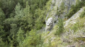
An easy walk along the Doron de Belleville torrent. A narrow path through the deciduous woodland leads to a fairy chimney known locally as the ‘Demoiselle Coiffée’. There is a small stone bridge at the start and, on the return journey, a wooden footbridge. The sound of the torrent accompanies you throughout the walk.
Morel route starting from La Lèchère
 4.76 mi
+850 ft
-837 ft
2h 55
Moderate
Departure from La Léchère (Savoie)
4.76 mi
+850 ft
-837 ft
2h 55
Moderate
Departure from La Léchère (Savoie)
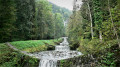
A route starting from the Thermes de la Léchère-les-Bains on a pretty path along the Isère river and up the banks of the Torrent du Morel with its waterfalls, once the scourge of the Aigueblanches valleys, now tamed by humans who have turned it into a peaceful mountain stream. After crossing the village of Saint-Oyen and returning with a view of the valley, you will reach the Thermes de la Léchère spa.
Pointe de Daillait (Saint-Martin-de-Belleville)
 6.90 mi
+3,711 ft
-3,720 ft
6h 25
Moderate
Departure from Saint-Martin-de-Belleville (Savoie)
6.90 mi
+3,711 ft
-3,720 ft
6h 25
Moderate
Departure from Saint-Martin-de-Belleville (Savoie)
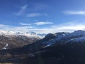
A high-altitude walk above the Saint-Martin-de-Belleville valley, passing through the hamlets of Le Châtelard, Villarenger and La Gittaz (or La Gitte). Magnificent views of Mont Blanc and the entire Alpine range. Curious sinkholes carved into the gypsum.
Le Rocher de Villeneuve - La Montagne
 5.48 mi
+3,051 ft
-3,048 ft
5h 10
Moderate
Departure from Pralognan-la-Vanoise (Savoie)
5.48 mi
+3,051 ft
-3,048 ft
5h 10
Moderate
Departure from Pralognan-la-Vanoise (Savoie)
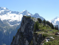
Although located on the edge of the Vanoise National Park, the Rocher de Villeneuve is a little-visited peak that nevertheless offers a stunning view of the Vanoise glaciers.
There are few markings, but there are directional signs at strategic points.
Refuge des Lacs Merlets – Refuge de la Valette
 10.22 mi
+4,514 ft
-3,917 ft
8 hrs
Very difficult
Departure from Saint-Bon-Tarentaise (Savoie)
10.22 mi
+4,514 ft
-3,917 ft
8 hrs
Very difficult
Departure from Saint-Bon-Tarentaise (Savoie)
This third stage will take you from the Refuge des Lacs Merlets to the Refuge de la Valette.
This stage is undoubtedly the most challenging, with 1,400 metres of elevation gain. The ascent of the Petit Mont Blanc, a difficult descent to Les Prioux, followed by another beautiful and long climb (900m of elevation gain) to the Col de la Valette and its refuge, will make for a memorable day.
From the Lacs Merlet refuge to the Péclet-Polset refuge
 9.96 mi
+3,438 ft
-3,232 ft
7h 35
Difficult
Departure from Saint-Bon-Tarentaise (Savoie)
9.96 mi
+3,438 ft
-3,232 ft
7h 35
Difficult
Departure from Saint-Bon-Tarentaise (Savoie)
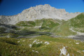
After the long stages of the previous days, this one is more leisurely.The climb to the Col du Soufre is gradual until you reach the edge of the Gébroulaz glacier.The beauty of the Col du Soufre (the day’s highest point), with its ochre and white colours, more than makes up for the day’s efforts.
The Eau Rousse footbridges starting from Notre-Dame de Briançon
3.15 mi
+2,408 ft
-2,408 ft
3h 35
Moderate
Departure from La Léchère (Savoie)
Climb up and admire the industrial and natural heritage around the Torrent de l’Eau Rousse.
Hamlets of Planlebon and Les Priots
 4.12 mi
+1,089 ft
-1,089 ft
2h 50
Moderate
Departure from Saint-Martin-de-Belleville (Savoie)
4.12 mi
+1,089 ft
-1,089 ft
2h 50
Moderate
Departure from Saint-Martin-de-Belleville (Savoie)
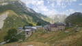
In the Belleville Valley, this easy hike allows you to discover, with family or friends and even in overcast weather, the valley of the Encombres torrent and two of its hamlets, the first of which is in ruins. They give you a picture of the agricultural activity in the valley. This trail passes through a very pleasant setting of forest and clearings, streams... You can extend the route by taking the circular that leads to the hamlet of Gittamelon.