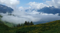
The Col du Gollet

The Belleville valley is a major centre for winter sports. Set apart from the main route, Novallay is one of those villages and hamlets where almost nothing has changed.
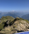
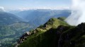
The setting for this walk remains largely unspoilt, and it is only at the pass that you can see Valmorel and its facilities on the other side of the valley.

Details

n°358248
Creation:
Last update:
Last review:
  • Walking
    Activity: Walking
  • ↔
    Distance: 3.60 mi
  • ◔
    Average duration: 3h 30 
  • ▲
    Difficulty: Moderate

  • ⚐
    Back to start: Yes
  • ↗
    Ascent: + 2,080 ft
  • ↘
    Descent: - 2,083 ft

  • ▲
    Highest point: 6,496 ft
  • ▼
    Lowest point: 4,413 ft

Description of the walk

Park in the centre of the village of Le Novallay; there are no more than ten spaces.

(S/E) From the car park, follow the road north-east as it climbs above the village.

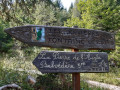
(1) 150m after the hairpin bend, take the path on the right (hand-made signpost) and walk uphill for about 100m.

(2) Turn sharply left, continue the climb – which is quite steep in places – through the woodland and reach the mountain pasture, keeping a westerly course.

(3) The climb now continues through the mountain pasture. Ignore all the paths and tracks branching off to the left and head north-west to reach the Col du Gollet, which becomes increasingly visible.

(4) Descend back to the car park via the same route (S/E).
Waypoints

  1. S/E : mi 0 - alt. 4,416 ft - Centre of the village of Le Novallay
  2. 1 : mi 0.13 - alt. 4,478 ft - Path on the right
  3. 2 : mi 0.21 - alt. 4,567 ft - Turn left
  4. 3 : mi 0.74 - alt. 5,210 ft - Continue the ascent
  5. 4 : mi 1.8 - alt. 6,496 ft - Col du Gollet
  6. S/E : mi 3.6 - alt. 4,413 ft - Centre of the village of Le Novallay

Worth a visit

Notre-Dame-de-la Vie Chapel in Saint-Martin-de-Belleville.
Fountain in the village.
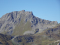
From the pass, it is possible to climb to the summit of Crève-Tête, weather permitting.
From point (1), you can head south down a sloping lane for a short tour of the village.

Reviews and comments

5 / 5
Based on 1 review

Reliability of the description
5 / 5
Ease of following the route
5 / 5
Route interest
5 / 5
Runnerup
Runnerup

Overall rating : 5 / 5

Date of your route : Jun 26, 2019
Reliability of the description : ★★★★★ Very good
Ease of following the route : ★★★★★ Very good
Route interest : ★★★★★ Very good

A lovely walk! At the top of the Col du Gollet, we took the path on the left towards Nant Brun and, shortly afterwards, turned left again towards the Chalet/Cave du Gollet, before finally rejoining the track we’d taken on the way up to head down towards Le Novallay. The walk was almost 9 km long with an elevation gain of 656 m.

Machine-translated

Other walks in the area

For more walks, use our search engine .

The GPS track and description are the property of this route's author. Please do not copy them without permission.