Country:

 City:
City:


To reach the start from Moutiers, take the D117 towards the Belleville Valley. At the hairpin bend before Fontaine-le-Puits, take the road to the Coche dam and park next to the red barrier at the dam entrance.
(S/E) At the signpost for “Retenue de la Coche”, take the path to the Refuge de Lachat and continue to the junction with the track.
(1) At the signpost for La Coche, continue straight ahead along the fairly flat track until you reach the junction with the Refuge de Lachat track.
(2) At the Refuge de Lachat signpost, turn right onto the track towards Valmorel, pass a hairpin bend and, after about 700 m, reach a junction at another hairpin bend.
(3) At the old wooden signpost, ignore the track on the right and carry on straight ahead, following the signs for Crève Tête. Pass afirst bend to the right, then asecond to the left, and reach the end of the track. Continue along the path, which climbs quite steeply, with Tetra Lyre drawings painted on the trees and rocks all along the way to keep you company on this long ascent until you reach the Longecha junction.
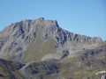
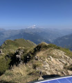
(4) At the signpost for Longecha, turn left towards Crève Tête along a path with unobstructed views. After a long climb above the Crève Tête pastures, you’ll reach the summit with its orientation table and clearly visible cross, offering a 360° view.
(5) Retrace your steps.
(4) Head straight on, following the signs for Plan de Pierre Larron along a path that winds through the forest. You will reach the Plan de Pierre Larron refuge.
(6) Follow the track for 250 metres, ignoring the path on the left, until you reach the junction at the Pas de Pierre Larron. Turn right towards La Coche and walk a good hundred metres.
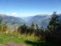
(7) At the wooden signpost indicating the Coche dam, there is a picnic table below with a lovely view, ideally situated for a break. Follow the path down to the left, which winds down through several hairpin bends and occasionally crosses tracks. You’ll reach the Pierre Larron track, which was resurfaced in 2022.
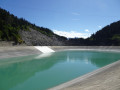
(8) Follow the track to the right and head towards the Coche basin with its reservoir and dam.
(9) Follow the tarmac road to go round the reservoir on the right, then take the road that climbs and takes you back to the starting point (S/E).

 because it was a Sunday and the site was deserted, but on weekdays you’ll need to plan to turn off before the dam...
 Visorando Member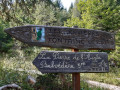
 Moderate
 Easy
Easy 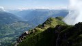
 Local authority