Country:

 City:
City:


From the main town of Saint-Martin-de-Belleville, head towards the hamlet of Le Châtelard via the road.
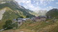
(S/E) In the old village of Le Châtelard, take a street that leads downhill, turns left and becomes a track suitable for vehicles, descending towards Villarenger. Marked with yellow signs. Opposite and above us lies the village of La Gittaz, clinging to the mountainside.
At the bottom of the valley, after crossing a river (the Doron de Belleville), turn left and follow the riverbank to the so-called Roman bridge (actually dating from the 18th century; a pretty stone arch).
(1) Cross the bridge. On the other bank, turn left onto the track, following the yellow signposts indicating route no. 30 towards La Gittaz and the Pointe de Daillait. Then, at the first bend to the right, take the small path that climbs up into the circular bend. This old path climbs through a deciduous woodland and runs roughly parallel to the track, which zigzags further and which we will cut across several times.
(2) At the hamlet of Les Communaux, follow the track to the left for about sixty metres before rejoining the path on the right. After about an hour’s climb, at the upper tree line, you’ll reach the village of La Gittaz. This hamlet is accessible only via the path or the track.
(3) After the village, continue along the track which climbs up the narrow and rather forbidding valley of the Ruisseau de la Gittaz.
(4) Fortunately, the track turns right along the mountainside towards the Léchaux chalet.
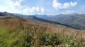
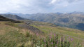
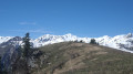
Beyond Léchaux, walk along the ridge. An increasingly spectacular landscape gradually comes into view. The climb faces due south; the warmth of the sun is welcome in winter, though probably less so in summer.
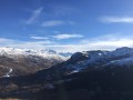
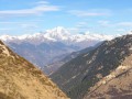
You can make out the cross on the summit of the Pointe de Daillait, which is our destination. To the right of the summit, Mont Blanc gradually comes into view.
The ridge, formed of gypsum, is dotted with curious narrow, deep sinkholes – holes created by water dissolving the gypsum – which are undoubtedly dangerous in foggy weather as they lie very close to the path.
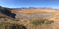
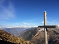
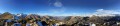
(5) Two hours after leaving La Gittaz, we reach the summit, marked by a cross. A remarkable tangle of sinkholes prevents us from proceeding further along the summit. A magnificent 270° view over the Belleville valley and its peaks, Mont Blanc and the Alpine summits in the distance.
Return to Le Châtelard (S/E) via the same route as on the way there.

 Visorando Member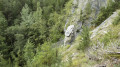
 Easy
Easy 
 Tourism professional
 Very difficult