Country:

 City:
City:


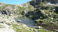
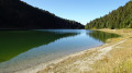
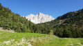
Head to Méribel-Mottaret station, walk through it and park at the Lac de Tuéda car park.
(S/E) Leave the car park via the south exit, walk about a hundred metres along the track towards Lac de Tuéda and reach the start of the path just before the public toilets.
(1) Leave the track and follow the path to the left towards the Refuge du Saut. Reach the Route du Châtelet, follow it uphill for about 800 metres, passing under the funicular, and reach the end of the road after passing the three garages on the right. Reach the start of the path on the right behind the buildings: signpost indicating the Refuge du Saut.
(2) Set off along this lovely path which climbs through the Bois de la Ramée and reach the junction where the Cave du Fruit is located.
(3) After a visit to the cellar, if you wish, continue along the path towards Le Saut through the Bois de la Ramée and reach a crossroads (elevation 2024).
(4) Ignore the path leading uphill to the left; carry on straight ahead along the descending path to reach the Vallon du Fruit. Walk past the springs and reach a crossroads.
(5) Ignore the path leading uphill to the left towards the Col du Fruit and continue along the right bank of the Doron des Allues. Cross the footbridge and immediately take the path on the left to join the track.
(6) Follow the track to the left and, about thirty metres before the very pretty Chalets de la Plagne, turn right and head round the back of the chalet to the small lake, which isn’t visible from the track.
(7) After a short break, set off to the left and rejoin the track next to the chalet. Follow it, turning right, walk for about 200 metres, then leave it to take the path on the right. Cross the wooden footbridge and continue along the path.
(8) Ignore the path on the right coming from Lac des Fées – you’ll take this on the way back – and carry straight on.
(9) Do the same and, after a short climb and a long flat stretch, you’ll reach the Refuge du Saut.
(10) Take the small path heading south-south-west towards the Col du Soufre. Walk up the valley, keeping the Doron des Allues on your left. Cross it via a double wooden footbridge at an altitude of 2,450 m.
(11) Leave the route towards the Col du Soufre and head due east along a well-defined but unmarked path. You’ll come to a small footbridge.
(12) Cross it and continue along the path, which will begin to climb steeply, leading to the first lake with its waterfall; turn off the path to the right.
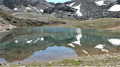
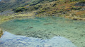
(13) Carry on, rejoining the path, and after another short climb, reach the second lake of Mont Coua on the left.
(14) Turn left to walk alongside it, reaching its far end: from there, there is no path. Continue down a gentle slope for 300 metres to see the final lake and reach its shore.
(15) Retrace your steps to the previous lake.
(14) Turn left onto the cairn-marked path over the rocks and reach the fourth and largest of the lakes.
(16) Continue to the right, skirting the lake, and head south-east. Pass the steep slope and reach the fifth lake on your left, set in a lunar landscape.
(17) Continue eastwards, passing a sixth lake which is often partly covered by lingering snow, and reach the Passage des Eaux Noires with its tuff rock: a clearly visible cairn.
(18) Turn left, heading due north, and follow the rocky gully marked by cairns. Snowfields that persist quite late in the season make the descent a little trickier, though it is possible to avoid them. After a long descent, you’ll reach the mountain pasture, where you’ll find a well-marked path; follow this to join the path leading to the Col Rouge.
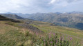
(19) Continue to the left, ignoring the path on the right which leads to the Col de Chanrouge. After about twenty metres, leave the path to the left, following the faintly marked track across the mountain pasture. After a short climb, you’ll reach Lac de Chanrouge in its basin.
(20) Walk along the lake and follow the descending path to rejoin the Chanrouge track, from where you can see the Saut mountain hut. Cross the footbridge over the Doron des Allues and follow the track on the left bank, which you took on the way there. You’ll reach a crossroads on the plateau.
(9) Leave the track and follow the path to the left to reach Lac des Fées, which is only visible on the descent.
(21) Continue on to rejoin the track on the left bank of the Doron.
(8) Turn left and carry on to the junction before the footbridge you crossed on the way up.
(6) Carry on to the left along the track, which becomes quite steep further down. You’ll reach a junction after crossing the track three times.
(22) Turn right, cross the Doron des Allues bridge and reach the Refuge du Plan. Stay on the path to reach Lac de la Tuéda, go round it on the right and join the start of the botanical trail on the right.
(23) Turn right onto the trail, cross a wooden footbridge to join the Tuéda track, follow it to the right and return to the original junction.
(1) Continue along the track and return to the car park (S/E).


 Visorando Member
 Difficult
 Moderate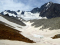
 Easy
Easy