


 Country:

 City:
City:


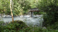
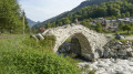
The car park is just before the stone bridge known as the ‘Roman’ bridge, although it actually dates only from the 1800s.
(S/E) Take this footbridge or the more recent road bridge right next to it, which crosses the Doron de Belleville. Take the signposted path on the right, which climbs steadily. Cross two piles of stones at the small streams flowing down towards the Doron. You’ll come to a signpost that should tell you to turn right, but as it’s poorly fixed, pranksters may have spun it round.
(1) So take the path that goes down to the right.
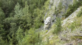
(2) At a Fork in the road, stop descending and head up to the left towards the Demoiselle Coiffée. You’ll catch a glimpse of it at the first bend, and you’ll be able to see it more clearly at the second. Head back down to the Fork in the road and continue the descent to the Doron.
(3) A footbridge will take you across to the other bank. Take the return path on the right, which zigzags uphill to a junction.
(4) Carry on straight along the path that runs alongside the Doron and you’ll come out onto the access road to the drinking water treatment plant.
(5) Follow the road to the car park near the bridge (S/E).
 Visorando Member
 Moderate
 Tourism professional
 Very difficult
 Difficult
