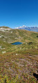
La Grande Rochette via the Colorado chairlift

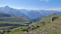
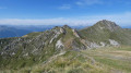
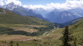
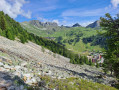
The Colorado chairlift in La Plagne operates during the summer. It provides access to the summit of the Grande Rochette with a gentle ascent. From there, you can admire the magnificent south face of the massif.

Details

61844831
Creation:
Last update:
Last review:
  • Walking
    Activity: Walking
  • ↔
    Distance: 3.94 mi
  • ◔
    Average duration: 2h 25 
  • ▲
    Difficulty: Moderate

  • ⚐
    Back to start: No
  • ↗
    Ascent: + 702 ft
  • ↘
    Descent: - 1,719 ft

  • ▲
    Highest point: 8,192 ft
  • ▼
    Lowest point: 6,509 ft
  • ⚐ Country: France
  • ⚐
    Areas: Alps, Vanoise
  • ⚐ City: Mâcot-la-Plagne (73210)
  • ⚑
    Start: N 45.493445° / E 6.679477°
  • ⚑
    End: N 45.505428° / E 6.677045°
  • ❏
    IGN map(s): Ref. 3532ET, 3532ETR, 3532OT, 3532OTR
  • Hour-by-hour weather

Photos

Description of the walk

Parking at La Plagne Centre. The Colorado chairlift departure point is located behind the tourist office. The chairlift operates in July and August; single-journey tickets can be purchased at the chairlift departure point.

(S) From the top station of the chairlift, head south towards the Col de la Petite Forcle. The path is not clearly marked. It climbs steeply; in winter, it is a ski run.

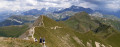
(1) At the pass, turn left (east) and follow a clearly marked path on the southern slope of the mountain. The path then winds its way up in numerous hairpin bends towards the Grande Rochette.

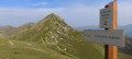
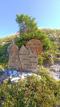
(2) Come out onto a track and turn left. Pass the upper station of a gondola lift on your left and quickly reach the summit of the Grande Rochette and its orientation table (360° panorama).

(3) Retrace your steps.

(2) Turn left, follow the track and head downhill – steep at first, then gentler. Follow this track to the Col de la Grande Forcle.

(4) Head straight ahead (north-north-east) along the track leading down towards the ski resorts (development work is due to take place in 2024, which may alter the layout of the area and the route). At the first junction (elevation 2202), continue along the main track (do not take the one on the left).

(5) Shortly afterwards, leave the track and take a well-marked path through the grass on the left. Join the track again and follow it to the left. Pass under a chairlift line and arrive at another junction.

(6) Carry on straight ahead, following a good, level path and ignoring the road leading down to La Plagne Village on the right.

(7) At a fork in the road directly beneath a chairlift line, keep to the right. Pass under a ski lift line, then leave the top station of a ski lift on your right.

(8) After a left-hand bend, leave the piste and turn right onto a path heading towards La Plagne centre.

(9) At the junction, turn left. Cross a road on the right-hand side and continue straight on. This will take you to the lower station of the Colorado chairlift (E).

Waypoints

  1. S : mi 0 - alt. 7,526 ft - Top station of the
  2. 1 : mi 0.24 - alt. 7,890 ft - Col de la Petite Force (2,409 m)
  3. 2 : mi 0.68 - alt. 8,173 ft - Slope – Access to the summit
  4. 3 : mi 0.78 - alt. 8,130 ft - Orientation table – La Grande Rochette (2,508 m)
  5. 4 : mi 1.97 - alt. 7,428 ft - Col de la Grande Forcle (2,266 m)
  6. 5 : mi 2.35 - alt. 7,162 ft - Trailhead
  7. 6 : mi 2.83 - alt. 7,034 ft - Road junction
  8. 7 : mi 2.94 - alt. 7,037 ft - Fork in the road
  9. 8 : mi 3.39 - alt. 6,864 ft - Trail start
  10. 9 : mi 3.56 - alt. 6,742 ft - Crossroads
  11. E : mi 3.94 - alt. 6,512 ft - Lower station of the

Notes

Colorado chairlift fare: €9 per person in 2024
Belleplagne, Bellecôte, La Plagne Centre and Aime are all connected by free public transport (bus or cable car).
Access to La Roche de Mio used to be via Belleplagne from Bellecôte; in 2026, it will still be from Bellecôte but via the Col de la Grande Forcle.

Reviews and comments

4.3 / 5
Based on 2 reviews

Reliability of the description
4.5 / 5
Ease of following the route
4.5 / 5
Route interest
4 / 5
User 9237295

Overall rating : 3.7 / 5

Date of your route : Aug 24, 2026
Reliability of the description : ★★★★☆ Good
Ease of following the route : ★★★★☆ Good
Route interest : ★★★☆☆ Average
Very busy route : No

Take the Colorado chairlift, then start the circular route to the left towards the pass. There’s a lovely view of the Vanoise on your right and plenty of marmots in summer!

Unfortunately, from the lake onwards, there are too many charmless, stony tracks – which is why we veered off onto a smaller, wilder path on the hillside, which then rejoins the main track heading down towards La Plagne Centre

Machine-translated

PAT 07 AMARIE
PAT 07 AMARIE

Overall rating : 5 / 5

Date of your route : Aug 11, 2025
Reliability of the description : ★★★★★ Very good
Ease of following the route : ★★★★★ Very good
Route interest : ★★★★★ Very good
Very busy route : Yes

Magnificent in sunny weather. Great picnic area

Machine-translated

Other walks in the area

For more walks, use our search engine .

The GPS track and description are the property of this route's author. Please do not copy them without permission.