From the village of La Thuile to the hamlet of La Balme and back

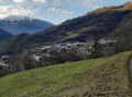
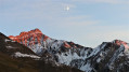
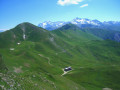
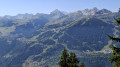
Set off to explore the pretty hamlet of La Balme via the forest track, enjoy the lovely views towards Méribel and Courchevel, and return via the footpaths.

Details

29483955
Creation:
Last update:
Last review:
  • Walking
    Activity: Walking
  • ↔
    Distance: 3.10 mi
  • ◔
    Average duration: 2h 20 
  • ▲
    Difficulty: Moderate

  • ⚐
    Back to start: Yes
  • ↗
    Ascent: + 1,070 ft
  • ↘
    Descent: - 1,070 ft

  • ▲
    Highest point: 4,469 ft
  • ▼
    Lowest point: 3,399 ft

Photos

Description of the walk

Car park on the D89 at the foot of La Thuile church or near a shelter by the Ruisseau du Dard.

(S/E) Walk up towards La Thuille church, take the steep street that runs alongside the church on the left and continue until you reach a path that climbs to the right.

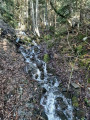
(1) The path climbs steeply, crosses the Ruisseau du Dard for the first time and joins a wide forest track.

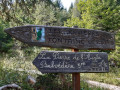
(2) Follow it to the left as it winds its way up. Ignore the hiking signposts and carry on along the forest track.

(3) Carry on along this wide forest track, which continues to wind. Ignore the path on the right, then another one, and go straight on at the next junction. Ignore a path on the left (you’ll take these paths on the way back).

(4) Pass a wide track on your right. Carry on, ignoring the paths on the right, until you reach the hamlet of La Balme. Walk as far as the last houses.

(5) Turn round and begin the descent. After the first hairpin bend, follow the path leading down to the left. Join the forest track and follow it to the left.

(4) Ignore the wide path on the left, then follow a path that descends to the right. Further on, cross the path you took on the way up and continue straight ahead along the path. Join the wide path again and follow it to the left.

(3) After a hairpin bend, follow the path down to the left. Continue down the slope, cross the Ruisseau des Eparays via a wooden bridge, cross the track and reach the junction you passed on the way out.

(2) Follow the forest track to the left. Further on, cross the Ruisseau du Dard again. Join the D89, cross carefully and head for the car park (S/E).

Waypoints

  1. S/E : mi 0 - alt. 3,399 ft - Car park along the D89
  2. 1 : mi 0.08 - alt. 3,478 ft - End of the street
  3. 2 : mi 0.27 - alt. 3,694 ft - Wide forest track
  4. 3 : mi 0.89 - alt. 4,009 ft - Crossroads: track / footpath
  5. 4 : mi 1.35 - alt. 4,265 ft - Crossroads
  6. 5 : mi 1.75 - alt. 4,469 ft - The hamlet of La Balme
  7. S/E : mi 3.1 - alt. 3,399 ft - Car park on the side of the D89

Notes

Public fountain opposite the church in La Thuille.
Water points located near the hamlet of La Balme; continue towards the hamlet after (5), go round it to the right and you’ll reach the water basins. There are no signs indicating whether the water is drinkable or not.

Worth a visit

Don’t forget your walking poles, as some sections of the descent are very steep.

Reviews and comments

4.5 / 5
Based on 2 reviews

Reliability of the description
5 / 5
Ease of following the route
5 / 5
Route interest
3.5 / 5
Artabane
Artabane

Overall rating : 4.7 / 5

Date of your route : Dec 09, 2024
Reliability of the description : ★★★★★ Very good
Ease of following the route : ★★★★★ Very good
Route interest : ★★★★☆ Good
Very busy route : Yes

A few fallen trees on the downhill run made the journey a bit tricky

Machine-translated

pierre gobin
pierre gobin

Hello, thank you for your feedback; I’ll get back to you on this.
As for the duration of the walk, as you’re no doubt aware, this is determined by the Visorando app. By way of comparison, when mapping out the route, we covered just over 6 km in 2 hours, including time spent taking photos and stopping here and there. You’re undoubtedly a little better than average .
My wife and I scouted the route during the 2023 end-of-year holidays – on 27 December to be precise – and I am very surprised, and above all disappointed, to read that you encountered so many vehicles, with their exhaust fumes right in your face. I’d find it very difficult to comment on the attitude of the residents of La Balme towards walkers, having met only one with whom we chatted for a while. We stopped near the three drinking troughs at the top of the hamlet, and if you look at the photos taken there, they give a good view of the panorama. I agree with you that the walk should be extended beyond La Balme; that’s what we’d planned to do, but the path had been rendered impassable by rockfalls and fallen trees blocking the way. As I live in Belgium, it will be difficult for me to return any time soon to check the condition of the path, but if you’re from the area, perhaps you could go back there and create your own walk. I would certainly be delighted to discover it.

Machine-translated

muse_88_
muse_88_
• Edited:

Overall rating : 4.3 / 5

Date of your route : May 26, 2024
Reliability of the description : ★★★★★ Very good
Ease of following the route : ★★★★★ Very good
Route interest : ★★★☆☆ Average
Very busy route : Yes

Hello,
I went on this walk today. I’m an intermediate walker; I’m not very fast, and yet it only took me 1 hour 45 minutes to complete the whole walk.
I was disappointed to see that the road is very busy with cars. That’s to be expected, as the hamlet of La Balme is quite busy at this time of year. As a result, the route isn’t very pleasant with exhaust fumes in your face.
Once I arrived at La Balme, there was nowhere to stop and enjoy the view, given that the village is inhabited at this time of year and, even whilst trying to be as quiet as possible, it was obvious that I was disturbing the residents seeking some peace and quiet. I don’t see the point in stopping at La Balme; I might as well have carried on the walk to the next pass.
In short, I won’t be doing this little walk again; personally, I found it rather uninteresting.
All the best

Machine-translated

Other walks in the area

For more walks, use our search engine .

The GPS track and description are the property of this route's author. Please do not copy them without permission.