Country:

 City:
City:


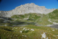
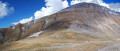
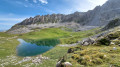
(S) From the Lacs Merlet Refuge, take the time to make a detour to the pretty Upper Lac Merlet: walk alongside the first lake, turning right at the junction below the refuge, to reach the lake.
(1) Then retrace your steps back to the junction below the refuge.
(2) This time, turn right towards the Col de Chanrouge and the Refuge du Saut. You’ll reach a crossroads of paths at Plan du Pêtre.
(3) Take the path on the right, still heading towards the Col de Chanrouge and the Refuge du Saut. After an easy climb, you’ll reach a crossroads of paths at the Col de Chanrouge.
(4) Head back down via the path on the right into the Chanrouge stream valley.
Once at the bottom, cross the Chanrouge stream and turn right.
(5) Shortly afterwards, follow the terrain as you climb straight up the slope towards Lac de Chanrouge. Walk alongside the lake until you reach a clear, well-marked path which descends to rejoin the main track you left earlier on your way to the lake. The Refuge du Saut is visible. Continue along the path and turn left after the footbridge over the torrent to reach the Refuge du Saut.
(6) Continue past the refuge towards the Col du Soufre (a sign indicates that the route is ‘unmarked’, but this simply means there is no paint marking. The path is very clearly marked throughout and cairns provide additional signposting; it is impossible to get lost). The path climbs gradually alongside the torrent until it reaches a large footbridge.
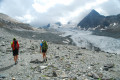
(7) Carry on through rocky scree before reaching the moraine of the Gébroulaz Glacier. The view of the glacier is magnificent. Just before the pass, the slope becomes a little steeper and the terrain a little more slippery, but it remains very passable all the way to the Col du Soufre.
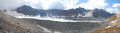
(8) Cross the pass and head down the other side to discover Lac Blanc and its delta.
The start of the descent, which is very gullied, isn’t easy to find, but you’ll soon come across a good path leading to Lac Blanc.
(9) From there, climb about sixty metres up the orange-coloured slabs to reach the Refuge de Péclet-Polset (E).
 Visorando Member
 Very difficult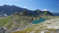
 Moderate