Country:

 City:


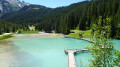
Access is via the Courchevel-Moriond resort. After the hairpin bend on the right, turn left onto the small road below which leads to Lac de la Rosière and park in the large car park.
(S/E) The route starts on the downhill track leading to the lake behind the barrier. Before reaching the lake, turn right onto the north-facing track marked ‘7’ towards the Dent du Villard; follow this route to the summit. Then keep right again to begin the ascent. Continue until you reach a junction.
(1) Leave the steep track and take a pleasant path on the right, which heads south-east before turning north to join the Sentier des Pins.
(2) This path is rated as difficult. Follow it to the right, continuing south-southeast towards the summit. Take three hairpin bends, keeping to the left at the third, and emerge from the forest to reach a Fork in the road.
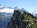
(3) Pass beneath the Dent, carry on straight ahead and take in the surrounding peaks, notably the Grand Bec and Bellecôte. Reach the summit.
(4) A 360° view stretching from La Réchasse to Mont Pelve, Sonnailles, Polset, Péclet… Mont Jovet, Mont Blanc and even the two peaks of La Grande Casse hidden behind the Pointe du Creux Noir.
Continue along the south-south-east path, then head towards the Col de la Chal by following a ridge flanked by spectacular craters. The slope then becomes steeper and the ridge narrows as it leads to the pass, with a branch off to the right. The route is marked with orange paint circles, which you should follow to the Vallon des Avals. This is the trail running route.
(5) At the Col de la Chal, leave the Sentier des 1000 Marches on your right and the Sentier du Planay on your left, and continue straight on towards the Col de la Dent. Walk along the foot of the ridge until you reach the pass.
(6) The Col de la Dent marks the start of the Arête du Mont Charvet. The views, both near and far, are magnificent. Turn left. “There is about 250 m of elevation gain left to reach the Col de la Grande Pierre. It is advisable to have your picnic on the summits of Mont Charvet, where the view is more unobstructed. La Grande Casse comes fully into view.” Arrive at the Col de la Grande Pierre (elevation 2,393).
(7) Leave the very steep, winding path of the couloir of the same name on your left.
Then begin the descent, which can be muddy and slippery, down to 2,200 m, where you must leave the path and take a well-marked track to the left, leading to Le Plan and the Dents de la Portetta path.
(8) At Le Plan, head due east, following the contour line to join, this time, the Col des Saulces path. The orange markings are still visible.
(9) Continue to the right, descending whilst leaving the Col des Saulces to your left. After several hairpin bends, you’ll reach a junction.
(10) From this point, the path is less visible, so follow the numerous orange markings to reach the track leading to the pretty Vallée des Avals.
(11) Follow the track northwards to Plan de la Porte.
(12) Near the altitude of 1780, a stony path begins to climb to the right. The path descends rapidly alongside the torrent and, via the numerous steps that line it, leads to the first footbridge at the first Waterfall des Poux. The route shown on the IGN map is inaccurate as an avalanche has swept away the old path. After the third footbridge, rejoin a track.
(13) Here, cross the footbridge on the left and take the path that leads back to the car park (S/E).

 Visorando Member

 Very difficult
 Moderate