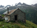
Pointe de la Vélière circular route from Champagny-en-Vanoise

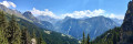
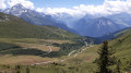
A circular ascent of the Pointe de la Vélière (ascending via the Bois des Fougères and descending via the Bois des Cabanes) from the village of Champagny-en-Vanoise. A fairly varied loop with successive sections through woodland (Bois de la Fougère, des Chapelets, des Cabannes) and high-altitude mountain pastures (towards the Plan du Bouc). Viewpoints overlooking the Vanoise, and an ascent up a wild valley (Les Arriérés). The circular route also offers numerous variations (for example, it can be extended by following the ridge line from the Sommet de la Vélière to the Col de la Bauche de Mio).

Details

36455340
Creation:
Last update:
Last review:
  • Walking
    Activity: Walking
  • ↔
    Distance: 6.19 mi
  • ◔
    Average duration: 6h 20 
  • ▲
    Difficulty: Difficult

  • ⚐
    Back to start: Yes
  • ↗
    Ascent: + 3,990 ft
  • ↘
    Descent: - 3,990 ft

  • ▲
    Highest point: 8,091 ft
  • ▼
    Lowest point: 4,101 ft

Description of the walk

Park near the Champagny-en-Vanoise bridge. There are several accessible car parks nearby.

(S/E) Take the path heading due north along the left bank of the Ruisseau du Remous. You’ll soon reach a junction of paths.

(1) Take the path on the right signposted ‘Bois des Fougères’. Follow the Route des Gorges for a few metres; at the hairpin bend, continue left onto the path and, climbing steadily, reach the hamlet of La Fougère. Carry on until you reach a Y-junction.

(2) Turn right towards Plan du Bouc. Follow the right bank of the Ruisseau de la Combe. Further up, you’ll reach a junction on the banks of this stream.

(3) Cross the stream and continue to the right, towards Les Chapelets, to reach the Plan du Bouc crossroads.

(4) Turn left and continue the steady climb. Cross several streams, including the Tougne and the Remous. You’ll come to another crossroads here.

(5) Take the path branching off to the right and climb as the path leads to reach the ruins of Le Tougne.

(6) Turn left to quickly reach the junction with the Pointe de la Vélière path.

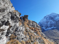
(7) Turn right onto this path and follow the clearly marked trail to the summit of the Pointe de la Vélière.

(8) Follow the same route downhill to return to the ruins of Le Tougne.

(6) Turn right, cross the Remous, then turn left and return to the Remous junction you passed on the way up.

(5) Continue straight ahead, cross the Ruisseau de la Rossa and, about a hundred metres further on, you’ll come to a crossroads of paths at the paragliding launch site.

(9) Turn left, cross the Ruisseau de la Rossa again and follow its left bank downhill. You’ll reach a junction a few steps from the stream.

(10) Keep to the right, cross the stream again and, at the next junction a few metres further on, turn 90° to the left and head down through the Bois des Cabanes until you reach a fork in the path. Pass a footbridge over the Remous on your left. Head off to the right and reach the junction with the Sentier des Dodes.

(11) Turn left, follow the Remous once more and then return to the junction you passed on the way out.

(1) Head straight ahead, following the route in the opposite direction to your outward journey, to return to the car park by the bridge (S/E).

Waypoints

  1. S/E : mi 0 - alt. 4,101 ft - Champagny-en-Vanoise Bridge
  2. 1 : mi 0.1 - alt. 4,199 ft - Crossroads of the circular loop
  3. 2 : mi 0.51 - alt. 4,888 ft - Bifurcation at Bois des Cabanes
  4. 3 : mi 0.78 - alt. 5,292 ft - Combe stream
  5. 4 : mi 1.46 - alt. 6,447 ft - Map of Le Bouc
  6. 5 : mi 2.31 - alt. 6,995 ft - Ruisseau du Remous junction
  7. 6 : mi 2.53 - alt. 7,228 ft - Ruins of Le Tougne
  8. 7 : mi 2.67 - alt. 7,323 ft - Junction towards La Vélière
  9. 8 : mi 3.18 - alt. 8,091 ft - Summit of the Vélière
  10. 9 : mi 4.4 - alt. 6,893 ft - Paragliding area
  11. 10 : mi 5 - alt. 5,827 ft - Junction with the Balcon du Miollet
  12. 11 : mi 5.78 - alt. 4,649 ft - Dodes junction
  13. S/E : mi 6.19 - alt. 4,101 ft - Champagny-en-Vanoise Bridge

Notes

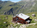
Please note: there are no water sources along the route (you can make a short detour to the Roc des Blanchets chalet)

Worth a visit

(8) Summit of the Pointe de la Vélière: unobstructed views of the Champagny valley above and the Vanoise Glaciers area.

Reviews and comments

5 / 5
Based on 2 reviews

Reliability of the description
5 / 5
Ease of following the route
5 / 5
Route interest
5 / 5
Franck07FB
Franck07FB

Overall rating : 5 / 5

Date of your route : Aug 16, 2025
Reliability of the description : ★★★★★ Very good
Ease of following the route : ★★★★★ Very good
Route interest : ★★★★★ Very good
Very busy route : No

It is indeed possible to extend the route by going to the Col de la Bauche de Mio, as suggested in the previous comment. In this case, you can cross the Vallon des Arriérés and descend between the Roche de la Tome and the Roc du Serac, then descend as far as you can see into the Vallon de la Rossa (preferably to the left of the chairlift) to rejoin the point (9)

Machine-translated

michel tout court
michel tout court

Overall rating : 5 / 5

Date of your route : Aug 03, 2025
Reliability of the description : ★★★★★ Very good
Ease of following the route : ★★★★★ Very good
Route interest : ★★★★★ Very good
Very busy route : No

very beautiful hike with stunning views. The route from the summit to the Bauche de Mio pass is superb (adds an hour to the hike)

Machine-translated

Other walks in the area

For more walks, use our search engine .

The GPS track and description are the property of this route's author. Please do not copy them without permission.