Circular Pointe de la Fenêtre via Lachat and the Col de la Fenêtre

A lovely circular snowshoe route in the heart of the Belleville mountains, leading to a summit with a 360° view. Ascent via Lachat, descent via the Col de la Fenêtre.

Details

n°19319421
Creation:
Last update:
Last review:
  • Snowshoeing
    Activity: Snowshoeing
  • ↔
    Distance: 5.98 mi
  • ◔
    Duration according to the author: 6 hrs 
  • ▲
    Difficulty: Moderate

  • ⚐
    Back to start: Yes
  • ↗
    Ascent: + 3,087 ft
  • ↘
    Descent: - 3,087 ft

  • ▲
    Highest point: 7,438 ft
  • ▼
    Lowest point: 4,350 ft

Photos

Description of the walk

From Albertville, follow the N90 up to Moûtiers. On entering Moûtiers, follow signs for Saint-Jean-de-Belleville, Les Menuires and Val Thorens (exit 40). In Saint-Martin-de-Belleville, turn right towards Le Châtelard.
There is usually a car park available near the summit of Le Châtelard, at the start of the hiking trails, but it fills up quickly. If so, avoid parking in the village and return to park in the large car park just before the hamlet (the trail starts from there).

(S/E) Head back up towards the village and turn left onto the Route des Encombres until you reach the upper car park, where the path starts.

(1) Turn left onto the summer path and then immediately turn right to head south along the summer trail, which crosses the Lachat sheep track several times; follow this track for a few metres at the end.

(2) At the junction marking the routes to the Col de la Fenêtre and Lachat, take the path on the right towards Lachat, which crosses the pastoral road again and, on emerging from the forest, reaches the Abord des Champs chalet.

(3) The route becomes more clearly marked in the mountain pastures. Continue climbing south-west to the group of chalets at Téton.

(4) Carry on past the Limbeau and then the Bouillet chalets.

(5) Continue the ascent to the Lachat chalets on the edge of a plateau, after passing the foot of a cross.

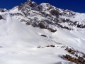
(6) Head south along a track (not always visible in winter) which climbs gently before ascending diagonally up the western face of the Pointe de la Fenêtre, towards the Col du Chenu. As soon as the slopes allow, veer left to take the ridge leading up to the summit of the Pointe de la Fenêtre.

(7) Retrace your steps southwards, then veer left to take the valley leading, in plain sight, towards the chalets at the Col de la Fenêtre, where you can climb a little further up towards Le Cochet for a better vantage point.

(8) From the pass, head north into a rolling valley where there are numerous tracks, winding along the foot of the Cochet. Pass more or less close to the Biolleys chalets, then, after a steep descent through woodland, reach flatter fields at the Parchy chalet.

(9) Do not continue straight on to the Route de Lachat, but turn right just before crossing the Ruisseau de la Perrière to reach the Chalet de Pralautray. Go round the back and head down to join a path that crosses the stream and climbs back up to the Route de Lachat just before a left-hand bend and the junction you passed on the way up.

(2) Head down to the right along the path you came up on to reach the upper car park.

(1) Continue through the village to reach the lower car park (S/E).

Waypoints

  1. S/E : mi 0 - alt. 4,350 ft - Le Châtelard – Lower car park near the - Doron de Belleville (rivière)
  2. 1 : mi 0.3 - alt. 4,439 ft - Le Châtelard – Upper car park
  3. 2 : mi 0.85 - alt. 5,043 ft - Junction for Lachat or Col de la Fenêtre
  4. 3 : mi 1.19 - alt. 5,453 ft - The approach to Les Champs – chalet
  5. 4 : mi 1.4 - alt. 5,699 ft - Téton – chalets
  6. 5 : mi 1.73 - alt. 6,102 ft - Bouillet – chalet
  7. 6 : mi 2.01 - alt. 6,552 ft - Lachat – chalets
  8. 7 : mi 2.96 - alt. 7,438 ft - Pointe de la Fenêtre (2268m)
  9. 8 : mi 3.37 - alt. 6,991 ft - Col de la Fenêtre (2268m)- Vannoise
  10. 9 : mi 4.8 - alt. 5,223 ft - Le Parchy – chalet
  11. S/E : mi 5.98 - alt. 4,350 ft - Le Châtelard – Lower car park

Notes

The route is signposted up to the Lachat chalets on the ascent and then from the Col de la Fenêtre on the descent (signs are not very visible in winter). Signs at junctions indicate, alternately at the start (up to (2)), the directions to Lachat or the Col de la Fenêtre.

This route can also be tackled on ski touring.

Worth a visit

From the summit, a 360° view: Écrins, Encombres, Cheval Noir, Beaufortain, Mont Blanc, Mont Maudit, Grande Casse, the Vanoise Glaciers, Péclet-Polset, Cime du Caron…

Reviews and comments

4.2 / 5
Based on 2 reviews

Reliability of the description
3.5 / 5
Ease of following the route
4 / 5
Route interest
5 / 5
SOLIGNAC
SOLIGNAC

Overall rating : 4 / 5

Date of your route : Feb 11, 2026
Reliability of the description : ★★★★☆ Good
Ease of following the route : ★★★☆☆ Average
Route interest : ★★★★★ Very good
Very busy route : No

Very beautiful snowshoe hike, with a more difficult trail to follow at the end due to the absence of tracks.
Follow the route on the map carefully.
Be aware of avalanche risks.

Machine-translated

Deuxpattes
Deuxpattes

Overall rating : 4.3 / 5

Date of your route : Mar 10, 2022
Reliability of the description : ★★★☆☆ Average
Ease of following the route : ★★★★★ Very good
Route interest : ★★★★★ Very good
Very busy route : No

A truly magnificent spectacle, well worth the effort.
However, this hike should be classified as ‘difficult’.
There is, in fact, a 960m climb over 4.5 km on a steep slope. The snow wasn’t great either, which added to the difficulty.
On the descent, there are no signposts, and it quickly becomes tedious to follow the GPS route as closely as possible.
It took us… almost 8 hours!!!

Machine-translated

Other walks in the area

For more walks, use our search engine .

The GPS track and description are the property of this route's author. Please do not copy them without permission.