Grand Naves – Nant du Beurre Mountain Hut

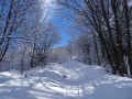
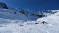
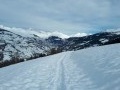
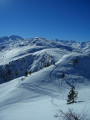
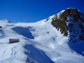
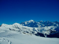
A magnificent, forgotten valley in the southern Beaufortain. The hike offers varied panoramic views across the entire Vanoise, from the Col de la Madeleine to the Mont Blanc massif and the Lauzière range.
Animal tracks (foxes, wolves, etc.) are not uncommon here.

This walk is part of a multi-day hike: La vallée secrête de Nâves

Details

n°467681
Creation:
Last update:
Last review:
  • Snowshoeing
    Activity: Snowshoeing
  • ↔
    Distance: 7.07 mi
  • ◔
    Duration according to the author: 7 hrs 
  • ▲
    Difficulty: Difficult

  • ⚐
    Back to start: No
  • ↗
    Ascent: + 3,399 ft
  • ↘
    Descent: - 1,719 ft

  • ▲
    Highest point: 7,497 ft
  • ▼
    Lowest point: 5,131 ft

Photos

Description of the walk

Leave your car in the car park at the bottom (entrance) of Grand Naves and take the shuttle bus to the Tovet car park.

(S) From the Tovet car park, follow the main track (the track that runs alongside the cross-country ski trail) north-east towards Bonpertui via Grand Plan.

(1) At the Grand Plan huts, leave the main track and take the path towards the Bonpertui huts on the right, heading towards the arcosses (north-east). Reach Bonpertui and admire the old huts, entirely covered in sheet metal, as well as the lovely rowan trees which are a delight for foxes.

(2) Carry on for a good hundred metres, then turn right, heading due east towards the Montagnettes de la Forclaz situated just above. Follow the valley of the Bochet stream through the arcosses to rejoin the main track (running north-south) and emerge at the Montagnettes de la Forclaz.

(3) Follow the main track southwards towards Lac du Bozon and Raymond Derex’s chalets (follow the signposts). You’ll reach Lac du Bozon.

(4) Turn left and continue due east, following the signs for “Passage du Bozon”. Reach this pass, where the path winds its way between the rocks and small fir trees, which are frequently blown about by the wind.

(5) When you reach the top, you’ll find yourself on a plateau facing the Vanoise. Continue north-east.

(6) Head towards the highest peak to the north, which is none other than the Quermoz, the highest point of the hike. Follow a gully leading to the summit ridge, then continue along the ridge to the summit, marked by a sign and a cross (2,296 m). From the summit, enjoy a magnificent panoramic view over the whole of the Vanoise, the Nave Valley, the Lauzière and Mont Blanc…

(7) Descend via the same small valley to return to the junction you passed earlier.

(6) Turn left, heading due east, to go round the Quermoz and join a track at an altitude of 2,150 metres.
Be aware of the risk of avalanches below the Quermoz, where the slopes are steep and sometimes leeward; check the snow conditions and do not approach the steep slopes of the Quermoz. To do so, stay in the relatively flat area. The suggested route allows you to bypass this potentially hazardous sector.

(8) Head north-west towards the Col du Va (2,222 m), to the right of the summit of the Quermoz. From the pass, there is a magnificent view of the Cheval Noir and the Lauzière massif.

(9) Descend into the valley towards La Forclaz (steep slope at the start) to join the main track heading north; this is the track you followed southwards to reach Lac du Bozon.

(10) Take this track to the right, heading north, passing close to La Cave and La Vieille Cave. Note that on this section, the track is marked with signposts that leave little room for error. Continue to the Nant du Beurre refuge (E).

Waypoints

  1. S : mi 0 - alt. 5,131 ft - Tovet car park
  2. 1 : mi 0.62 - alt. 5,479 ft - Le Grand Plan
  3. 2 : mi 1.25 - alt. 5,955 ft - Bonpertui
  4. 3 : mi 1.64 - alt. 6,325 ft - La Forclaz
  5. 4 : mi 2.47 - alt. 6,516 ft - Lake Bozon
  6. 5 : mi 2.82 - alt. 6,781 ft - Bozon Pass
  7. 6 : mi 3.42 - alt. 7,182 ft - Quermoz bypass junction
  8. 7 : mi 3.71 - alt. 7,497 ft - Summit of the Quermoz
  9. 8 : mi 4.37 - alt. 6,982 ft - Quermoz – Eastern Bypass
  10. 9 : mi 4.88 - alt. 7,303 ft - Col du Vâ (2222m)
  11. 10 : mi 5.57 - alt. 6,325 ft - Back on the trail
  12. E : mi 7.07 - alt. 6,827 ft - Refuge du Nant du Beurre

Notes

The Nant du Beurre stream hut is brand new (2012), very comfortable and staffed even in winter (bookings are required for overnight stays).

The Lac du Bozon refuge is unstaffed but can provide shelter. Please ensure you leave it clean and tidy behind you.
This guide does not present any particular difficulties, but you undertake this mountain activity at your own risk. There may be a risk of avalanches, particularly below the Quermoz, where the slopes are steep and sometimes leeward; simply take a wider route, keeping well clear of the steep slopes.

Please do not hesitate to check with mountain professionals for the latest conditions and to hire a professional guide.

Worth a visit

A panoramic view of the east and north-facing slopes of the Vanoise from north to south, including the Cheval Noir, the Col de la Madeleine, Mont Bellachat, Polcet, Le Grand Bec, La Grande Casse, Bellecote, Aliet and Mont Pourri… as well as Mont Blanc, the Col de la Louze, the Grand Mont, the Aravis, Belledonne and the Bauges…

Reviews and comments

5 / 5
Based on 1 review

Reliability of the description
5 / 5
Ease of following the route
5 / 5
Route interest
5 / 5
Thierryb26
Thierryb26

At the same time, Fred’s in Grand Naves is a roadside restaurant, not a mountain refuge, so the operating conditions and supply situation aren’t quite the same… The prices quoted aren’t exorbitant for this type of establishment.

Machine-translated

henri57
henri57 ★

Hello,

Thank you for all this information

Kind regards

Machine-translated

jla Savoie
jla Savoie

Overall rating : 5 / 5

Date of your route : Mar 11, 2020
Reliability of the description : ★★★★★ Very good
Ease of following the route : ★★★★★ Very good
Route interest : ★★★★★ Very good

We went up to stay at the mountain refuge on 11 March 2020 with a group of 34 people.
The refuge is very good, as is the dinner, although you have to go easy on the bread, just like at breakfast. The walks in the surrounding area are magnificent.
The only downside was the warden, who was ‘under the weather’, rather unfriendly and not at all business-minded… We were supposed to be a group of 35, but in the morning there were only 34 of us. Between half-board and drinks, we spent over €2,000 with her in a single day, yet she still found a way to charge us €15 for the night’s accommodation for the person who didn’t turn up. It’s just like the €5 beer or the €2 pastis. If you add a bit of syrup to make a ‘tomate’, she charges you an extra 50 cents. Not to mention the €1 shower token that doesn’t even let you rinse off, and when you ask for a second one, it costs you €6.
In short, the manager isn’t business-minded at all. Not at all like Fred in Grand Naves, who, when you pop in for a drink at the end of the day, welcomes you with a big smile – even if there are 34 of you turning up unannounced – and, on top of your drinks, offers you some mini bugnes. Lovely!!!

Machine-translated

Chris Worst
Chris Worst

Good evening, everyone.

A lovely hike to do in winter on snowshoes, or even on touring skis if you’re not put off by the effort involved in the ascents. There’s no real risk of avalanches below Le Quermoz provided you set off early in the morning and the risk level is 2 or 3 at most.
This is a variation on a hike I undertook on foot and by mountain bike a few years ago, with a ‘must-visit’ stop at Pascale Meiller’s, the landlady of the Nant du Beurre refuge, where we received a ‘four-star’ welcome. I also had the chance to drive up there with my fellow musicians from the Ker Noz Trio (a Celtic folk group from the Tarentaise) to perform for around fifty guests who’d come to enjoy spit-roasted ‘caillon’ on the large terrace under the glorious September sunshine… We have the most memorable memories of that occasion…

I will most certainly return to this part of the Tarentaise, which I know well, to tackle the route linking the two peaks of the Quermoz to the slightly higher Dzonfié: 2,455 metres.

Happy hiking to you all...

Machine-translated

Other walks in the area

For more walks, use our search engine .

The GPS track and description are the property of this route's author. Please do not copy them without permission.