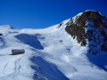
Crêt Coquet and Le Signal circular loop starting from Hautecour

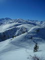
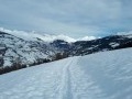
This short circular loop above Hautecour climbs up to the mountain pastures, where the snow covers gentle slopes that are pleasant to walk on, as you can make your own track pretty much wherever you like. The view, particularly from the Signal, is exceptionally sweeping, stretching all the way to the Écrins.

Details

n°70395725
Creation:
Last update:
Last review:
  • Snowshoeing
    Activity: Snowshoeing
  • ↔
    Distance: 6.15 mi
  • ◔
    Duration according to the author: 6 hrs 
  • ▲
    Difficulty: Difficult

  • ⚐
    Back to start: Yes
  • ↗
    Ascent: + 2,451 ft
  • ↘
    Descent: - 2,451 ft

  • ▲
    Highest point: 6,706 ft
  • ▼
    Lowest point: 4,242 ft

Photos

Description of the walk

Set off from Hautecour, via the CD 85 from Moutiers, and climb up to the last hamlet of Pradier, where the road ends in winter.

(S/E) Continue along the forest road.

(1) Take a wide bend to the right until you reach the start of a forest track at Bois des Larges

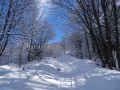
(2) Turn right to head up this track. When it opens out into a clearing, veer left to follow the signposted path through the forest, until you reach a junction with a path coming from the left at La Combe au Roi.

(3) Carry on straight ahead until you reach the junction with the mountain pasture road at Bois de la Mottaz.

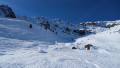
(4) Turn right to follow this road and, once in sight, head for the chalet in front of which there is a picnic table.

(5) Head straight up the west-facing slope behind the chalet and opposite Prariond, then veer right to climb up to a small pass overlooking Lac du Bouchet.

(6) Go round it on the right or left (summer path), then climb the slope leading to the Crêt Coquet refuge.

(7) Climb the snow-covered ridge to the north until you can see the summit of Le Signal (alt. 2,040 m).

(8) Head north towards the cross-country ski trails coming from Le Bozon and veer right to descend, skirting around Lac du Saut.

(9) Continue descending towards the Chalet du Planet.

(10) Turn right, heading due south, to follow the valley and the downhill track, which curves to the left, passes under the power lines, changes valleys and leads to a secluded chalet.

(11) Leave the track and turn right into the valley, keeping to the left-hand side to pass beneath the high-voltage pylons and head straight down towards the chalets at La Faverge, which you passed on the way up.

(5) Head back down to the left, along the mountain pasture road, to the Bois de la Mottaz, which you also passed on the way out.

(4) Turn left to head down the reverse route of the outward journey to the Bois des Larges, which you passed on the way out.

(2) Rather than returning to the road, cross over to the opposite side to descend via a more direct path passing a water intake.

(1) Cut across the road to head down and admire the tiny Chapel of Saint-Bernard-de-Menthon. Continue down for a short while, then head back up to the right to the car park where you started ( S/E).

Waypoints

  1. S/E : mi 0 - alt. 4,255 ft - Pradier
  2. 1 : mi 0.09 - alt. 4,301 ft - Chapelle Saint-Bernard de Menthon (Pradier)
  3. 2 : mi 0.31 - alt. 4,409 ft - Bois des Larges
  4. 3 : mi 1.11 - alt. 5,177 ft - La Combe au Roi
  5. 4 : mi 1.51 - alt. 5,623 ft - Bois de la Mottaz
  6. 5 : mi 1.76 - alt. 5,784 ft - Chalets de la Faverge
  7. 6 : mi 2.26 - alt. 6,299 ft - Lac du Bouchet
  8. 7 : mi 2.47 - alt. 6,417 ft - Crêt Coquet
  9. 8 : mi 2.83 - alt. 6,693 ft - Le Signal
  10. 9 : mi 3.18 - alt. 6,529 ft - Lac du Saut
  11. 10 : mi 3.42 - alt. 6,463 ft - Le Planet
  12. 11 : mi 3.84 - alt. 6,204 ft - Chalet on the Chemin du Planay
  13. S/E : mi 6.15 - alt. 4,255 ft - Pradier

Notes

Several chalets in the mountain pastures can serve as shelter, notably the small Crêt Coquet refuge (7).

Given the aspect, the forest section of the route is often free of snow. You can therefore put on your snowshoes at (4) or (5).

Worth a visit

Once you reach the mountain pastures, there are sweeping views across the Vanoise, the Lauzière and as far as the Écrins.

Reviews and comments

4.7 / 5
Based on 1 review

Reliability of the description
5 / 5
Ease of following the route
5 / 5
Route interest
4 / 5
merlusa
merlusa

Overall rating : 4.7 / 5

Date of your route : Dec 31, 2025
Reliability of the description : ★★★★★ Very good
Ease of following the route : ★★★★★ Very good
Route interest : ★★★★☆ Good
Very busy route : No

A beautiful circular completed on 31 December
We put on our snowshoes at the Faverges chalets, which was no luxury, as the snow was often crusty and not always supportive.
We were alone in the world that day.
The magnificent landscapes made us forget the high-voltage pylons.
A plateau at around 2,000 metres to explore.
Thank you for this route.

Machine-translated

Other walks in the area

For more walks, use our search engine .

The GPS track and description are the property of this route's author. Please do not copy them without permission.