Country:

 City:


In the Tarentaise, head up towards Courchevel, pass Le Praz and turn left at Moriond. Leave the road to Lac de la Rosière and walk uphill alongside the Belvédère chalets to the end of the tarmac road at Prâlin (signposted ‘Le Belvédère’).
The road is closed beyond this point during the season, although it is passable
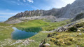
(S/E) Continue along the level, stony track towards the Vallée des Avals, through the Forêt du Laition. It skirts a rocky area before heading south and eventually descends slightly to open out onto the mountain pastures of the Plan de la Porte.
(1) Carry on straight ahead, either along the pastoral track or via the grassy paths running parallel to it. The route climbs slightly before emerging onto the Biol mountain pasture and its cross.
(2) One hundred metres past the cross, turn left to begin the steep climb towards La Portetta. You’ll reach a first plateau where you’ll cross the path to the Col de la Grande Pierre.
(3) Cut across this path to continue the climb up to the Glacerets plateau.
(4) Continue the climb heading east. The grass gradually gives way to scree, which you climb up to the foot of the cliffs.
(5) At the junction of the paths, take the track that climbs up the rocky gully; in the middle of this, a sign points left towards the Brèche Portetta: head up towards it to see Mont Blanc from its entrance.
(6) It is possible to enter the Brèche from below, via a narrow passage (you’ll need to set your rucksack down to get through) and a steep climb towards the eastern exit.
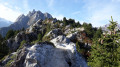
Then return to the couloir to resume the ascent, carefully following the fluorescent green markings. Navigating between scree and large boulders that are not always stable, you climb up to a ledge with a view of Mont Blanc, then veer right to ascend through a chaotic landscape to the Passage de Mey, where the view opens out onto the Vanoise Glaciers and, usually, the sun.
(7) The section continuing along the eastern slope of the Aiguilles is equipped with handholds and cables and requires safety equipment: a via ferrata lanyard or at least a belay rope. This is the Tour de l’Aiguille de Mey (Via Cavo del Mey), which crosses over to the Col de Mey.
To stick to a hiking route, retrace your steps and descend the Brèche couloir to its base.
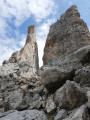
(5) Turn left to begin an ascent at the foot of the Aiguille de Mey, over scree then well-gripped slabs, and finally over chaotic boulders leading up to the cliff at the base of the route to the Col de Mey.
(8) The Col de Mey is reached to the left via an exposed ledge equipped with steps and a cable, which also requires a lanyard or a belay rope.
If hiking, turn right to traverse south-west, skirting a sinkhole carved into the permafrost and then keeping level beneath the Rocher de Plassa, before emerging abruptly at the Passage de Plassa, where the rocky terrain in the shade gives way to sunny grassy ground.
(9) At the cairn, continue a little further before veering left onto the grassy slope, proceed to a viewpoint overlooking Pralognan and return to the valley to reach the Plan des Baux, finishing on level ground towards the Col des Saulces.
(10) Facing the Petit Mont Blanc, turn right onto the pastoral track heading north, which is initially level then slopes gently downwards, until it reaches its end.
(11) Continue straight ahead along a path winding down through the mountain pasture to a junction, from where you can head right towards Les Glacerets and the ascent path.
(12) Instead, continue down towards the valley via the Combe des Roches, following wide switchbacks after a short, easy chimney, until you reach an area of gypsum erosion from where the path to the Col de la Grande Pierre branches off to the right.
(13) Turn left to cross an area of rugged terrain, then descend towards the valley, either via a hairpin bend on the left or via a better-marked ridge path on the right. The two paths meet at the top of a ridge overlooking the valley floor.
(14) Head north along the path, which descends gradually in a zigzag pattern to the valley floor; either cross the Ruisseau des Avals to reach the road, or stay on the right bank to join the road further down, at Le Biol, where the circular route closes (choice of route).
(2) Follow the outward route back down the Vallée des Avals to the Plan des la Porte.
(1) Following the reverse route of the outward journey, continue with a short climb through the forest before letting yourself slide down to the starting point (S/E).

 Visorando Member

 Moderate
 Difficult
 Tourism professional