Mont Charvet Circular Ridge Loop

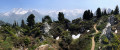
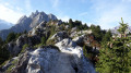
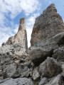
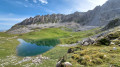
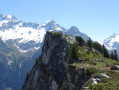
A very lovely circular walk with breathtaking views of the Vanoise glaciers, not to mention the Waterfall des Poux at the start of the route and the steep climb to the Col de la Grande Pierre, the highest point of the hike. The ridges are traversed via a path winding between remarkable gypsum craters to reach the Col de la Chal; a final climb leads to the Dent du Villard with its orientation table and imposing cross, and the Grand Bec in the background.

Details

n°56329963
Creation:
Last update:
Last review:
  • Walking
    Activity: Walking
  • ↔
    Distance: 9.17 mi
  • ◔
    Average duration: 7h 20 
  • ▲
    Difficulty: Difficult

  • ⚐
    Back to start: Yes
  • ↗
    Ascent: + 3,540 ft
  • ↘
    Descent: - 3,573 ft

  • ▲
    Highest point: 7,867 ft
  • ▼
    Lowest point: 5,020 ft

Photos

Description of the walk

Head to Courchevel Moriond via the D91A; turn left at the roundabout at the entrance to the resort and follow signs for Lac de la Rosière. Drive uphill and pass six hairpin bends before descending back to the lake, then park in the car park (pay-and-display from July to August).

(S/E) From the eastern end of the car park, take the level track heading south-east, cross the picnic area with its shelters and the Rosière stream via the footbridge, and head for the crossroads.

(1) Keep to the right, heading towards the Col de Grande Pierre along a well-maintained path, ignoring the two paths on the left. You will reach the Waterfall des Poux (signposted).

(2) Continue along the path, crossing the Rosière torrent twice via metal footbridges. After climbing the wooden steps, you’ll reach the Vallée des Avals track and the Plan de la Porte plateau.

(3) Follow the Vallée des Avals track for about 1.5 km due south and, after the Croix au Biol, reach the start of a path on the left.

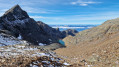
(4) Take this path (signposted ‘Col de Grande Pierre’), ignoring the paths to the right. After a long, steady climb, you’ll reach the Col de la Grande Pierre (signposted).

(5) Follow the Crête du Mont Charvet to the left, heading north, to reach the Col de la Dent. The path winds its way through the Gypse craters, alternating between ascents, descents and skirting the craters.
After a long walk through absolutely stunning scenery, enter the pine forest to reach the nearby junction at the Col de la Dent. Follow the path to the left and you’ll soon reach another junction (signpost).

(6) Take the path on the right, towards the Col de la Chal and the Dent du Villard, and reach the Col de la Chal (signpost).

(7) Take the path leading uphill, heading north-west, to reach the summit of the Dent du Villard, with its orientation table.

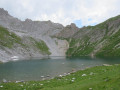
(8) Continue past the cross and follow the fairly long, steady downhill path, ignoring the Chemin des Pins on your right; head towards Lac de la Rosière and reach the lake.

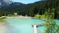
(9) Follow the lake’s shore to the right, heading north, until you reach the footbridge. Cross the footbridge over Lac de la Rosière. Then follow the opposite shore southwards and continue straight on to return to the car park where you started (S/E).
Waypoints

  1. S/E : mi 0 - alt. 5,092 ft - La Rosière car park
  2. 1 : mi 0.23 - alt. 5,105 ft - Junction
  3. 2 : mi 0.89 - alt. 5,397 ft - Waterfall des Poux
  4. 3 : mi 1.29 - alt. 5,833 ft - Map of La Porte
  5. 4 : mi 2.1 - alt. 6,145 ft - Le Biol
  6. 5 : mi 3.23 - alt. 7,854 ft - Col de la Grande Pierre (2,393 m)
  7. 6 : mi 4.57 - alt. 6,975 ft - Col de la Dent
  8. 7 : mi 5.08 - alt. 6,785 ft - Col de la Chal (2,069 m)
  9. 8 : mi 5.95 - alt. 7,490 ft - Dent du Villard (2,285 m)
  10. 9 : mi 8.69 - alt. 5,023 ft - Lac de la Rosière
  11. S/E : mi 9.17 - alt. 5,089 ft - La Rosière car park

Reviews and comments

5 / 5
Based on 1 review

Reliability of the description
5 / 5
Ease of following the route
5 / 5
Route interest
5 / 5
Mbar2
Mbar2

Overall rating : 5 / 5

Date of your route : Jul 12, 2026
Reliability of the description : ★★★★★ Very good
Ease of following the route : ★★★★★ Very good
Route interest : ★★★★★ Very good
Very busy route : Yes

A lovely hike through varied scenery (the Vallon des Avals, the climb up to the Col de la Grande Pierre, the Crête de Gypse, and the descent along a very pleasant path at the end of the day).
The climb up to the Dent du Villard allows you to prolong the pleasure of the ridge, even though the view remains similar to that from the Mont Charvet ridge, which we had previously walked along.
This is a T3-level walk—
It is therefore suitable for experienced walkers, but the overall physical effort is moderate and there is virtually no exposure (2 or 3 sections on the ridge rated E3)
Car park: €6 for the day
As with any hike of this level, it is advisable to set off before 9.00 am

Machine-translated

Other walks in the area

For more walks, use our search engine .

The GPS track and description are the property of this route's author. Please do not copy them without permission.