Country:

 City:
City:


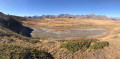
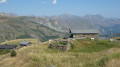
Park in the Cochet car park at the entrance to Saint-Martin-de-Belleville. Take Rue du Cochet to reach the gondola lift quickly. This stops at Le Molard (1,800 m). The ascent continues via the chairlift, which takes you up to the summit known as Tougnète (2,437 m).
(S) On arrival at the chairlift station, head down to the left, heading north, along the tarmac track. Watch out for the many mountain bikes hurtling down the slope at high speed: be sure to observe the pedestrian restrictions.
(1) Take the path on the left to cut across a bend in the track before rejoining it further on at a bend.
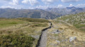
(2) Continue straight down the stony track. You’ll come to the first yellow sign marking the cycle and pedestrian route.
(3) The pedestrian sign directs you to climb the small rocky hill. Please note: there is a pedestrian path on the right; the one on the left is for cyclists. Follow the path downwards, which joins the stony track further on.
(4) Continue down the slope to the right along this track until you reach the Pas de Cherferie.
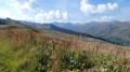
(5) Take the track on the left to continue descending. Further on, a sign directs you to cut across the bend via a grassy path.
(6) Don’t miss the signpost directing you to turn left onto a grassy path shared with cyclists. Pass by a small lake and continue down to a chalet.
(7) Take the stony path leading downhill opposite. Follow the yellow signposting until you reach a level track at a junction.
(8) Follow it to the left as far as Le Molard (S). From there, simply take the cable car down to return to the car park.
 Visorando Member
 Very difficult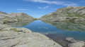
 Difficult

 Moderate