Tour of the Montagne de Méribel starting from Plan Fournier

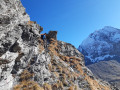
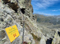
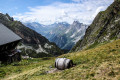
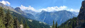
The Tour de la Montagne de Méribel is a circular route offering a wide variety of views, including the Vanoise glaciers, Mont Blanc and the Champagny-le-Haut valley. It is a trail with a few tricky sections, though these are well-equipped (with chains), particularly below the Col des Gallinettes.

Details

26904876
Creation:
Last update:
Last review:
  • Walking
    Activity: Walking
  • ↔
    Distance: 6.51 mi
  • ◔
    Average duration: 6h 25 
  • ▲
    Difficulty: Difficult

  • ⚐
    Back to start: Yes
  • ↗
    Ascent: + 3,976 ft
  • ↘
    Descent: - 3,990 ft

  • ▲
    Highest point: 9,016 ft
  • ▼
    Lowest point: 5,653 ft

Photos

Description of the walk

Head to the hamlet of Plan Fournier, which lies above the village of Chambéranger. Plan Fournier is accessible via a tarmac road; park in the designated car park.

(S/E) Head south-east, then turn left, following the signs for Col des Gallinettes. Make your way to the chalets at Plan Fournier above.

(1) Carry on and keep left at the next junction. Cross the Ruisseau de Méribel several times to reach another junction.

(2) Take the path on the left which climbs steeply up the slope, following the Canal des Gallinettes to reach the Col des Galinettes at the foot of the Pointe de Méribel.

(3) Begin the descent along the path, which is fairly well signposted, to reach the Passage de la Grande Marianne.

(4) Turn sharply right and follow the descent to reach the Refuge du Plan des Gouilles.

(5) Now turn left and continue downhill. Cross several streams before reaching the edge of the Plan Bois François.

(6) Follow the edge of the forest and continue downhill to reach the Chalets de Méribel.

(7) Carry on until you reach a T-junction in the bed of a stream.

(8) Carry on straight ahead and, after a short climb, you’ll reach a pass at the foot of the Tour du Merle.

(9) From here, you can reach the Tour du Merle by turning right onto the ridge, but be warned: there are a few sections requiring some climbing.
Continue the descent, ignoring the path on the right leading to La Golle, to reach the car park in the hamlet of Plan Fournier, heading due south (S/E).


Waypoints

  1. S/E : mi 0 - alt. 5,666 ft - Car park in the hamlet of Plan Fournier
  2. 1 : mi 0.55 - alt. 6,467 ft - Plan Fournier above
  3. 2 : mi 1.47 - alt. 7,667 ft - Crossroads towards the Col des Gallinettes
  4. 3 : mi 2.24 - alt. 8,993 ft - Col des Galinettes
  5. 4 : mi 2.83 - alt. 8,031 ft - Passage de la Grande Marianne
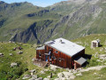
  6. 5 : mi 3.41 - alt. 7,717 ft - Plan des Gouilles mountain hut
  7. 6 : mi 4.33 - alt. 7,060 ft - Plan Bois François
  8. 7 : mi 5.02 - alt. 6,572 ft - Méribel chalets
  9. 8 : mi 5.41 - alt. 6,027 ft - Stream junction
  10. 9 : mi 5.79 - alt. 6,365 ft - Pass at the foot of the Tour du Merle
  11. S/E : mi 6.51 - alt. 5,666 ft - Car park in the hamlet of Plan Fournier

Notes

(S/E) Plan Fournier is the starting point for numerous walks, such as the Tour du Merle and the Refuge du Grand Bec, etc.
(3) Col des Gallinettes: a beautiful viewpoint over the Vanoise.
(5) The main water source is the Plan des Gouilles mountain hut.

Worth a visit

An interesting circular route that takes in a variety of landscapes as it heads towards the heart of the Vanoise to the Col des Gallinettes, followed by a descent through a couloir – the Passage de Marianne – which is very wild. Then a view of the Champagny-en-Vanoise valley comes into full view, with the Grande Motte in the background.

Reviews and comments

4.7 / 5
Based on 2 reviews

Reliability of the description
4.5 / 5
Ease of following the route
5 / 5
Route interest
4.5 / 5
danielfr40
danielfr40

Overall rating : 4.7 / 5

Date of your route : Sep 13, 2026
Reliability of the description : ★★★★★ Very good
Ease of following the route : ★★★★★ Very good
Route interest : ★★★★☆ Good
Very busy route : No

I’ve cycled up the Col des Galinettes several times without going over to the other side.
Apart from a few short tricky sections, such as the Grande Marianne passage, the paths aren’t particularly difficult.
The climb up to the Col des Galinettes is more exposed than it is difficult, provided it doesn’t put you off.
A lovely circular route with unobstructed views after the pass.
Thanks for the route and the description.

Machine-translated

gérard bruet
gérard bruet

Overall rating : 4.7 / 5

Date of your route : Nov 01, 2024
Reliability of the description : ★★★★☆ Good
Ease of following the route : ★★★★★ Very good
Route interest : ★★★★★ Very good
Very busy route : No

A lovely walk with some technical sections where you mustn’t be afraid of heights.
A pleasant surprise. Worth doing again when the weather’s warmer – the ground was frozen on the Champagny side and quite slippery.

Machine-translated

Other walks in the area

For more walks, use our search engine .

The GPS track and description are the property of this route's author. Please do not copy them without permission.