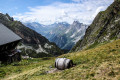
Balcon de la Forêt du Miollet, starting from Champagny-en-Vanoise

A lovely summer walk in Champagny-en-Vanoise.
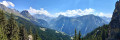
After a fairly steep climb through the Bois des Chapelets, you follow a ridge walk in the Forêt du Miollet with magnificent views of the Vanoise Massif, the Grand Bec and the Vanoise Glaciers.
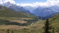
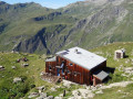
The descent then takes you through the Bois des Genévriers and past the alpine chalets at Combes d’en Haut and La Traye.

Details

13876693
Creation:
Last update:
Last review:
  • Walking
    Activity: Walking
  • ↔
    Distance: 5.25 mi
  • ◔
    Average duration: 4h 10 
  • ▲
    Difficulty: Moderate

  • ⚐
    Back to start: Yes
  • ↗
    Ascent: + 2,005 ft
  • ↘
    Descent: - 1,978 ft

  • ▲
    Highest point: 5,922 ft
  • ▼
    Lowest point: 4,049 ft

Description of the walk

Park in the centre of the village of Champagny-en-Vanoise in one of the covered car parks near the Champigny cable car.

(S/E) Walk through Champagny along the D91B, exiting via the lower end of the covered car park. The start of the route is about 200 m away. Reach the Ruisseau du Remous and you will immediately come to a junction of paths with a sign indicating the directions to Fougère, Chapelets and Cabanes.

(1) Take this path on the left, follow the stream, then veer off to the right and continue on to reach the houses at La Fougère.

(2) Turn left, then at the next hairpin bend turn right towards Bois des Chapelets to get closer to the Ruisseau de la Combe. Cross it and you’ll reach another junction.

(3) Here, follow the signs for Miollet, continue uphill and you’ll reach another four-way junction.

(4) Carry on straight ahead, leaving the path signposted ‘Rossa’ on your right, then, a few metres further on, ignore the path on the left signposted ‘Cabanes’. You will then begin to walk along a balcony path through the Forêt du Miollet. Pass under the cable car, continue on and arrive at a junction of footpaths and a track.

(5) Follow the track to the right for a few metres, then quickly leave it to the left onto a footpath. Head downhill, past a hairpin bend, and reach the Ruisseau du Reclard.
Continue down the slope and then cross the stream via a bridge. Begin another gentle climb to reach another junction by a fountain.

(6) Leave the descending path on your left and continue slightly uphill until you reach the top, at a hairpin bend, where the path meets a track. Please note: on two occasions, the footpath crosses a mountain bike track (which is therefore off-limits to pedestrians)

(7) Turn left onto this track and follow it downhill to reach Les Combes d’en Haut. Walk round the houses and, at the end, you’ll come to a crossroads of footpaths.

(8) Take the path on the left, continue downhill and reach the hamlet of Les Combes d’en Bas.

(9) Take the path on the left to reach the hamlet of La Traye. Turn right at the hairpin bend to return to Champagny and the cable car car park (S/E).

Waypoints

  1. S/E : mi 0 - alt. 4,091 ft - Car park at the - Télécabine de Champagny
  2. 1 : mi 0.38 - alt. 4,098 ft - Ruiseau du Remous
  3. 2 : mi 0.8 - alt. 4,672 ft - La Fougère
  4. 3 : mi 1.26 - alt. 5,322 ft - Junction towards Miollet
  5. 4 : mi 1.73 - alt. 5,830 ft - Four-way junction
  6. 5 : mi 2.64 - alt. 5,682 ft - Trail junction
  7. 6 : mi 3.18 - alt. 5,302 ft - Fountain
  8. 7 : mi 3.57 - alt. 5,381 ft - Crossroads at the highest point
  9. 8 : mi 4.12 - alt. 5,095 ft - Les Combes d’en Haut
  10. 9 : mi 4.55 - alt. 4,593 ft - Les Combes d’en Bas
  11. S/E : mi 5.25 - alt. 4,091 ft - Car park at the - Télécabine de Champagny

Notes

Make sure you wear suitable footwear.
The climb to the start of the Balcon is quite steep, along a path that is generally signposted.
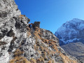
You will need to cross a scree slope, also on a signposted path.
There are no water sources during the crossing of the Balcon. Make sure you carry enough water, particularly during the hottest part of the day or in the event of a heatwave

Worth a visit

Between (4) and (5), the Miollet Forest Balcony offers a magnificent view of the Vanoise, stretching from the Grande Motte Glacier on the left, through Tignes, to the Verdons on the right, with Courchevel and the village of Champagny below.

There are numerous peaks visible in succession, notably the Grand Bec, the Chasseforêt, Peclet and Polset domes, the Rocher de Plassa and its Aiguilles de Mey and d’Août.
The Miollet Forest was partially burnt during the summer of 2003. Along this balcony, you can see the charred tree trunks that remain, as well as the many young trees that are growing back.

(S/E) At the cable car station, several information boards describe the 2003 fire.

Reviews and comments

3.7 / 5
Based on 5 reviews

Reliability of the description
3.6 / 5
Ease of following the route
3.6 / 5
Route interest
3.8 / 5
Franck07FB
Franck07FB

Thank you for your comment and for closing the route due to the risk of rockfall. You’re right – under these conditions, the hike is no longer worth doing.

Machine-translated

lqtx
lqtx

Overall rating : 3.7 / 5

Date of your route : Aug 10, 2024
Reliability of the description : ★★★★☆ Good
Ease of following the route : ★★★☆☆ Average
Route interest : ★★★★☆ Good
Very busy route : No

Due to the risk of a rockslide, the path is closed at the top of the initial climb through the Chapelets woods
I had to head back down the same way without being able to enjoy the view from the forest viewpoint. What a shame. The climb is lovely but a bit of a workout

Machine-translated

VAN DE WOESTYNE
VAN DE WOESTYNE

Overall rating : 4.3 / 5

Date of your route : Sep 07, 2022
Reliability of the description : ★★★★☆ Good
Ease of following the route : ★★★★☆ Good
Route interest : ★★★★★ Very good
Very busy route : No

We went for a walk in fine weather. We missed the starting point but managed to rejoin the path a little further on by turning right down a street. A lovely climb through the Bois des Chapelets. A superb view from the balcony in the Miollet forest.
On the way back, we took the path to the left of the fountain as the one on the right was closed.
We returned to the cable car station near the lodge we’d rented
A lovely 12 km walk with an elevation gain of around 600 m.

Machine-translated

Franck07FB
Franck07FB

I’ve just made a few adjustments to the route description, particularly to make it easier to find the start point and because of the junction on the descent between the footpath and a mountain bike track

Machine-translated

Lire7lynx3
Lire7lynx3
• Edited:

Overall rating : 3.3 / 5

Date of your route : Jul 17, 2022
Reliability of the description : ★★★☆☆ Average
Ease of following the route : ★★★☆☆ Average
Route interest : ★★★★☆ Good
Very busy route : No

Parked in the cable car car park, next to a stream and a sign marking the start of Rue des Hauts du Crey, it took us a long time to realise that the path (point 1) with a sign reading “Fougères, Chapelet, …” was actually much further down, near another stream (the Remous), to the left of a building under construction.
The route features a viewing platform offering a fantastic view of several glaciers (for now)... but the ascents and descents before and after are quite a challenge... especially on a sweltering day!
At point 6 (Fontaine), we didn’t continue along the main track but took a path leading down to the left (there was a prefectural sign prohibiting pedestrians on the track due to mountain bikes). We couldn’t work out where the actual path indicated by Visorando was at that point. Much further down, we were able to rejoin the Visorando GPX route...

Machine-translated

Franck07FB
Franck07FB

Thank you for your comment. I’ll certainly amend the text, as the balcony gets a lot of sun in the height of summer. I’ll also check points 5 and 6
Franck

Machine-translated

JOSETTE25
JOSETTE25

Overall rating : 3.3 / 5

Date of your route : Jul 20, 2022
Reliability of the description : ★★★★☆ Good
Ease of following the route : ★★★★☆ Good
Route interest : ★★☆☆☆ Disappointing
Very busy route : No

A rather dull walk. A steep climb to the highest point. Nothing of interest.

Machine-translated

berthet.helene
berthet.helene

Overall rating : 3.7 / 5

Date of your route : Jul 18, 2022
Reliability of the description : ★★★☆☆ Average
Ease of following the route : ★★★★☆ Good
Route interest : ★★★★☆ Good
Very busy route : No

We had trouble finding the start of the route. In fact, you shouldn’t take Rue des Hauts du Crey; you simply need to follow the D91B, exiting via the lower end of the covered car park. It’s about 200 metres away.
On the descent between points 5 and 6, we couldn’t find the junction by the fountain. We followed the signposted footpath. Elsewhere, it was just scrub. There were no possible turnings. The Reclard stream had run dry due to the terrible drought we’ve been experiencing this summer.
A lovely walk with a magnificent view of the Vanoise, but it was sad to see that the glaciers are disappearing… This route should be avoided during heatwaves as you are, in fact, very often in direct sunlight.

Machine-translated

Other walks in the area

For more walks, use our search engine .

The GPS track and description are the property of this route's author. Please do not copy them without permission.