The Eau Rousse footbridges starting from Notre-Dame de Briançon

Climb up and admire the industrial and natural heritage around the Torrent de l’Eau Rousse.

Details

18243226
Creation:
Last update:
Last review:
  • Walking
    Activity: Walking
  • ↔
    Distance: 3.15 mi
  • ◔
    Average duration: 3h 35 
  • ▲
    Difficulty: Moderate

  • ⚐
    Back to start: Yes
  • ↗
    Ascent: + 2,408 ft
  • ↘
    Descent: - 2,408 ft

  • ▲
    Highest point: 3,294 ft
  • ▼
    Lowest point: 1,417 ft

Description of the walk

Park in the car park by the cemetery behind the Notre-Dame de Briançon power stations.

(S/E) Turn your back on the cemetery and walk for about a hundred metres. Turn right onto a path through the Cudray forest, from where you can see the hydroelectric facilities at Notre-Dame de Briançon, notably its penstock.

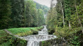
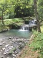
(1) At the first junction, continue straight ahead to take a flight of steps that will take you over the penstock. Then follow a path cantilevered above the Eau Rousse canyon, running as close as possible to the torrent. You’ll cross a few footbridges before the path draws closer to the torrent, bringing you down to its level. Please note: during periods of high water, the torrent can rise very high and make the path impassable. You’ll reach a junction with, on your right, a footbridge allowing you to cross the Eau Rousse.

(2) Turn left and head uphill through the Cudray forest. The path isn’t always easy to follow, but it’s marked by small green and yellow markers attached to the trees.

(3) Back on a wide path, turn right to reach the picturesque village of Le Cudray (circular return). After passing the first houses, follow the road to the right and continue straight on until you reach the village square.

(4) A few metres further on, at the entrance to the village, there is a public car park. Just before this, take the small path that winds sharply uphill to the left and runs behind the houses. After a few bends, you’ll cross the track for the first time. Continue straight ahead on the path that overlooks the track.

(5) After crossing the track a second time, the track takes a hairpin bend to the right. Leave it behind and continue straight ahead along the path which leads back into the forest, and carry on to the highest point of the walk: the Grand Jet viewpoint (990 m).

(6) Once you reach this point, return along the same route to Sous le Cudray (750 m).

(3) On your left is the path you followed on your way up from the stream. Head straight on along a magnificent forest path flanked by impressive dry-stone walls. Return to the junction beneath the penstock, where you rejoin the path you took at the very start of the walk.

(1) Follow this path to the right to descend to the car park at the Notre-Dame de Briançon cemetery (S/E).

Waypoints

  1. S/E : mi 0 - alt. 1,417 ft - Notre-Dame de Briançon Cemetery
  2. 1 : mi 0.28 - alt. 1,854 ft - Junction of the circular loop
  3. 2 : mi 0.74 - alt. 2,060 ft - Pont de l’Eau Rousse
  4. 3 : mi 0.96 - alt. 2,503 ft - Junction: A/ right – R/ straight on
  5. 4 : mi 1.11 - alt. 2,631 ft - Le Cudray
  6. 5 : mi 1.57 - alt. 3,173 ft - Exit the trail opposite
  7. 6 : mi 1.7 - alt. 3,232 ft - Grand Jet Viewpoint
  8. S/E : mi 3.15 - alt. 1,417 ft - Notre-Dame de Briançon Cemetery

Notes

Some exposed sections may be difficult for those prone to vertigo.

Worth a visit

Between (1) and (2), the section with the footbridges is the most spectacular. It was built in 1897 during the installation of the penstock at the Notre-Dame de Briançon power station.
(3) You can shorten the route by turning left to reach the (1).
(6) Grand Jet viewpoint: it offers an exceptional, bird’s-eye view of the Aigueblanche Basin, the lower Tarentaise valley and the surrounding mountain ranges.

Reviews and comments

5 / 5
Based on 2 reviews

Reliability of the description
5 / 5
Ease of following the route
5 / 5
Route interest
5 / 5
Pierrot1704
Pierrot1704

Overall rating : 5 / 5

Date of your route : Sep 12, 2024
Reliability of the description : ★★★★★ Very good
Ease of following the route : ★★★★★ Very good
Route interest : ★★★★★ Very good
Very busy route : No

Hike completed today, 12 September.
The weather is quite cool and overcast.
It was impossible to get through to point 2 because of the amount of timber and rocks partially blocking the stream, which flooded the path and made it impassable. We returned to point 1 and continued the walk, which offered a magnificent view from the viewpoint.

Machine-translated

jla Savoie
jla Savoie

Overall rating : 5 / 5

Date of your route : Apr 22, 2024
Reliability of the description : ★★★★★ Very good
Ease of following the route : ★★★★★ Very good
Route interest : ★★★★★ Very good
Very busy route : No

This route isn’t very well known, but it’s well worth a visit for its insights into the history of the water intake, as well as its scenery, which features very safe sections (small tunnels, barriers and wire fencing). The most scenic route is to walk it anti-clockwise. It’s also best to do it in dry weather, as crossing the stream bed is impossible during floods – you can see all the timber that’s been washed away and how the path has been altered.
For the return journey, the zigzagging path to the right of the pipe as you head downhill is impressive and magnificent; it’s quite wide (1.5 to 2 metres) and presents no major difficulty, apart from the steep gradient.
When you think of the work that’s gone into it, it’s truly magnificent.
It’s a surprising route, but one that’s definitely worth sharing.
We did it in two groups of 20 and everyone was delighted with the outing.

Machine-translated

Other walks in the area

For more walks, use our search engine .

The GPS track and description are the property of this route's author. Please do not copy them without permission.