Mont du Vallon and its three lakes

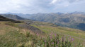
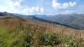
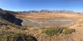
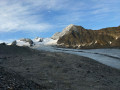
This hike takes you up Mont du Vallon via Lac de Tuéda, Lac des Fées and Lac du Borgne. Passing through the Vallon du Fruit allows you to spot marmots in their natural habitat. Once at the top of Mont du Vallon, you’ll be treated to breathtaking views of the surrounding peaks and glaciers. A stop at Lac du Borgne provides the perfect setting for a snack.

Details

106987481
Creation:
Last update:
Last review:
  • Walking
    Activity: Walking
  • ↔
    Distance: 13.33 mi
  • ◔
    Average duration: 10h 00 
  • ▲
    Difficulty: Difficult

  • ⚐
    Back to start: Yes
  • ↗
    Ascent: + 4,426 ft
  • ↘
    Descent: - 4,413 ft

  • ▲
    Highest point: 9,531 ft
  • ▼
    Lowest point: 5,522 ft

Description of the walk

Starting from the Méribel-Mottaret resort, the hike begins at the Lac de Tuéda car park.

(S/E) Follow the track leading from the car park towards the lake. An arch marks the entrance to a nature reserve.

(1) At the wooden bridge, continue straight on towards the lake. The lake comes into view on the left.

(2) Carry on walking past the lake for about 300 metres and turn left towards the Refuge du Plan.

(3) Walk past the Refuge du Plan on the left, continuing uphill.

(4) After a short descent, cross the Doron des Allues via the wooden bridge. Turn immediately left and take the path directly in front of you towards the Chalet du Fruit.

(5) At the top of the climb, enter the enclosure and continue through the Vallon du Fruit.

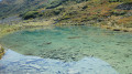
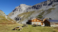
(6) Follow the stream (the Doron des Allues), pass the chalets, and you’ll find the Lac des Fées on the right-hand side of the path at the foot of the mountain.

(7) Retrace your steps, keeping the Doron des Allues on your right.

(6) Turn left at the chalets. The ascent of Mont du Vallon begins. It passes via the Col du Vallon.

(8) It then crosses a red run (Combe du Vallon). Pass under the chairlift and carry on to the next junction.

(9) Continue the ascent, turning left and then right.

(10) Turn right towards Lac du Borgne.

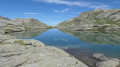
(11) Lac du Borgne comes into view. Turn back to the previous junction.

(10) Turn right towards Mont du Vallon.

(12) Follow the black run and carry on straight ahead beneath the ski lift, as the original path is closed (due to the danger of rockfalls (2026)). Once you have the ski lift on your right, the climb up the black run is steep right up to the summit.

(13) Once at the summit, head back down via the arrival path to the Mont Vallon junction.

(9) At this junction, turn left and continue downhill to the Ruisseau du Borgne.

(14) Cross two streams, then cross a blue run to descend to the base of the Mont Vallon and Plan des Mains ski lifts.

(15) Walk alongside the Mont Vallon ski lift on the right and follow the path that runs alongside the Ruisseau du Vallon until you come to a red ski run.

(16) Follow the red ‘Combe du Vallon’ ski run opposite as you descend.

(17) Continue downhill along the blue ‘Ours’ ski run until you reach the end.

(18) When the Plattières ski lift comes into view, turn right and follow the Doron des Allues stream upstream to the Lac de Tuéda car park (S/E).

Waypoints

  1. S/E : mi 0 - alt. 5,535 ft - Car park at - Lac de Tuéda
  2. 1 : mi 0.15 - alt. 5,574 ft - Wooden bridge - Doron des Allues (rivière)
  3. 2 : mi 0.74 - alt. 5,594 ft - Start of the path from the Refuge du Plan
  4. 3 : mi 0.97 - alt. 5,755 ft - Refuge du Plan
  5. 4 : mi 1.21 - alt. 5,794 ft - Bridge over the - Doron des Allues (rivière)
  6. 5 : mi 2 - alt. 6,545 ft - Entrance to the Vallon du Fruit enclosure
  7. 6 : mi 2.6 - alt. 6,601 ft - Chalet de la Plagne. Return trip to the lake
  8. 7 : mi 2.95 - alt. 6,647 ft - Lac des Fées (2030 m)
  9. 8 : mi 4.17 - alt. 7,881 ft - Col du Vallon (2393 m)
  10. 9 : mi 5.31 - alt. 8,323 ft - Common junction for out-and-back route
  11. 10 : mi 5.53 - alt. 8,547 ft - Access to Lac du Borgne and Mont Vallon
  12. 11 : mi 6 - alt. 8,379 ft - Lac du Borgne
  13. 12 : mi 6.98 - alt. 9,032 ft - Leaving the path
  14. 13 : mi 7.44 - alt. 9,531 ft - Mont du Vallon (2949 m)
  15. 14 : mi 9.57 - alt. 7,441 ft - Borgne Stream
  16. 15 : mi 10.58 - alt. 6,946 ft - Mont Vallon ski lift
  17. 16 : mi 11.12 - alt. 6,480 ft - Base of the Combe du Vallon ski run
  18. 17 : mi 11.29 - alt. 6,368 ft - Junction of the Combe du Vallon and Ours runs
  19. 18 : mi 13.03 - alt. 5,548 ft - Plattières ski lift
  20. S/E : mi 13.33 - alt. 5,535 ft - Car park at the - Lac de Tuéda

Notes

The ascent of Mont du Vallon requires you to leave the path and climb a black ski run head-on. The climb is not very long but is steep.

This route passes through multiple protected areas, which may be subject to special regulations:

Worth a visit

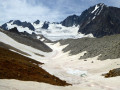
From the summit of Mont du Vallon, numerous other peaks and glaciers are visible. Mont Blanc is also visible on a clear day.

Other walks in the area

For more walks, use our search engine .

The GPS track and description are the property of this route's author. Please do not copy them without permission.