Crossing Mont Jovet via the Dou de Moutiers and the Roc du Bécoin

Mont Jovet is a magnificent vantage point in the heart of the Vanoise. It can be climbed fairly easily from its various sides, from Montagny, Bozel, Champagny, La Plagne or Notre-Dame du Pré. This circular route takes you across the mountain, passing through the various hills that surround it and along west-to-east ridgelines, adding a bit of challenge to the hike and offering a variety of views.

Details

3574199
Creation:
Last update:
Last review:
  • Walking
    Activity: Walking
  • ↔
    Distance: 12.38 mi
  • ◔
    Average duration: 9h 40 
  • ▲
    Difficulty: Difficult

  • ⚐
    Back to start: Yes
  • ↗
    Ascent: + 4,600 ft
  • ↘
    Descent: - 4,587 ft

  • ▲
    Highest point: 8,494 ft
  • ▼
    Lowest point: 5,010 ft
  • ⚐ Country: France
  • ⚐
    Areas: Alps, Vanoise
  • ⚐ City: Bozel (73350)
  • ⚑
    Start/End: N 45.466941° / E 6.647515°
  • ❏
    IGN map(s): Ref. 3532ET, 3532ETR, 3532OT, 3532OTR
  • Hour-by-hour weather

Photos

Description of the walk

Start at the hamlet of La Cour, near Bozel: access is from the village of Bozel; walk through the village and head up towards Villemartin, then continue towards Mont-Jovet until you reach La Cour. Walk past the hamlet to park in the car park just beyond.

(S/E) Walk back down the road through the hamlet for about 200 metres, then turn right onto the path signposted ‘Mont Jovet via the Bois de la Cour’.
The path climbs alongside fields before entering the forest. It crosses a forest track, which you should follow to the right for about a hundred metres, before turning left back onto the ascending path.
Further up, it crosses a forest track at a right angle, rejoining it shortly afterwards. Follow this track for about 100 m to the right towards Plan des Moutons until you reach the start of the path on the left.

(1) The path climbs to a junction. At this point, you can continue straight on to the right for a shorter route, but it is more interesting to turn left to climb the “Grande Roche”.

(2) From the viewpoint, head down slightly to the north-west for a long traverse along the mountainside until you reach the path coming from Montagny via the Bois des Rottes.
Turn right to climb up through the pastures and join the main path up to Le Jovet, at the signpost below Mont du Challier.

(3) It is possible to climb directly up the slope to Mont du Challier or, more easily, to follow the path northwards and, when it becomes too flat, to leave it and climb up to the left across the grassy slopes onto the ridge of Mont du Challier. There are a few tracks, but these are made by livestock and often criss-cross the terrain. Leave them regularly to make your way up towards the nearby ridge.
On the ridge line, follow the grassy humps to the right, then climb straight up the Dou du Soublet.

(4) Just before the summit, head down to the left to reach the Combe d’Aigue, passing between two lakes and joining the sheep track leading up to the Mont Jovet refuge.

(5) Leave this track quickly and head due north up a path climbing the south-western end of the Dou de Moutiers (elevation 2,447).
From this point, follow the ridge path to the highest point of the Dou de Moutiers.

(6) Descend the path north-north-east towards the Jovet. At the bottom of the descent, do not turn right towards the refuge but continue straight on along a small grassy ridge to its summit (elevation 2,424). There, turn right to descend into the small valley and cross as the terrain dictates to rejoin the correct path leading up to Mont Jovet from the refuge.

(7) Climb the switchbacks of the path leading to the western ridge and then on to the summit itself (orientation table).

(8) From the summit, take the ridge path eastwards, which descends to the Pas des Brebis, continues along the Crête des Étroits to the Col du Bécoin, then climbs up the Roc du Bécoin via its western ridge.

(9) Descend the south-eastern ridge to the Col de la Lovatière.

(10) Turn right to cross beneath the western flank of the Roc des Verdons and join the path of a ski run descending towards Champagny. Ignore the track coming from the left.

(11) Immediately afterwards, head straight south towards the Petite Forcle to reach the clearly visible Bozelet area and its chapel.

(12) From the chapel, head back towards the path to the south, skirting the Mont de la Guerre on the left. It veers south-west to pass beneath the Mont de la Guerre and, after a bend to the right, arrives at the junction near the Croix de la Porcière.

(13) At the crossroads, 50 metres from the cross, leave the path leading down towards Champagny and head due west into the Tincave Forest. Descend via numerous hairpin bends to the Bois de Tincave forest track.

(14) Take this level track to the right. It crosses several streams before returning to the hamlet of Mirabozon.

(15) Continue along the gravel track which crosses meadows, joins the path leading down from the refuge, crosses the Ruisseau du Jovet and heads south back to La Cour (S/E).

Waypoints

  1. S/E : mi 0 - alt. 5,062 ft - Bozel – La Cour
  2. 1 : mi 0.93 - alt. 5,951 ft - Plan des Moutons
  3. 2 : mi 1.32 - alt. 6,348 ft - La Grande Roche
  4. 3 : mi 1.82 - alt. 6,604 ft - Below Mont du Challier
  5. 4 : mi 3.08 - alt. 7,503 ft - Dou du Soublet
  6. 5 : mi 3.26 - alt. 7,392 ft - Combe d’Aigue
  7. 6 : mi 3.98 - alt. 8,146 ft - Dou de Moutiers
  8. 7 : mi 4.63 - alt. 7,923 ft - Path at the foot of Mont Jovet
  9. 8 : mi 5.1 - alt. 8,389 ft - Mont Jovet
  10. 9 : mi 6.54 - alt. 8,491 ft - Roc du Bécoin
  11. 10 : mi 6.97 - alt. 7,927 ft - Col de la Lovatière
  12. 11 : mi 7.5 - alt. 7,680 ft - Take a shortcut to the south
  13. 12 : mi 7.89 - alt. 7,454 ft - Bozelet Chapel
  14. 13 : mi 9.03 - alt. 6,795 ft - Croix de la Porcière
  15. 14 : mi 10.25 - alt. 5,292 ft - Forest track through the Bois de Tincave
  16. 15 : mi 11.41 - alt. 5,253 ft - Mirabozon
  17. S/E : mi 12.38 - alt. 5,062 ft - Bozel – La Cour

Notes

There are no technical difficulties on this hike. Just a few slightly exposed ridge sections whilst crossing the Crête des Étroits or in the Roc de Bécoin area. Its length and the frequent ascents and descents require a good level of fitness.

Some sections are off the beaten track but follow obvious ridges or grassy hummocks… except in foggy conditions, when it’s best to stick to the paths.

Worth a visit

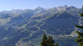
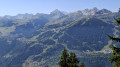
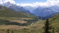
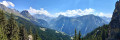
The views are exceptional along much of the route, particularly at the Grande Roche, the Dou de Moutiers, Mont Jovet (viewpoint) and the Roc du Bécoin: Mont Blanc, the Grand Combin and the border range, Mont Pourri and the Sommet de Bellecôte, the Grande Motte, the Grande Casse and the Grand Bec de Pralognan, the Vanoise Glaciers, Péclet-Polset, the Écrins and the Meije, the Aiguilles d’Arves, the Grandes Rousses, Lauzière and Beaufortain.

Closer by, the views take in the resorts of Courchevel and then La Plagne.

Reviews and comments

5 / 5
Based on 2 reviews

Reliability of the description
5 / 5
Ease of following the route
5 / 5
Route interest
5 / 5
Xav B
Xav B

Overall rating : 5 / 5

Date of your route : Aug 14, 2023
Reliability of the description : ★★★★★ Very good
Ease of following the route : ★★★★★ Very good
Route interest : ★★★★★ Very good
Very busy route : No

A magnificent hike with panoramic views.
A superb section along the ridges.
We did it over two days, spending the night at the Mont Jovet mountain hut.
A real highlight: the sunrise from Mont Jovet!

Machine-translated

danielfr40
danielfr40

Overall rating : 5 / 5

Date of your route : Sep 10, 2022
Reliability of the description : ★★★★★ Very good
Ease of following the route : ★★★★★ Very good
Route interest : ★★★★★ Very good
Very busy route : No

I quite like ridges, so I really enjoyed this circular walk
The path is easy, but quite steep in places
Recalculating the elevation data from my track shows a total ascent of around 1,450, completed in 8 hours
The return along the track was a bit of a slog, but my feet were grateful.
Thanks for this route

Machine-translated

Other walks in the area

For more walks, use our search engine .

The GPS track and description are the property of this route's author. Please do not copy them without permission.