Country:

 City:
City:


Head to Méribel via the D 90. Take thefirst exit at the roundabout and thefirst road on the right at the roundabout beneath the cable car; take the track on the left and you’ll reach the car park 200 m further on.
(S/E) Set off along the track towards Les Granges and Col de Jean (signposted); after a steep climb, you’ll reach a junction (elevation 1,475 m). Leave the track on your left and follow the level track to the right for 60 m. You’ll reach the start of a path.
(1) Follow the path to the left; it climbs at first, then levels out. Pass above the Granges chalets and reach the junction with the track suitable for vehicles. Follow the track on your left. Ignore the other track on the left 200 m further on and continue following the direction of La Traie (signpost) along the track suitable for vehicles. You will reach the junction and the signpost for the hamlet of Grangettes.
(2) Ignore the path coming from the left (return route) and continue along the track towards La Traie. You’ll reach a Fork in the road.
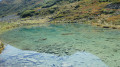
(3) Follow the track descending to the right. Pass above the Chalet des Duisettes with its small lake below. Continue until you reach the junction of paths on the left.
(4) Leave the track and continue left onto a fairly easy footpath for about 200 m. You’ll come to another track, which you should follow, ignoring the descending track on your right. Head towards Plan Parchet and La Traie (signpost). Pass the two chalets at Plan Parchet, then, after a short descent, you’ll reach the crossroads.
(5) Follow the ascending track to the left, pass above the pretty chalets of Mergolaz and arrive at the crossroads (elevation 1542)
(6) Take the path furthest to the left and, via a steady climb with a few hairpin bends, reach the crossroads (elevation 1689).
(7) Head towards the Col de Jean, ignoring the path on the right which leads to La Traie. The climb becomes steeper. At a right-hand bend, pass above the village chalet and, after another steep climb, reach a flat section and finally arrive at the Col de Jean (signpost).
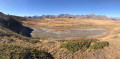
(8) Head left towards the south, ignoring the path on the right. Stay on this path and keep to the left to reach the junction above the Grand Lac (a lake that only holds water in spring).
(9) Continue along the path descending to the left towards Les Grangettes and Méribel. After a long descent and a 90° left-hand bend, you’ll reach the Les Grangettes junction, which you passed on the way out.
(2) Turn right, following the opposite route to the one taken on the way there, to reach the car park (S/E).

 Visorando Member
 Very difficult
 Difficult
 Easy
Easy