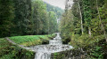
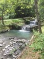
The hillsides of Aigueblanche as seen from Grand Cœur

A route for exploring the hillsides of Aigueblanche, through woods and meadows, with no major technical difficulties.

Details

17462914
Creation:
Last update:
Last review:
  • Walking
    Activity: Walking
  • ↔
    Distance: 3.86 mi
  • ◔
    Average duration: 2h 55 
  • ▲
    Difficulty: Moderate

  • ⚐
    Back to start: Yes
  • ↗
    Ascent: + 1,345 ft
  • ↘
    Descent: - 1,345 ft

  • ▲
    Highest point: 2,776 ft
  • ▼
    Lowest point: 1,506 ft

Description of the walk

Park in the school car park in Grand Cœur.

(S/E) Walk up through the village from the school car park

(1) Enter the woodland, which offers a cool retreat on hot days. After passing under a power line, the path then crosses through Villoudry.

(2) Continue along a path heading straight up towards Villargerel, alternating between woodland and meadows and offering beautiful views over the Tarentaise Valley. The path joins a circular route before reaching the hamlet.

(3) After a few sections of road, interspersed with stretches along narrow paths, the route leads to the highest point of the circular route: the Baroque church of Villargerel (845 m), a listed historic monument.

(4) Turn back for a short stretch.

(3) Once you’ve left Villargerel, turn left towards the eastern part of Villoudry. A pleasant path, which crosses the D 92 several times, leads to Bellevue through the woods.

(5) On leaving the village, after crossing the D 92, turn right towards the N 90, where you’ll join the Route de Villargerel. Follow this road to pass under the main road and continue to the junction just before the railway line.

(6) Take the hairpin bend to the right and follow the road running parallel to the railway line. Pass Le Plan du Truy, turn right onto the path which crosses under the main road once more, then turn left.

(7) At the Fork in the road, keep left to return to Grand Cœur via the Chemin des Vignes and walk alongside the old vineyard terraces on a well-maintained path with a few benches. At the church, turn right to return to the school car park (S/E).

Waypoints

  1. S/E : mi 0 - alt. 1,660 ft - School car park in Grand Cœur
  2. 1 : mi 0.14 - alt. 1,772 ft - Entrance to the woodland
  3. 2 : mi 0.76 - alt. 2,402 ft - Villoury
  4. 3 : mi 1.02 - alt. 2,657 ft - Villargerel circular loop
  5. 4 : mi 1.15 - alt. 2,776 ft - Église Saint-Martin (Villargerel)
  6. 5 : mi 1.95 - alt. 1,955 ft - Bellevue
  7. 6 : mi 2.53 - alt. 1,568 ft - T-junction before the railway line
  8. 7 : mi 3.26 - alt. 1,699 ft - Vineyard Trail
  9. S/E : mi 3.86 - alt. 1,660 ft - School car park in Grand Cœur

Notes

The route crosses the road several times, so please take care.

Road access
From Albertville, take the RN 90 (exit 38), then the RD 990A (Rue de la Cassine), followed by the RD 990 (turn left under the bridge), then turn right onto Rue de l’Église, followed by the second left onto Rue des Seigneurs de Cor. You’ll find the car park 150 metres further on, on your right.

From Moutiers, take the RN 90 (exit 37), then the RD 990 to the entrance to Grand Cœur; take the first left onto Rue de la Piat, then go straight on to the car park.

Parking: school car park, Grand Cœur

Worth a visit

The Baroque church at Villargerel.

This section of the walk offers views of the Morel Valley and its 82-metre waterfall, as well as the Cheval Noir (2,832 m) towering above it.

Reviews and comments

4 / 5
Based on 3 reviews

Reliability of the description
3.7 / 5
Ease of following the route
4 / 5
Route interest
4.3 / 5
User 18302538

Overall rating : 4 / 5

Date of your route : Jul 15, 2026
Reliability of the description : ★★★★☆ Good
Ease of following the route : ★★★★☆ Good
Route interest : ★★★★☆ Good
Very busy route : No

A hike where we didn’t meet a single soul, yet we still managed it over the long weekend of 14 July. Beautiful alpine scenery in the Lauzes range, particularly near the little Baroque church at the highest point (which was unfortunately closed). A perfectly situated bench provided a cool spot to rest and take in the view. There were plenty of shaded sections, which were much appreciated in the intense heat, though the return leg was more exposed. The ascent was quite steep and the descent a little long but gentle.

Machine-translated

mimi26600
mimi26600

Overall rating : 4.3 / 5

Date of your route : Apr 27, 2026
Reliability of the description : ★★★★☆ Good
Ease of following the route : ★★★★★ Very good
Route interest : ★★★★☆ Good
Very busy route : No

It’s true that the climb up to Vilargerel is quite steep, but we took it at a leisurely pace… a beautiful church, but it wasn’t open – what a shame! Otherwise, there were magnificent views of the villages of Saint Oyen, the Morel Valley and Aigueblanche. We returned via the vineyard path. The route was easy to follow using GPS.

Machine-translated

pourchere
pourchere

Overall rating : 3.7 / 5

Date of your route : Oct 07, 2024
Reliability of the description : ★★★☆☆ Average
Ease of following the route : ★★★☆☆ Average
Route interest : ★★★★★ Very good
Very busy route : No

very steep climb
route not always clearly signposted

Machine-translated

Other walks in the area

For more walks, use our search engine .

The GPS track and description are the property of this route's author. Please do not copy them without permission.