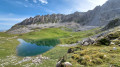
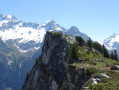
The Brèche Portetta from Courchevel Moriond

A challenging hike in breathtaking, vertiginous and highly varied surroundings. Plenty of wildlife to spot and a very rocky landscape at the summit. Not recommended for young children or those who suffer from vertigo. Do not attempt in uncertain weather conditions

Details

n°25047567
Creation:
Last update:
Last review:
  • Walking
    Activity: Walking
  • ↔
    Distance: 6.58 mi
  • ◔
    Duration according to the author: 6 hrs 
  • ▲
    Difficulty: Very difficult

  • ⚐
    Back to start: Yes
  • ↗
    Ascent: + 3,091 ft
  • ↘
    Descent: - 3,081 ft

  • ▲
    Highest point: 8,724 ft
  • ▼
    Lowest point: 5,728 ft

Photos

Description of the walk

From Courchevel Moriond, head up towards the Belvédère car park, turn left and continue to the hamlet of Pralin. Park after the last chalet.

S/E: Take the track, following signs for Vallée des Avals and Le Biol. After a stretch through the spruce forest, ignore the various paths leading to Lac de la Rosière or towards Ariondaz. The track overlooks the Torrent de la Rosière.

(1) Below on the left, you can see the Waterfall des Poux. Continue along the track and, after a short descent, you’ll reach Plan de la Porte at 1,774 m. You’ll arrive at a clearing with a large boulder.

(2) Follow the path (choose your route) or cut straight across and keep an eye out for marmots! After a few bends uphill, you’ll reach Le Biol; continue along the path.

(3) At the yellow signposts, leave the track and turn left towards “Brèche Portetta”. After a few hairpin bends through the mountain pastures, you’ll reach the edge of the forest where you may spot some roe deer. The climb then becomes steeper. You’ll reach a junction with a path branching off to the left towards the Col de la Grande Pierre.

(4) Continue straight on up towards Les Glacerets. The landscape changes, with numerous boulders at the foot of the scree slopes.

(5) Ignore a path on the right heading towards the Col des Saulces and carry on straight ahead.

(6) Turn left towards the Plassa pass, ignoring a path on the right.

(7) The climb continues through the scree: there are fluorescent paint marks at regular intervals on the rocks to guide you. The slope becomes much steeper, and you must be very careful as the ground gives way beneath your feet. You’ll reach the foot of the Dents de la Portetta.

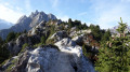
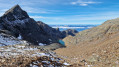
(8) The view is breathtaking. A sign fixed to the rock face points to the breach on the left and the Col de Mey on the right: it is possible to tackle the via ferrata with the necessary equipment. The pass can be reached by climbing up using your hands or by slipping between the rock faces. There is still a snowfield, and on the other side you can admire the Vanoise Glacier, Pralognan and its peaks.

(9) The descent follows the reverse route, taking extreme care.

(7). Continue along the reverse route of the ascent to return to the car park at Pralin (S/E).
Waypoints

  1. S/E : mi 0 - alt. 5,728 ft - Pralin
  2. 1 : mi 0.8 - alt. 5,846 ft - View of the Cascade des Poux waterfall
  3. 2 : mi 1.27 - alt. 5,827 ft - Clearing
  4. 3 : mi 1.92 - alt. 6,165 ft - Leave the track
  5. 4 : mi 2.28 - alt. 6,818 ft - Crossroads, opposite – Col de la Grande Pierre (2,393 m)
  6. 5 : mi 2.63 - alt. 7,392 ft - Junction, straight on – Col des Saulces (2,456 m)
  7. 6 : mi 2.69 - alt. 7,428 ft - Turn left at the fork
  8. 7 : mi 2.82 - alt. 7,552 ft - Scree
  9. 8 : mi 3.25 - alt. 8,560 ft - Foot of the Dents de la Portetta
  10. 9 : mi 3.29 - alt. 8,724 ft - Brèche Portetta
  11. S/E : mi 6.58 - alt. 5,728 ft - Pralin

Notes

High-top boots, equipment for the Via cavo del Mey via ferrata (2,780 m), including a helmet, lanyards, harness, etc.

Alternatives
It is possible to take alternative routes or extend the walk via the Petit Mont Blanc:

(4) Head left towards the ridges of Mont Charvet via the Col de la Grande Pierre.

(6) Head south towards the Rocher le Passage de Plassa.

I
- southwards (6)
- or towards the Charvet ridges to the north (4)
Return to the starting point (S/E)

Reviews and comments

5 / 5
Based on 1 review

Reliability of the description
5 / 5
Ease of following the route
5 / 5
Route interest
5 / 5
Mbar2
Mbar2
• Edited:

Overall rating : 5 / 5

Date of your route : Sep 28, 2023
Reliability of the description : ★★★★★ Very good
Ease of following the route : ★★★★★ Very good
Route interest : ★★★★★ Very good
Very busy route : No

A lovely walk with a gradual start (warming up on the Sentier des Avals, followed by a slightly steeper climb through the grassy slopes – though with switchbacks – and finishing on steeper scree).

However, I didn’t understand the warnings on Visorando:“Caution: very difficult route. This walk includes some very challenging sections and is only suitable for experienced mountaineers...”
Personally, I thought it was just a D- level.
Admittedly, there are a few rare sections where you need to use your hands, but it’s just basic ‘scrambling’ (nothing like proper climbing) and it’s only when you’re tackling the two gaps to see the other side.
It’s worth noting, however, that conditions are likely to be very different at the start of the season if there’s snow.

In short, in September (without snowfields), it’s just a D- hike which requires (like any hike at this altitude) proper footwear and walking poles.

The Portetta Pass, the Mey Pass and the Col de Mey are three surprising and rather impressive spots.
Well worth a visit, then.

Thanks to ChrisMarmot for this route

Machine-translated

Other walks in the area

For more walks, use our search engine .

The GPS track and description are the property of this route's author. Please do not copy them without permission.