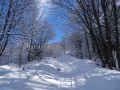
The ridge from Dos de Crêt-Voland to Le Verdet

A beautiful circular route covering part of the ridge separating the Belleville and Allues valleys, with sweeping views across much of the Alps.

Details

n°5410714
Creation:
Last update:
Last review:
  • Snowshoeing
    Activity: Snowshoeing
  • ↔
    Distance: 6.71 mi
  • ◔
    Duration according to the author: 6 hrs 
  • ▲
    Difficulty: Moderate

  • ⚐
    Back to start: Yes
  • ↗
    Ascent: + 2,631 ft
  • ↘
    Descent: - 2,625 ft

  • ▲
    Highest point: 7,523 ft
  • ▼
    Lowest point: 5,167 ft

Photos

Description of the walk

Start from the hamlet of Béranger (car park at the entrance), which can be reached from St-Martin-de-Belleville via the D117 from Moutiers.

(S/E) Head south-east along the path signposted ‘Col de Jean’. When you reach a flat area, veer left to climb up to the Dogettes chalets.

(1) At the junction, take the path up to the left and, when it appears to head back down towards the forest, leave it and head up to the right (left bank of the Ruisseau des Dogettes) running parallel to the forest, until you reach the Cartelaz chalet.

(2) Walk past the chalet and, before returning towards the stream, take a path on the left that winds its way up to the Chalet de l’Arpette and its cross a few metres further on. You’ll be looking down over the Altiport plateau.

(3) Turn right in front of the chalet and follow the slopes northwards, then north-eastwards, until you reach the rounded summit of the Dos de Crêt-Voland, where you can enjoy the view in all directions.

(4) The rest of the route to Le Verdet is visible: follow the ridge line south-eastwards, climbing to the next hump topped by the Jean-Claude Cross overlooking Les Allues.

(5) Continue along the ridge southwards, descending via the Plan de Leschaux to the Col de Jean.

(6) Continue south along the western flank of the ridge to reach the Grand Lac.

(7) Carry on in the same direction, alternating between the western slope and the main ridge: pass the Dou des Grandes Combes and the Guignot rock in the Roc de Fer area, until you reach the summit of the Verdet (cable car from Les Allues and orientation table).

(8) Retrace your steps slightly along the ridge and, as soon as possible, head down the gentle north-westerly slopes, aiming for the Cacabeurre chalet at their foot. This slope remains powdery for a long way.

(9) Continue to the next chalet (Les Arcosses).

(10) From there, a wide path winds its way down into the Bois de Goffay. Some of the bends can be cut across if visibility allows. On emerging from the forest, you’ll reach the Fleurettes chalets.

(11) Carry on straight ahead along a gentle slope to Les Dogettes.

(1) Turn left and head back down the path you took on the way up (S/E).

Waypoints

  1. S/E : mi 0 - alt. 5,167 ft - Béranger
  2. 1 : mi 0.74 - alt. 5,774 ft - Les Dogettes
  3. 2 : mi 1.16 - alt. 6,106 ft - La Cartelaz
  4. 3 : mi 1.34 - alt. 6,266 ft - L’Arpette
  5. 4 : mi 1.99 - alt. 6,860 ft - Crêt Voland ridge
  6. 5 : mi 2.23 - alt. 6,834 ft - Croix Jean-Claude
  7. 6 : mi 2.81 - alt. 6,722 ft - Col de Jean
  8. 7 : mi 2.97 - alt. 6,729 ft - Grand Lac
  9. 8 : mi 4.19 - alt. 7,523 ft - Le Verdet
  10. 9 : mi 4.99 - alt. 6,552 ft - Chalet de Cacabeurre
  11. 10 : mi 5.09 - alt. 6,444 ft - Chalet des Arcosses
  12. 11 : mi 5.72 - alt. 5,919 ft - Les Fleurettes
  13. S/E : mi 6.71 - alt. 5,167 ft - Béranger

Notes

A fairly easy but long route, suitable in all snow conditions, even after heavy snowfall, as the slopes are generally safe. Be wary only of possible cornices in a few places along the ridge.

Worth a visit

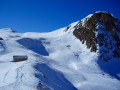
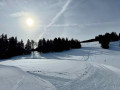
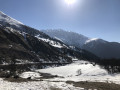
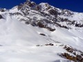
The views are magnificent along most of the route from (4) to (8).
Beaufortain, Mont Blanc, the Valais Alps, Mont Pourri-Bellecôte, Vanoise and the Trois Vallées, Péclet-Polset, Meije and the Aiguilles d’Arves, Perron des Encombre-Cheval Noir, Lauzière and Grand Arc, Tournette and Charvin.

Reviews and comments

5 / 5
Based on 1 review

Reliability of the description
5 / 5
Ease of following the route
5 / 5
Route interest
5 / 5
SOLIGNAC
SOLIGNAC

Overall rating : 5 / 5

Date of your route : Feb 02, 2026
Reliability of the description : ★★★★★ Very good
Ease of following the route : ★★★★★ Very good
Route interest : ★★★★★ Very good
Very busy route : No

A very beautiful hike, easy and safe despite the snow. Be sure to download the Visorando map, as it helps you find your way safely.

Machine-translated

Other walks in the area

For more walks, use our search engine .

The GPS track and description are the property of this route's author. Please do not copy them without permission.