From Aime la Plagne to Belle Plagne via Mont Jovet

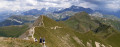
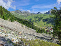
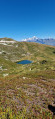
This hike can be done in a single day, but by taking your time, a short two-day trek allows you more time to admire the magnificent views of the mountains and valleys of the Vanoise and Tarentaise, as well as Mont Blanc. Doing it over two days gives us time to rest and take in these breathtaking landscapes. The climbs are relatively challenging and the ridge walk offers dizzying yet unforgettable experiences.

Details

36820038
Creation:
Last update:
Last review:
  • Walking
    Activity: Walking
  • ↔
    Distance: 10.25 mi
  • ◔
    Average duration: 7h 55 
  • ▲
    Difficulty: Difficult

  • ⚐
    Back to start: No
  • ↗
    Ascent: + 3,681 ft
  • ↘
    Descent: - 3,796 ft

  • ▲
    Highest point: 8,491 ft
  • ▼
    Lowest point: 6,296 ft

Photos

Description of the walk

The start point is at the northern end of the main building at Aime 2000. For parking, there are car parks a little further down in the village, or you can take the ‘Télémétro’ (a large, free gondola lift from La Plagne centre) directly to the ‘Amiral’ building at Aime 2000.

(S) Start by following the stony track, then, very soon – after about 50 m – turn left onto the small path heading due west. Follow it to the Ruisseau des Frasses.

(1) Then take the track for about 900 m. Go round the farm building by following the path on the left without going all the way to Lac des Grenouilles. You’ll come to a junction.

(2) Take the path on the left towards the Tête du Jarset: please note that there are several routes to the Col du Lac.

(3) Once you reach the Tête du Jarset, continue along the path over the ridges to the Col du Lac.

(4) Go round Lake Bovet to the south, following the path.

(5) When you reach the Col du Jovet, take the path on the left and follow the ridge.

(6) Look out for the path on the right which you will take on the descent, and continue along the ridge to the summit of Mont Jovet.

(7) Descend by following the same route you took on the ascent.

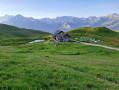
(6) Turn left onto the path which winds slightly towards the Chalet du Mont Jovet.

(8) Take the path on the left heading east, which goes round Mont Jovet. Continue to the Pas des Brebis.

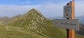
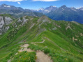
(9) Continue along the ridge path heading due east. Please note that some sections are vertiginous and may make you feel a bit uneasy, but the view from the Crête des Étroits is magnificent. After a lovely short climb, you’ll reach the summit of the Roc du Bécoin, which, at 2,594 m, is the highest point of this hike.

(10) Continue along the ridges, heading south-east, until you reach the Col de la Lovatière.

(11) Go round the Roc des Verdons to the south until you reach a track suitable for vehicles.

(12) Turn left onto the track and follow it to the Roc des Verdons. Continue, generally north-east, to the Col de la Petite Forcle.

(13) Carry on to the right towards the Grande Rochette, following the footpath rather than the direct but rather uninteresting ski run.

(14) Carry on eastwards, staying on the path rather than the parallel track suitable for vehicles, and begin the descent for about 300 m.

(15) Take the relatively inconspicuous path on the left which descends towards La Plagne, running alongside the Crête de la Grande Forcle.

(16) Pass close to the top station of the Colosses chairlift and continue along the track. About 300 m past the top station, follow the track to the right until you reach the junction with the other track, leading from Plan Leychoum to the Col de la Grande Forcle.

(17) Cross this junction to continue straight ahead, then immediately turn left. Follow this poorly marked path and head down to the right towards the track. The path is poorly marked but you can see the track below. Follow the track to the right and continue the descent until you reach Belle Plagne.

(18) Cross the village and its shops via the various paths and finish the route by arriving at the covered car park – free in summer – located at the top of the village, to the north (E).

Waypoints

  1. S : mi 0 - alt. 6,913 ft - Northern tip of the ‘Admiral’ building at Aime 2000
  2. 1 : mi 0.76 - alt. 6,296 ft - Ruisseau des Frasses
  3. 2 : mi 1.67 - alt. 6,627 ft - Crossroads leading to the Tête du Jarset
  4. 3 : mi 2.19 - alt. 7,448 ft - Tête du Jarset (2271m)
  5. 4 : mi 2.73 - alt. 7,736 ft - Col du Lac (2359mm)
  6. 5 : mi 3.15 - alt. 7,995 ft - Col du Jovet (2437m)
  7. 6 : mi 3.26 - alt. 8,189 ft - Start of the descent trail
  8. 7 : mi 3.51 - alt. 8,369 ft - Mont Jovet
  9. 8 : mi 4.41 - alt. 7,690 ft - Chalet du Mont Jovet
  10. 9 : mi 5.23 - alt. 7,999 ft - Not sheep
  11. 10 : mi 6.1 - alt. 8,422 ft - Roc du Bécoin
  12. 11 : mi 6.59 - alt. 7,927 ft - Col de la Lovatière (2417m)
  13. 12 : mi 6.84 - alt. 7,953 ft - Trail
  14. 13 : mi 7.3 - alt. 7,979 ft - Col de la Petite Force (2409m)
  15. 14 : mi 7.72 - alt. 8,146 ft - Grande Rochette
  16. 15 : mi 7.93 - alt. 7,877 ft - Descent from the Grande Rochette
  17. 16 : mi 8.59 - alt. 7,362 ft - Top station of the Colosses chairlift
  18. 17 : mi 9.16 - alt. 7,228 ft - Elevation 2,202 – Junction of two trails
  19. 18 : mi 9.95 - alt. 6,814 ft - Belle Plagne
  20. E : mi 10.25 - alt. 6,791 ft - Car park at the top of Belle Plagne

Notes

You can travel between the villages by shuttle bus, chairlift or gondola. They are all free of charge, making it easy to get around.

If you choose to complete the route over two days, the Chalet du Mont Jovet mountain refuge offers accommodation in private rooms, dormitories or as a bivouac. You can also book hot meals, breakfast and drinks. The staff are very friendly. Please check before you set off to make a booking. The refuge is not open all year round.

Reviews and comments

4.7 / 5
Based on 2 reviews

Reliability of the description
4.5 / 5
Ease of following the route
4.5 / 5
Route interest
5 / 5
User 24894968

Overall rating : 4.3 / 5

Date of your route : Sep 14, 2026
Reliability of the description : ★★★★☆ Good
Ease of following the route : ★★★★☆ Good
Route interest : ★★★★★ Very good
Very busy route : No

Stunning scenery, magnificent views

Machine-translated

vevedeneuvy
vevedeneuvy

Overall rating : 5 / 5

Date of your route : Jul 15, 2026
Reliability of the description : ★★★★★ Very good
Ease of following the route : ★★★★★ Very good
Route interest : ★★★★★ Very good
Very busy route : No

A day-long hike undertaken in the opposite direction to that suggested, as I was staying in Belle Plagne and the shuttle bus timetables were incompatible with my set-off time (7.45 am). A circular hike returning to the starting point in the early afternoon: via the signposted ‘balcony path’, situated slightly below the famous flagship building mentioned in the original description. The views are indeed magnificent at every stage (Grande Rochette, Bécoin, Crêtes des Étroits, Mont Jovet, Col du Lac). Edelweiss grew alongside the 4x4 track on the ascent to the Grande Rochette chalet. We encountered very few other walkers along the route (up to Plagne Aime 2000). It seems to me that the hike is less demanding when done in this direction, as once you reach Mont Jovet, it’s simply a matter of letting the path take you to the end. A really lovely hike and some wonderful memories!

Machine-translated

Other walks in the area

For more walks, use our search engine .

The GPS track and description are the property of this route's author. Please do not copy them without permission.