Circuit of the Aiguille du Rateau via the Merlet Lakes

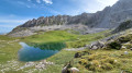
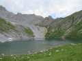
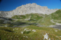
Starting from the Courchevel ski area, the suggested route heads into the Vanoise National Park to circumnavigate the Aiguille du Rateau via the Col du Rateau. On the return journey, a slight detour is suggested to visit the Merlet Lakes.

A very scenic hike through the Rosière valley in the Vanoise National Park.
There is a long stretch over scree, which explains why the hike is rated ‘Difficult’.

A circular variant compared to the other route suggested on Visorando, taking in the Merlet Lakes.

Details

60717566
Creation:
Last update:
Last review:
  • Walking
    Activity: Walking
  • ↔
    Distance: 10.50 mi
  • ◔
    Average duration: 7h 25 
  • ▲
    Difficulty: Difficult

  • ⚐
    Back to start: Yes
  • ↗
    Ascent: + 2,966 ft
  • ↘
    Descent: - 2,995 ft

  • ▲
    Highest point: 8,822 ft
  • ▼
    Lowest point: 6,909 ft

Photos

Description of the walk

Starting point: Signal d’Ariondaz car park, near Lac d’Ariondaz. The route is well signposted from Courchevel 1850 and is tarmac-surfaced right up to the car park.

(S/E) Head south-east, skirting Lake Ariondaz on the left, towards the Signal d’Ariondaz chairlift.

(1) Just below the chairlift, at the junction, turn right towards the Vallon de la Rosière. Cross a stream and continue along the path until you rejoin the road in the valley.

(2) At the junction, go straight on, following the road, until you reach the junction at the Cave de la Grande Val.

(3) Turn left, heading towards the Col des Saulces or the Petit Mont Blanc. Carry on walking until you reach the Chalets de la Grande Val.

(4) Carry on straight ahead to reach the Cave de la Petite Val.

(5) Head towards the Col du Rateau by turning right.

(6) At the next junction, carry on straight ahead, skirting the Aiguille du Rateau on the left, and head for Lac du Rateau.

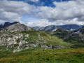
(7) Follow the path through the scree, which is easy to spot by following the orange circles painted on the rocks. At the end, a steep climb leads up to the Col du Rateau.

(8) Descend from the pass via the scree slope, taking the path on the right that runs alongside the Aiguille du Rateau. Orange markings are visible on the rocks. You’ll reach a junction at the Ruisseau des Avals.

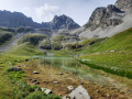
(9) Ignore the sign for the Col de Chanrouge. Turn right to go round the Aiguille du Rateau. Follow the stream and continue along the valley floor until you reach the next junction, from where you can see Lac du Pêtre in the distance.

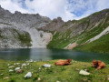
(10) Turn left to climb up to the Lacs Merlet, as indicated on the signposts. Climb up to the Lower Lac Merlet.

(11) At the junction, you can continue straight on towards the Refuge des Lacs Merlet and pass through it. However, it is recommended that you take a detour and turn left to climb up to Upper Lac Merlet.

(12). If you have taken the detour to Upper Merlet Lake, return to the fork in the path.

(11) Turn left and head up to the Refuge des Lacs Merlet.

(13) Head up behind the refuge to continue the route and reach the Col de la Platta.

(14) Continue straight on at the junction, towards Courchevel. You’ll reach the Courchevel ski area, including the Roc Merlet chairlift. Follow the Pyramide ski lift, veering away from it at times, and head for the Signal d’Ariondaz car park (S/E).

Waypoints

  1. S/E : mi 0 - alt. 7,083 ft - Signal d’Ariondaz car park
  2. 1 : mi 0.5 - alt. 7,293 ft - Upper station of the - Télésiège du Signal
  3. 2 : mi 1.83 - alt. 6,913 ft - Junction between the path and the road
  4. 3 : mi 2.21 - alt. 7,116 ft - Cave de la Grande Val
  5. 4 : mi 2.37 - alt. 7,119 ft - Chalets de la Grande Val
  6. 5 : mi 2.7 - alt. 7,333 ft - Cave de la Petite Val
  7. 6 : mi 2.83 - alt. 7,379 ft - Junction towards the Col du Rateau
  8. 7 : mi 3.83 - alt. 8,022 ft - Lac du Rateau
  9. 8 : mi 4.49 - alt. 8,822 ft - Col du Rateau (2688m)
  10. 9 : mi 5.18 - alt. 8,143 ft - Junction towards the Col de Chanrouge
  11. 10 : mi 6.31 - alt. 7,523 ft - Plan du Pêtre junction
  12. 11 : mi 7.17 - alt. 7,867 ft - Junction - Lac Merlet inférieur
  13. 12 : mi 7.7 - alt. 8,031 ft - Lac Merlet supérieur
  14. 13 : mi 8.34 - alt. 7,927 ft - Refuge des lacs Merlet
  15. 14 : mi 9.29 - alt. 7,890 ft - Col de la Platta
  16. S/E : mi 10.5 - alt. 7,083 ft - Signal d’Ariondaz car park

Notes

There are a few water sources along the way.
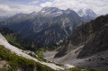
The scree slopes on the ascent and descent of the Col du Rateau can be challenging due to the steepness, and the signposting is not very visible; do not hesitate to take your time.
We strongly recommend hiking up to Lac supérieur Merlet!

Worth a visit

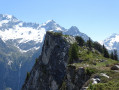
Views of the Vanoise glaciers and the Grande Casse can be enjoyed throughout the route, particularly from the Col du Rateau.

Reviews and comments

5 / 5
Based on 2 reviews

Reliability of the description
5 / 5
Ease of following the route
5 / 5
Route interest
5 / 5
quito84
quito84

Overall rating : 5 / 5

Date of your route : Sep 05, 2026
Reliability of the description : ★★★★★ Very good
Ease of following the route : ★★★★★ Very good
Route interest : ★★★★★ Very good
Very busy route : No

A really lovely hike, quite challenging around the Col du Rateau (with steep sections on both the eastern and western approaches)! We set off from the Col de la Platta, then on to the Refuge du Merlet, the Col de Chanrouge, the Lac du Rateau, the Refuge du Grand Plan and the Lacs du Merlet on the way back (there was no one at the upper lake, which is absolutely stunning at that time of day)! Heading in this direction, as mentioned earlier, the orange markers are clearly visible throughout the hike. Stunning views, passes and lakes, and varied trails – don’t hesitate!! Thanks for the suggestion!!

Machine-translated

Franck07FB
Franck07FB

Overall rating : 5 / 5

Date of your route : Aug 15, 2024
Reliability of the description : ★★★★★ Very good
Ease of following the route : ★★★★★ Very good
Route interest : ★★★★★ Very good
Very busy route : No

It’s best to do this hike in this direction, so you can spend some time by the Merlets lakes.
Please note that the pink-and-orange signposts were probably put up for a route in the opposite direction (this is the Courchevel trail route), so the markers are sometimes less visible

Machine-translated

Other walks in the area

For more walks, use our search engine .

The GPS track and description are the property of this route's author. Please do not copy them without permission.