Country:

 City:
City:


Use the large Cochet car park at the entrance to Saint-Martin-de-Belleville. Follow Rue du Cochet to reach the start of the ski lift. Ski passes are available for the 3 Vallées: €65.50 for unlimited access over seven consecutive days, or €10.30 per ride in 2026. Take the cable car up to Le Molard, then the chairlifts to Tougnète.
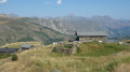
(S) From the top station of the chairlift,follow the signposts for ‘Les Ménuires Roc 1’ and head due south. The well-marked path is easy going and descends gently.
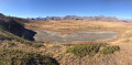
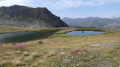
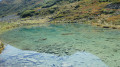
(1) Leave the path on the left to visit the lakes known as Grand Lac. A return trip is possible, with a chance to stop for a break by the lower lake.
(2) Retrace your steps.
(1) Continue to the left along the pleasant descent on the well-marked path.
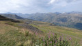
(3) On your left you’ll find the path leading up to Lac des Allamands. (You can take this as an alternative route; the circular path rejoins the main path.) Continue down the zigzagging path, then climb slightly towards the finish at Roc 1 and the cable car (E).
Take the cable car, which will take you down to Les Ménuires in the La Croisette district. Make your way to the coach station to catch a free shuttle bus, which will take you back to your car parked in Saint-Martin-de-Belleville.
 Visorando Member
 Very difficult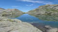
 Difficult
 Moderate