The circuit around the Aiguille du Rateau

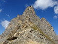
A physically demanding, off-the-beaten-track walk in a landscape that is at times very wild and rocky.

Details

2826751
Creation:
Last update:
Last review:
  • Walking
    Activity: Walking
  • ↔
    Distance: 9.88 mi
  • ◔
    Average duration: 7h 10 
  • ▲
    Difficulty: Difficult

  • ⚐
    Back to start: Yes
  • ↗
    Ascent: + 2,972 ft
  • ↘
    Descent: - 2,943 ft

  • ▲
    Highest point: 8,825 ft
  • ▼
    Lowest point: 6,089 ft

Photos

Description of the walk

To reach the start of the walk, follow the Vallée des Avals to the left at the roundabout in Courchevel 1650. Then take a dirt track to the Croix du Biol, the starting point of the walk.
Park where best you can, taking care not to obstruct the passage of farm machinery.

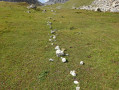
(S/E) Head due south towards the Croix de la Grande Val, staying on the track. Pass some strange cairns. Continue to the junction at the Chalets de la Cave de la Grande Val.

(1) Head towards the Chalets de la Grande Val, leaving the path leading to the Grand Plan refuge and the Merlets lakes on your right. Turn left and head for the crossroads of paths at the Cabane Cave de la Petite Val.

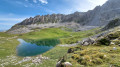
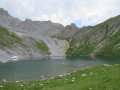
(2) Go round the hut, either to the right or to the left, and look out for the path heading due south. Take this path. Once on the path – which sometimes disappears – head towards the lake via the Combe du Rateau until you reach it.

(3) Walk along the right-hand side of the lake, then follow a path that is clearly marked at the start. Further on, the cairns and markings become scarce. You will reach a rock marked ‘Col du Râteau’. This is not the pass itself, which is visible in the distance beyond the snowfield.

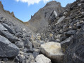
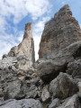
(4) Head towards the Col du Râteau by sight, making your way through the rocks.
Take care here: snowfields may be present all year round. The slope becomes steep and requires caution due to the unstable terrain. Reach the pass.

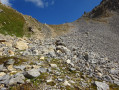
(5) Begin the descent with great caution for the first few metres. The landscape opens out. The path is not always visible, but lines of stones indicate the direction to follow. Reach the end of the scree slope.

(6) Continue over easier terrain to reach the junction at the Ruisseau des Avals.

(7) Turn left to climb up to the Col de Chanrouge, where you can enjoy a fine view.

(8) Return via the same route to the previous junction.

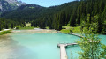
(7) Start the descent on the left, following the Ruisseau des Avals. You’ll reach Le Plan and Lac du Pêtre.

(9) Walk round the lake and take the well-marked path. You’ll reach the junction at the Chalets de la Grande Val, which you passed on the way out.

(1) Follow the route back in the opposite direction to return to the Croix de Biol car park (S/E).

Waypoints

  1. S/E : mi 0 - alt. 6,089 ft - Biol Cross
  2. 1 : mi 2.03 - alt. 7,116 ft - Junction of the circular loop
  3. 2 : mi 2.39 - alt. 7,320 ft - Crossroads at the Cabane Cave in the Petite Val
  4. 3 : mi 3.57 - alt. 8,015 ft - Lac du Rateau
  5. 4 : mi 4.16 - alt. 8,638 ft - Engraved rock
  6. 5 : mi 4.3 - alt. 8,819 ft - Col du Rateau (2688m)
  7. 6 : mi 4.7 - alt. 8,412 ft - End of the scree slope
  8. 7 : mi 5.07 - alt. 8,143 ft - Ruisseau des Avals junction
  9. 8 : mi 5.32 - alt. 8,310 ft - Col de Chanrouge
  10. 9 : mi 7 - alt. 7,497 ft - Lac du Pêtre
  11. S/E : mi 9.88 - alt. 6,089 ft - Biol Cross

Notes

The climb to Grande Val takes you through alpine pastures. Please ensure you close the gates properly.
This walk does not present any technical difficulties, but requires a good understanding of the terrain and sure-footedness for the ascent and descent of the pass. Avoid in unsettled or rainy weather.
There is little running water along the route, so please bring sufficient drink.

Worth a visit

This walk intersects with many other routes and offers numerous alternatives: the Petit Mont-Blanc, the Merlet Lakes, and Courchevel via Plan Mugnet or the Pyramide.
(7) See here: Lake Chanrouge, the Aiguille de Chanrossa, Mont Coua, La Tueda

Reviews and comments

4.7 / 5
Based on 2 reviews

Reliability of the description
4 / 5
Ease of following the route
5 / 5
Route interest
5 / 5
Charline M
Charline M

Overall rating : 4.7 / 5

Date of your route : Jul 10, 2022
Reliability of the description : ★★★★☆ Good
Ease of following the route : ★★★★★ Very good
Route interest : ★★★★★ Very good
Very busy route : No

A very beautiful, uncrowded and pleasantly steep walk.
At the moment (July 2022), orange markers make it easier to find your way across the Col du Râteau, where the path isn’t always easy to spot.
As mentioned in a previous review, the car park at the Croix de Biol isn’t ideal. You’ll therefore need to add a few kilometres to the route by starting from the Belvédère car park. According to my GPS watch, the total distance of the route was closer to 24 km.

Machine-translated

ngillot
ngillot

Overall rating : 4.7 / 5

Date of your route : Aug 10, 2021
Reliability of the description : ★★★★☆ Good
Ease of following the route : ★★★★★ Very good
Route interest : ★★★★★ Very good
Very busy route : No

Hello,

please note that it is forbidden to drive along the track to the Croix de Biol. Allow 2 × 3 = 6 km of easy walking to reach the Croix de Biol from the car parks in front of the blocks of flats on Rue des Avals.

https://www.google.fr/maps/@45.405474,6....!3m6!1e1!3m4!1sZc971h9OtqwS-4Yvk2hjLw!2e0!7i13312!8i6656!5m1!1e4

Point 2 is a small building on the right with no sign; we walked past it and then had to retrace our steps.

We had a brilliant walk – many thanks to the author.

Machine-translated

Other walks in the area

For more walks, use our search engine .

The GPS track and description are the property of this route's author. Please do not copy them without permission.