Country:

 City:




The car park is situated on the left-hand side of the D89, at the entrance to Montagny when coming from Brides-les-Bains, heading towards Bozel.
(S/E) Follow the path which climbs alongside the car park on the right; when you reach a road, turn right and then immediately left to continue the climb. When you reach a crossroads, turn right, pass a path on your right and, after a hairpin bend to the left, you’ll come to a path leading off to the right.
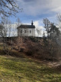
(1) Cross the track and continue along a path on the left. Follow this path, cross the track once more and, after a final climb, reach the site of the Notre-Dame de Neiges Chapel, which is on the right. Walk to the end of the headland and back, returning to a crossroads.
Take the path on the right which descends towards the hamlet of Le Villard; you’ll reach it at a car park and continue on to a fork in the path.
(2) Leave the road on your left and continue down the slope. Ignore a street on your right; you’ll reach a crossroads and a chapel on your right. Cross carefully, leave the path leading straight ahead and follow the one descending to the right. Ignore another path on the left and continue down a clearly marked slope. You’ll reach a car park; continue to the right, then quickly leave the track for the path leading down to the left. You’ll reach a road; cross it carefully and continue down the steep path to reach the hamlet of La Roche.
(3) When you reach the D89, near an old oven and a pond, cross it carefully and continue straight ahead up the steps to reach a street. Follow it to the right, reach a car park and continue to the path that begins at the end of the street. Follow this wide track, ignoring the other paths, and continue downwards. Pass under a high-voltage power line and join another track coming from the left, then turn right.
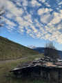
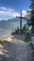
(4) The track gives way to a lovely balcony-style path that winds along the hillside and offers beautiful views over the Doron de Bozel valley. After a steep descent, the path curves to the right and reaches a signpost for walking routes.
(5) Take the very steep path that starts off to the right and follow the winding track which, after passing a pylon, leads onto a stony path that continues to climb steeply until you reach the first hairpin bend. Ignore a path on the left and continue climbing to the right. You’ll reach another junction with a hiking signpost; turn right.
(6) Stay on the path leading to Montagny. Reach the first houses at the bottom of the village, pass a street on the left and reach a Fork in the road.
(7) Do not continue uphill towards the D89; instead, follow the left-hand branch, the Rue du Bas du Village (Rue Saint Germain on the IGN map), until you reach the Rue des Pavés on your right.
(8) Take this road and climb up to the D89, then turn left. Follow Rue de la Scierie, passing a chapel on the right and a pond on the left, and continue to the car park (S/E).

 Visorando Member

 Easy
 Difficult