


Refine your search for walks in Vauthiermont
Vauthiermont walks


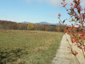
 Saint-Nicolas circular route: the Haut Bois route
 Visorando Member
 8.33 mi
 +236 ft
 -210 ft
 4h 00
 Moderate
 Departure from Vauthiermont (Territoire-de-Belfort)
This route will take you deep into the natural forest environment and offer you a glimpse of a wide variety of agricultural landscapes.
Located 15 km east of Belfort, this circular walk is a little long but fairly easy.
It is signposted.
Larivière Circular
6.93 mi
+66 ft
-69 ft
3h 15
Moderate
Departure from Larivière (Territoire-de-Belfort)
A beautiful discovery of the region around the village of Larivière. In the clearing 10 km north-east of Belfort, this walk will introduce you to a varied landscape of forests, ponds, cultivated fields and pastures.
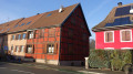
The Felon friends’ outing to Lachapelle-sous-Rougemont
 4.72 mi
+66 ft
-72 ft
2h 15
 Easy
Departure from Lachapelle-sous-Rougemont (Territoire-de-Belfort)
A pleasant walk through the countryside and woodland. Beautiful views of the Vosges peaks.
Easily accessible from the D83 (formerly the N83), about fifteen kilometres north-east of Belfort.
Numerous information boards provide details of the local heritage, wildlife, flora and landscapes.
The route is marked with a Red Ring.
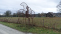
The lower fields of Petitefontaine. The Birds of Prey Walk.
 3.27 mi
+82 ft
-82 ft
1h 35
Easy
Departure from Lachapelle-sous-Rougemont (Territoire-de-Belfort)
A signposted walk suitable for families through the countryside and forest. Beautiful views of the Vosges peaks without having to climb them. Easily accessible from the D83 (formerly the N83), about 15 km north-east of Belfort. Numerous information boards provide details of the heritage, wildlife, flora and landscapes.
The route is marked with a Blue Ring.
Circular starting from Lachapelle-sous-Rougemont
 Local authority6.34 mi
+115 ft
-115 ft
3h 00
Moderate
Departure from Lachapelle-sous-Rougemont (Territoire-de-Belfort)
Discover a splendid circular hiking loop starting from Lachapelle-sous-Rougemont in the Belfort gap, on the border with Alsace, 15 kilometres north-east of Belfort.
You will admire landscapes of cultivated fields, meadows and magnificent forests, not to mention the stork nests at Petitefontaine.
You can stop for refreshments at Lac de la Seigneurie.
Enjoy exceptional views of the Southern Vosges mountain range and the Swiss Jura.
Ideal for walking enthusiasts keen to discover the region's natural and cultural heritage.
The route is signposted.
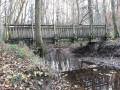
The natural areas of Lagrange and its arboretum
 1.78 mi
+69 ft
-66 ft
0h 55
Easy
Departure from Lagrange (Territoire de Belfort) (Territoire-de-Belfort)
An invitation to explore and help preserve the forest’s fragile habitats and trees.
A short, easy walk 10 km east of Belfort.
It is signposted.
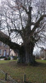
Aéroparc à Fontaine, Reppe et Larivière. Circuit des trois villages.
 7.86 mi
+98 ft
-102 ft
3h 40
Moderate
Departure from Fontaine (Territoire de Belfort) (Territoire-de-Belfort)
This pleasant hike will allow you to discover three typical villages: Fontaine, Reppe and Larivière, as well as the former Fontaine aerodrome.You will also see magnificent countryside landscapes and beautiful views of the Vosges mountains.This walk is signposted.
01/2026: the path has been diverted at the exit of Reppe to avoid traffic on the main road.
Traubach, heritage and the surrounding natural area
 10.55 mi
+472 ft
-443 ft
5h 15
Moderate
Departure from Traubach-le-Haut (Haut-Rhin)
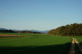
This fairly long but easy walk will take you past the site of the former Hohburg Castle in Traubach, a fountain well in Guevenatten, the fortified church of Saint-Cosme, Notre-Dame de Bellefontaine, the markers of the old border, the Étang du Milieu and, finally, the oratory, a tribute to the Virgin Mary by a sailor.
La Seigneurie and its lake from Petitefontaine
 4.54 mi
+92 ft
-92 ft
2h 10
Easy
Departure from Petitefontaine (Territoire-de-Belfort)
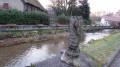
A pleasant hike near Petitefontaine, 20 km north-east of Belfort. You will discover a charming little village and countryside landscapes of forests with numerous ponds. You can take a short detour to admire Lac de la Seigneurie.
The hike is marked with a Green Ring.
The Pré des Loups Trail: Felon – Saint-Germain-le-Châtelet – Romagny
 6.22 mi
+505 ft
-502 ft
3h 20
Moderate
Departure from Felon (Territoire-de-Belfort)
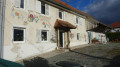
A pleasant walk through the countryside and forest.
Beautiful views of the Vosges peaks without having to climb them.
It is easily accessible from the D83 (formerly the N83), about ten kilometres north-east of Belfort.
The route is marked with a Green Ring.
The storks’ passage through Petitefontaine via the ponds
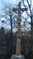 3.50 mi
+98 ft
-98 ft
1h 40
Easy
Departure from Petitefontaine (Territoire-de-Belfort)
A lovely walk that takes you through countryside and woodland, dotted with some very pretty ponds. There are plenty of footpaths and very little tarmac along this route.
The circular route is signposted with a Red Ring.
Moulin loop between Lacollonge and Bethonvilliers
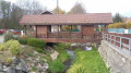 5.77 mi
+102 ft
-98 ft
2h 45
Easy
Departure from Lacollonge (Territoire-de-Belfort)
A beautiful walk in the countryside of Lacollonge and Bethonvilliers. 10 km east of Belfort. Beautiful view of the peaks of the Southern Vosges.
Countryside landscape watered by the Madeleine River. Beautiful old farms, a beautiful covered wooden bridge, a few beautiful ponds, an old mill...
The walk is signposted.
Le Pré de la Caille, Frais route
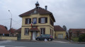 4.66 mi
+72 ft
-72 ft
2h 10
Easy
Departure from Frais (Territoire-de-Belfort)
A pleasant hike near Frais, located 10 km east of Belfort.
You can admire a rich architectural and natural heritage, beautiful half-timbered houses and a superb view of the Southern Vosges.
The route is marked with a red ring.
Chavannes-sur-l'Étang pond trail
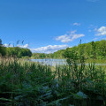 6.27 mi
+66 ft
-66 ft
2h 55
Easy
Departure from Chavannes-sur-l'Étang (Haut-Rhin)
A superb hike on the border between Belfort and Haut Rhin. You will discover a landscape of countryside and forests with magnificent ponds. As a bonus, there is a discovery trail with information panels about the trees of our region.
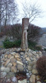
Circular starting from Saint-Germain-le-Chatelet
 3.81 mi
+282 ft
-279 ft
2h 00
Easy
Departure from Saint-Germain-le-Châtelet (Territoire-de-Belfort)
A pleasant walk to discover the villages of Anjoutey, Bourg-sous-Châtelet and Saint-Germain-le-Châtelet, as well as lovely countryside and woodland scenery.
A special feature of this walk: poems created by a local ‘writing workshop’ are displayed on signs along the route.
The walk is signposted with a Blue Ring.
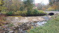
A circular path at Les Errues
 6.02 mi
+390 ft
-390 ft
3h 05
Easy
Departure from Menoncourt (Territoire-de-Belfort)
This route will reveal its many facets: architecture, landscape and geology will unfold before you as you walk.
The route is situated 10 km north-east of Belfort.
It is easily accessible from the D83 (formerly the N83)
It is signposted with a Blue Disc.
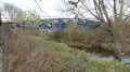
The Marnière circular in Foussemagne
 4.11 mi
+30 ft
-30 ft
1h 55
Easy
Departure from Foussemagne (Territoire-de-Belfort)
This is a very pretty hike that will allow you to discover a charming village and its suburbs, an old synagogue and an "Arromanches" type bridge. It passes near the Porte d'Alsace area with the Fosses discovery trail, where you will learn to recognise the trees of our region. Not to mention the Étang de la Marnière, a vast wetland with flora and fauna to discover.
The hike is signposted.
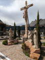
The new municipality of Haut-Soultzbach
 4.52 mi
+302 ft
-315 ft
2h 20
Easy
Departure from Mortzwiller (Haut-Rhin)
Formed from the merger of the former independent communes of Soppe-le-Haut and Mortzwiller, Haut-Soultzbach offers lovely paths and views from its higher ground.
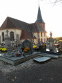
The Bois de Bessoncourt, Fort Route
 8.67 mi
+203 ft
-200 ft
4h 10
Moderate
Departure from Bessoncourt (Territoire-de-Belfort)
A lovely circular walk 10 km east of Belfort. It will take you through Bessoncourt with its fort, Phaffans, its church and its former presbytery, and Denney with its superb town hall and a perfectly preserved wash house. Not to mention beautiful countryside scenery and a lovely view of the Vosges mountain range.
This walk is signposted.
Circular route of La Madeleine from the Étang du Moulin des Bois
4.52 mi
+69 ft
-69 ft
2h 10
Easy
Departure from Bessoncourt (Territoire-de-Belfort)
Starting from the Étang du Moulin car park, explore the villages of Phaffans and Lacollonge on an easy circular route around the River La Madeleine, offering beautiful views of the Southern Vosges from the Planche des Belles Filles to the Grand Ballon.
Tour of the village of Rougemont-le-Château
4.10 mi
+522 ft
-522 ft
2h 20
Easy
Departure from Rougemont-le-Château (Territoire-de-Belfort)
A walk in the vicinity of Rougemont-le-Château at the foot of the Vosges Mountains, 15 km north-east of Belfort. It will allow you to discover superb ponds, woodland, a few meadows and a small part of this charming town. It is signposted with the coat of arms of Rougemont, featuring a drawing of a castle.
From Montreux-Vieux to Montreux-Châteaux via Reppe and Fontaine
19.29 mi
+236 ft
-246 ft
9h 05
 Very difficult
Departure from Montreux-Vieux (Haut-Rhin)
This is a long, completely flat walk that straddles the Franche-Comté and Alsace regions. It is a challenging walk due to its length, but it offers the chance to see many points of interest such as the Marnière and Belle Île ponds, the Notre-Dame de Bellefontaine Chapel, the Tilleul de Turenne, the Petit-Croix Church and, finally, the Sainte-Catherine Chapel and the feudal motte of Montreux-Château. The entire walk alternates between woodland, villages and countryside.
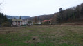
Circular route at the foot of the old castle in Rougemont-le-Château
 5.55 mi
+961 ft
-961 ft
3h 25
Moderate
Departure from Rougemont-le-Château (Territoire-de-Belfort)
Starting from Rougemont-le-Château, this is a pleasant walk with a beautiful view of the Saint-Nicolas valley. A detour is possible to reach the castle ruins.
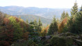
The Baerenkopf in Rougemont-le-Château
 10.30 mi
+2,313 ft
-2,306 ft
6h 45
Very difficult
Departure from Rougemont-le-Château (Territoire-de-Belfort)
One of our great challenging walks, offering all the variety of scenery we love: panoramic views, ridge paths, pine forests, streams, ancient stones – you name it, it’s all here.
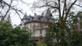
Around Mont Marty in Rougemont-le-Château
 5.55 mi
+610 ft
-640 ft
3h 05
Easy
Departure from Romagny-sous-Rougemont (Territoire-de-Belfort)
A hike mainly through woodland around Mont Marty near Rougemont-le-Château, 15 km north-east of Belfort.You will discover beautiful countryside and woodland scenery with some lovely ponds.You will pass by the Mont Marty nature trail, featuring sixteen botanical markers on the trees in our forests.The walk is signposted with a Blue Ring.
The Baerenkopf from Rougemont-le-Château
 12.57 mi
+3,346 ft
-3,343 ft
8h 40
 Difficult
Departure from Rougemont-le-Château (Territoire-de-Belfort)
A hike with no technical difficulty but a significant elevation gain. Beautiful panoramic views, including the Belfort Gap. This hike takes you past the highlights of the ruins of Rougemont Castle, Sainte Catherine Chapel, the Sudel, the Baerenkopf and the hamlet of Saint Nicolas.
The green escape from La Madeleine to Anjoutey
 5.16 mi
+285 ft
-289 ft
2h 35
Easy
Departure from Anjoutey (Territoire-de-Belfort)
Explore the magic of the Madeleine River in Anjoutey: a captivating adventure with the added bonus of discovering the Moulin wetlands. Set off on a dynamic hike where the wild nature of the Belfort gap reveals an enchanting landscape. Explore the diversity of the landscape through vast meadows and peaceful ponds, not to mention superb views of the countryside and the Southern Vosges mountains. An enriching experience to fully enjoy the local natural heritage.
Walk around Mont Bonnet and the spinning mills of Anjoutey and Étueffont
 6.46 mi
+522 ft
-512 ft
3h 25
Moderate
Departure from Anjoutey (Territoire-de-Belfort)
A pleasant hike through the countryside and forest. It allows you to discover the villages of Anjoutey and Étueffont as well as beautiful landscapes along the Madeleine.
Beautiful view of the Vosges peaks without having to climb them.
It is easily accessible, about ten kilometres north-east of Belfort.
The route is marked with a red ring.
The Doller along the Lauw
 4.85 mi
+148 ft
-141 ft
2h 20
Easy
Departure from Sentheim (Haut-Rhin)
Follow the Doller river on this route, which showcases the villages of Sentheim and Lauw.
Circular route from La Baroche to Phaffans
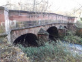 7.18 mi
+131 ft
-105 ft
3h 25
Moderate
Departure from Phaffans (Territoire-de-Belfort)
This route showcases the Vosges landscape.
A fairly long walk but with very little elevation gain, easily accessible from 6
balisakm to the north-east of Belfort.
Beautiful views of the Vosges peaks without having to climb them.
It can easily be split into two if you wish to shorten the route.
The walk is signposted.
The Oberwald and Sainte-Anne Chapel Circular Route, starting from Lauw
3.63 mi
+125 ft
-138 ft
1h 45
Easy
Departure from Lauw (Haut-Rhin)
From the centre of Lauw, enjoy a pleasant walk through fields and the beautiful deciduous forests of the Oberwald, returning from Sentheim via the Chapel of St Anne and past the Hohlenstein Cave before following the banks of the Doller.
The Hochburg via the Cols d'Hundsruck, Schirm and Rocher du Poilu
12.04 mi
+2,110 ft
-2,096 ft
7h 20
Difficult
Departure from Sentheim (Haut-Rhin)
From the car park at Sentheim church, a pleasant, undulating hike passes through Spannplatz between Bourbach-le-Bas and Rammerstatt, climbing towards the Col d'Hundsruck via the Hochburg shelter, where you can enjoy beautiful views of the Swiss Jura and the Bernese Alps in good weather. Then descend towards Bourbach-le-Haut, passing through the Col du Schirm and climbing up to the Rocher du Poilu to enjoy the magnificent view despite the somewhat overgrown forest, before returning to Sentheim via the Chapelle des Mineurs and part of the Geological Trail and Hasenwald.
The Doller Valley from Sentheim to Masevaux via Wolfenloch
9.47 mi
+856 ft
-837 ft
5h 05
Moderate
Departure from Sentheim (Haut-Rhin)
This hike takes you mainly through forest from Sentheim to Masevaux via the Wolflenloch discovery trail. The return route follows the Doller river, passing the Hohenstein Cave and Sainte-Anne Chapel.
Circular walk of the Miners' Chapel and the geological trail from Sentheim
 5.25 mi
+400 ft
-404 ft
2h 45
Easy
Departure from Sentheim (Haut-Rhin)
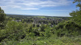
From the car park at Sentheim church, cross the Doller river and climb the hill above the village via the Way of the Cross and its thirteen stations, the Virgin of Rollenberg, the Eichwald forest and the old sports trail. Return via Knapphutte and the Miners' Chapel, then take a section of the geological discovery trail.
The Bessoncourt high wood tour
7.63 mi
+200 ft
-203 ft
3h 40
Moderate
Departure from Bessoncourt (Territoire-de-Belfort)
A true journey through history, this hike alternates between remarkable sites and natural gems.
The route is marked with a yellow disc.
Circular route to the north of Sentheim
 9.36 mi
+1,388 ft
-1,391 ft
5h 30
Moderate
Departure from Sentheim (Haut-Rhin)
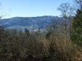
A route partly through woodland, offering the chance to discover numerous sites and monuments.
The wonders around Rougemont-le-Château
4.26 mi
+876 ft
-879 ft
2h 45
Easy
Departure from Rougemont-le-Château (Territoire-de-Belfort)
A magnificent walk through woodland and history. The deciduous forests, bathed in beautiful light, are majestic and welcoming.The walk starts at La Fouille l’Âne and follows the GR®532, which leads up to the heights of the village of Rougemont-le-Château. After crossing the Coiche forest, you arrive at the Plainot crossroads, a picnic spot, then head towards the old medieval castle. Then, via a shaded path, you head to the Sainte-Catherine chapel, another picnic spot below the Montagne du Sudel.The return journey follows a similarly shaded forest track; after skirting the quarry, you return to the starting point.
From Guewenheim to Hundsruck via Rammersmatt and then the heights of Bourbach
 13.79 mi
+2,169 ft
-2,159 ft
8h 15
Difficult
Departure from Guewenheim (Haut-Rhin)
Enjoy a long hike starting from the centre of the village of Guewenheim and heading towards the Col du Hundsruck. You can enjoy beautiful views of the plain, Lake Michelbach and the heights of Bourbach, and have a meal at the Chalet du Hochburg in Rammersmatt. In good weather, you may be able to see the snow-capped mountains of the Alps.
Circular loop via the Étang de l'Autruche and the Faré
 7.27 mi
+722 ft
-699 ft
4h 00
Moderate
Departure from Roppe (Territoire-de-Belfort)
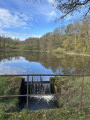
This family walk, starting from the Château Lesmann car park in Roppe, will take you to the distinctive Y-shaped Étang de l'Autruche lake and then to the Faré,the first line of defence of Fort de Roppe. Enjoy magnificent views of the Vosges mountains from Planche des Belles Filles to Grand Ballon. Finally, you will pass by the Maie farm and then near old gypsum mines (or holes), with views of the Jura and the Alps on a clear day, before returning to the starting point.
Discovering the heritage around Dannemarie
9.64 mi
+315 ft
-318 ft
4h 40
Moderate
Departure from Dannemarie (Haut-Rhin) (Haut-Rhin)
You’ll discover Dannemarie’s monuments and the surrounding countryside, with a beautiful view of the Ballersdorf viaduct and, further afield, the Sundgau and the Vosges. At the end of the walk, you’ll admire the Relais Nautique along the Rhône–Rhine Canal, followed by the former Gilardoni tile works.
Circular walk around the castle mound at Montreux-Château
 6.59 mi
+102 ft
-98 ft
3h 05
Moderate
Departure from Montreux-Château (Territoire-de-Belfort)
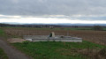
A lovely walk starting in Montreux-Château, located 15 km east of Belfort.
A pretty village with a chapel built near the site of a motte-and-bailey castle. You’ll discover a rural landscape with views of the Swiss Jura.
The walk passes the spot where Adolphe Pégoud, a flying ace, was shot down in 1915.
This walk is signposted.
The Fish Trail in Étueffont
2.86 mi
+66 ft
-66 ft
1h 20
Easy
Departure from Étueffont (Territoire-de-Belfort)
A superb walk for the whole family. The route crosses the village, runs alongside the Madeleine, passes by some beautiful ponds and ends at the Étueffont leisure centre, which offers a lovely spot for fishing and picnics.
Adolphe Pégoud circular in Petit-Croix
 6.50 mi
+102 ft
-102 ft
3h 05
Easy
Departure from Petit-Croix (Territoire-de-Belfort)
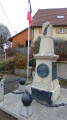
A beautiful hike starting in Petit-Croix, located 10 km east of Belfort.
You will discover a pleasant landscape at the foot of the Vosges mountains as you pass through the villages of Cunelières and Foussemagne.
The hike passes by the spot where Adolphe Pégoud, an aviation ace, was shot down in 1915. You will also see the monument dedicated to him in the centre of the village.
The trail is signposted.
From Étuffont to Saint-Nicolas
 4.32 mi
+292 ft
-266 ft
2h 15
Easy
Departure from Étueffont (Territoire-de-Belfort)
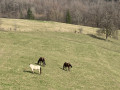
Head downhill and walk past Rougemont-le-Château before reaching the magnificent Saint-Nicolas valley.
Return along the hillside of the Tête le Moine.
Grambaechle circuit in Masevaux
 4.01 mi
+561 ft
-571 ft
2h 20
Easy
Departure from Masevaux (Haut-Rhin)
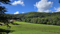
A pleasant discovery trail that takes you into the heart of nature around Masevaux. Along the way, you will enjoy some beautiful views of the Doller valley. A hilly circuit in the heart of the forest.
Circular route to Saint-Nicolas from Étueffont via Mont Bonnet and the ponds
6.31 mi
+761 ft
-738 ft
3h 35
Moderate
Departure from Étueffont (Territoire-de-Belfort)
Setting off from Étueffont, head uphill towards Mont Bonnet, passing between La Brosse and Mont Bonnet to enjoy the view over the surrounding valleys, then descend alongside the ponds, followed by the River Saint-Nicolas to the chapel of the same name in this hamlet. Return via the small road towards Étueffont, taking the ‘Red Ring’ marked trail, then further on an unmarked path, and from the Échancées farm, the ‘Chemin de Découverte du Renard’.
Boucle des Chevreuils via Tête Le Moine and Col des 7 Chemins
8.77 mi
+2,024 ft
-2,021 ft
5h 50
Difficult
Departure from Étueffont (Territoire-de-Belfort)
Loop starting from Étueffont-centre via the Chapelle du Mont Bonnet, the Tête Le Moine, the Trou du Loup, the small village of Lamadeleine Val des Anges, the Col des Sept Chemins (open shelter), the Tête des Mineurs and the place called Le Châtelat.Follow the Club Vosgien's "Anneau Jaune" (Yellow Ring) markings.
The Fox Nature Trail in Étueffont
2.52 mi
+420 ft
-400 ft
1h 30
Moderate
Departure from Étueffont (Territoire-de-Belfort)
A very pretty walk starting at the Étueffont forge, 15 km north-east of Belfort. It begins with a lovely stretch along the Madeleine and takes us through superb landscapes of forests and high-altitude meadows. At the Mont Bonnet chapel, you’ll discover a piece of our history.
Walk in Saint-Nicolas
6.02 mi
+620 ft
-620 ft
3h 20
Easy
Departure from Étueffont (Territoire-de-Belfort)
Short walk to Saint-Nicolas via forest paths and small roads along ponds and a small river.
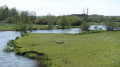
Circular Courlis and Rhône-Rhine Canal
 7.77 mi
+69 ft
-66 ft
3h 40
Moderate
Departure from Montreux-Château (Territoire-de-Belfort)
A pleasant hike in Montreux-Château, 15 km east of Belfort.
It will allow you to discover some very pretty villages:
- Autrage and Novillard with their pretty half-timbered houses.
- Petit-Croix with the Pégoud monument.
- Montreux-Château with its beautiful chapel and the motte castrale, the remains of a medieval castle.
The route is marked with a blue disc.
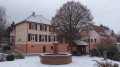
Les Terres Rouges: Petitmagny – Étueffont
 3.72 mi
+620 ft
-610 ft
2h 15
Easy
Departure from Étueffont (Territoire-de-Belfort)
A lovely walk through woodland and countryside.
Two charming villages to explore: Petitmagny and Étueffont.
An easily accessible walk at the foot of the Vosges, 15 km from Belfort.
The walk is signposted with a Green Ring.
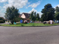
Circular between Étueffont and Grosmagny
 7.56 mi
+1,217 ft
-1,217 ft
4h 30
Moderate
Departure from Étueffont (Territoire-de-Belfort)
Discover a superb hike starting from Étueffont or Grosmagny, in the heart of a landscape offering a harmonious blend of forests, pretty authentic villages and peaceful ponds. Perfectly suited to nature lovers, this route will lead you to discover the splendid landscapes of the Southern Vosges. Let yourself be seduced by the tranquillity of the forests and the coolness of the ponds, true havens of biodiversity. The starting point is at the foot of the Vosges, about fifteen kilometres north of Belfort. The trail is signposted.
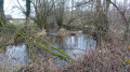
Circular Madeleine in Novillard, Fontenelle and Petit-Croix
 7.55 mi
+171 ft
-167 ft
3h 35
Moderate
Departure from Novillard (Territoire-de-Belfort)
A beautiful hike starting in Novillard, located 10 km east of Belfort.
You will discover Novillard, Fontenelle, Petit-Croix and beautiful countryside landscapes with views of the Swiss Jura and the Vosges. You will walk along the banks of the Madeleine river through the undergrowth.
The hike passes by the spot where Adolphe Pégoud, a flying ace, was shot down in 1915.
This hike is signposted.
The Hundsruck and Schirm Passes and Bourbach-le-Haut as seen from Bourbach-le-Bas
9.00 mi
+1,841 ft
-1,824 ft
5h 45
Moderate
Departure from Bourbach-le-Bas (Haut-Rhin)
A pleasant, undulating walk through varied landscapes, starting from Bourbach-le-Bas, passing through Spannplatz and the Krastkopf graves, near the summit of the Kohlberg, then on to the National Monument to the Shock Troops, where you can enjoy the view over the Doller Valley and the Thannerhubel and Rossberg massifs, followed by a descent via the Col d’Hundsruck, a walk through Bourbach-le-Haut and a return via the Col du Schirm.
The cabbage trail in Chevremont
5.37 mi
+171 ft
-167 ft
2h 35
Easy
Departure from Chèvremont (Territoire-de-Belfort)
This hike is marked with cabbage-shaped markers.
It will allow you to discover the village of Chèvremont and some of the old military installations located in the commune.
You will discover its church dating from 1784, built by the architect Kleber, the town hall and the adjoining facilities: school, nursery, cultural centre, Chougalante, cemetery.
The Sudel from Masevaux
 Tourist office
 4.43 mi
+1,473 ft
-1,463 ft
3h 20
Moderate
Departure from Masevaux (Haut-Rhin)
Starting from Masevaux, this hike will take you to Sudel, the south-eastern tip of the Vosges. It offers a beautiful view of the Belfort area, the Jura and the Alps. The hike is not difficult, there is just a slight incline.
A circular countryside walk in Pont d'Aspach
3.28 mi
+36 ft
-36 ft
1h 30
Easy
Departure from Burnhaupt-le-Haut (Haut-Rhin)
A lovely little walk, ideal for families in winter. It’s very easy but particularly pleasant on public holidays or Sundays, as you avoid the noise of traffic when walking alongside the RN83.
From Masevaux to Rossberg
 9.96 mi
+2,874 ft
-2,874 ft
7h 05
Difficult
Departure from Masevaux (Haut-Rhin)
This beautiful hike takes you from Masevaux to the summit of Rossberg at an altitude of 1,191 metres. From the top, you can enjoy magnificent views of the Vosges, the Alsace plain, the Black Forest, the Jura and the Alps. The elevation gain is significant, but the route is otherwise easy.
Circuit des Moineaux in Roderen
 4.39 mi
+577 ft
-577 ft
2h 30
Easy
Departure from Roderen (Haut-Rhin)
Between unspoilt nature and the pretty villages of Roderen and Rammersmatt, enjoy the beautiful panoramic views and wide open spaces offered by this part of Alsace. A varied walk through fields, orchards, farm animals, etc.
From Masevaux to Niederbruck via forest paths
 3.49 mi
+479 ft
-479 ft
2h 00
Easy
Departure from Masevaux (Haut-Rhin)
Between Masevaux and Niederbruck, more than ten kilometres of new forest paths have recently been created. Here is a nice little route of about 6 km that partly follows these new paths...
Hike accessible via Niederbruck Centre station.
Michelbach dam
 Association / Club / Walk leader
 2.65 mi
+49 ft
-49 ft
1h 15
Easy
Departure from Haut-Rhin
A circular walk around Michelbach dam with views over the Swiss Alps and 'Le Grand Ballon d'Alsace' on a clear day. Perfect spot for wildlife spotting. Along the way there are many signs giving some information about what to see and the history.
Michelbach Dam via Guewenheim
 6.94 mi
+463 ft
-443 ft
3h 35
Moderate
Departure from Haut-Rhin
A lovely family walk through forests and along riverbanks. Discover this dam, built between 1979 and 1982, which regulates the water table and ensures the supply of drinking water to the Mulhouse conurbation and its surroundings. It is a protected area; come and spot the birds in its nature reserve.
A circular starting from Roderen, Maria auf dem Rain chapel
 5.74 mi
+1,194 ft
-1,165 ft
3h 40
Moderate
Departure from Roderen (Haut-Rhin)
A beautiful hike through forests and fields with, depending on the weather, a beautiful view of the Alps as a bonus.
Niederbruck via the Bruckenwald farmhouse inn
 3.01 mi
+892 ft
-892 ft
2h 10
Moderate
Departure from Niederbruck (Haut-Rhin)
From Niederbruck to Bruckenwald: go via the trail and return via the path.
Virgin of Alsace, Sickertbach Pass and Rocher de la Croix
5.87 mi
+1,273 ft
-1,280 ft
3h 50
Moderate
Departure from Sickert (Haut-Rhin)
Starting from the centre of Sickert, a beautiful hike offering views of the Virgin of Alsace overlooking the Doller Valley, then ascending the Sickertbach valley, passing the Sickertbach Shelter and the pass of the same name, and returning via the foot of the Falkenstein to the Col de Luttersberg to enjoy the magnificent view from the Rocher de la Croix. Descent towards Sickert via the charming Chapel of the Owls (Kutzakapalala).
Route des autres chênes (Other Oaks Route) towards Autrage
 5.43 mi
+131 ft
-135 ft
2h 35
Easy
Departure from Autrechêne (Territoire-de-Belfort)
A pleasant hike through the countryside and forest. Beautiful views of the Jura mountains.
Very pretty villages of Novillard, Autrage and Autrechêne with artistic decorations.
Easily accessible, about ten kilometres south-east of Belfort.
This hike is marked.
The summit of the Baerenkopf via Lake Lachtelweiher
 8.07 mi
+2,388 ft
-2,365 ft
5h 45
Moderate
Departure from Niederbruck (Haut-Rhin)
This hike passes by the small Lachtelweiher lake, which nestles peacefully at an altitude of 740 metres. The route passes numerous authentic farm inns, alternates between forests and stubble fields, climbs passes and peaks with panoramic views, and ventures close to the source of the Doller.
Schlumpf trail, Fennematt, Lochberg from Niederbruck
 8.54 mi
+2,103 ft
-2,077 ft
5h 45
Moderate
Departure from Niederbruck (Haut-Rhin)
Enjoy the beautiful view from the Schlumpf trail. The Grand Ballon and the Ballon d’Alsace will be visible among the other surrounding peaks overlooking the Masevaux valley floor. Make the most of this route to stop at the Ferme-Auberge du Lochberg for a bite to eat or enjoy a packed lunch at the Graber Breitenstein shelter.
Walk in Niederbruck
 2.83 mi
+1,010 ft
-1,010 ft
2h 10
Moderate
Departure from Niederbruck (Haut-Rhin)
Short walk in Niederbruck to the Entzenbach farmhouse inn, nestled in a peaceful spot at the bottom of the valley.
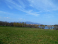
Around Michelbach Lake from Aspach-Le-Bas
 4.83 mi
+177 ft
-171 ft
2h 20
Easy
Departure from Aspach-le-Bas (Haut-Rhin)
A very beautiful walk around a lake with views of the Vosges mountains and a bird observation post.
The Vézelois circulars
 6.54 mi
+69 ft
-69 ft
3h 05
Moderate
Departure from Vézelois (Territoire-de-Belfort)
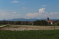
The Vézelois circular loops offer a perfect blend of exploring the local heritage and enjoying the scenic beauty of the surrounding countryside.
5 and 10 km routes, unmarked.
Aspach-le-Bas via Schweighouse
 5.38 mi
+115 ft
-102 ft
2h 35
Easy
Departure from Aspach-le-Bas (Haut-Rhin)
This circular walk linking the villages of Aspach-le-Bas and Schweighouse will allow you to enjoy the beauty of the Plaine d’Alsace and the southern slopes of the Vosges, with a surprise… of considerable size.
The Grand Tour of Riervescemont, Lamadeleine and Val des Anges
 11.26 mi
+2,385 ft
-2,365 ft
7h 15
Moderate
Departure from Lamadeleine-Val-des-Anges (Territoire-de-Belfort)
A long walk starting from Lamadeleine Val des Anges, 20 km north-east of Belfort.
Along the way, you’ll enjoy the coolness of the forest and superb views from the heights. You’ll pass the shelters at the Col des Sept Chemins and the Col de Chantoiseau. On the ridge, just after the Refuge du Baerenkopf, you’ll be treated to a superb view of the Vosges mountains.
Around the Baerenkopf
 11.07 mi
+2,644 ft
-2,635 ft
7h 25
Difficult
Departure from Lamadeleine-Val-des-Anges (Territoire-de-Belfort)
A hike through high-altitude forests and meadows between the Territoire de Belfort and the Haut-Rhin. Passing by the source of the Doller, the Fennematt, the Schlumpf panoramic trail, the Lochberg farmhouse inn and the Baerenkopf, the route is dotted with several shelters, mountain huts and picnic areas, as well as numerous viewpoints.
Schlumpf and Baerenkopf ridges from Lamadeleine-Val-des-Anges
8.51 mi
+1,900 ft
-1,903 ft
5h 35
Moderate
Departure from Lamadeleine-Val-des-Anges (Territoire-de-Belfort)
Starting from the small village of Lamadeleine-Val-des-Anges at the bottom of the Madeleine river valley, there is a pleasant climb through the forest to the Lochberg Pass via the Sept Chemins and Chat passes. From the Col du Lochberg, a circular route will allow us to discover the stubble fields and ridges of the Schlumpf with beautiful views of the upper Doller valley and the nearby peaks, as well as its magnificent log shelters (Sommerseite, Graber) before returning to the pass via the Fennematt and the Source de la Doller. Return to the starting point via the summit of Baerenkopf, Haquin and Trou du Loup.
On the heights of Lamadeleine-Val-des-Anges
 5.32 mi
+1,411 ft
-1,414 ft
3h 40
Very difficult
Departure from Lamadeleine-Val-des-Anges (Territoire-de-Belfort)
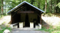
In the hills above Lamadeleine-Val-des-Anges, setting off from one of the smallest and most picturesque villages in the Territoire de Belfort, you’ll climb the Baerenkopf to the legendary refuge of the same name.
A climb to the Baerenkopf from the Entzenbach Farm Inn
 Tourism professional
 6.01 mi
+1,808 ft
-1,808 ft
4h 20
Moderate
Departure from Niederbruck (Haut-Rhin)
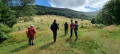
Starting from the secluded Entzenbach Farm Inn (612 m), this circular route takes you to another, very discreet farm inn in the Doller Valley, the Bruckenwald (750 m). Then, after a long climb to the Baerenkopf (1,074 m), at the summit of which stands one of the oldest mountain huts in the Vosges, the trail leads you to a third farmhouse inn, the Lochberg (910 m), before returning to your starting point.
Fennematt pasture and Baerenkopf refuge
6.29 mi
+1,365 ft
-1,365 ft
4h 05
Moderate
Departure from Lamadeleine-Val-des-Anges (Territoire-de-Belfort)
A lovely walk that follows a pleasant forest track to the Fennematt hut, then a short circular route to the Refuge de la Tête de l’Ours (Baerenkopf) between Haut-Rhin and the Territoire de Belfort.Return via the same route as the outward journey, with a short detour via the Col des Sept Chemins. This route is the least strenuous way to reach the Fennmatt hilltop or the nearby Lochberg inn.
From Lachtelweiher, a circular route that passes via the summits of the Baerenkopf and the Sudel
9.05 mi
+1,821 ft
-1,821 ft
5h 45
Moderate
Departure from Haut-Rhin
From Lachtelweiher (in the municipality of Kirchberg), a pleasant circular route follows the Doller valley, passing over the peaks of Baerenkopf and Sudel in the Southern Vosges and through the farmhouse inns at Lochberg and Bruckenwald. This circular route also has historical interest as it follows, for a long stretch along the ridge, theGR®5, which runs along the former border between France and Germany from 1871 until the First World War.
The source of the Doller at the start of the Lachtelweiher
 5.17 mi
+1,142 ft
-1,155 ft
3h 20
Moderate
Departure from Haut-Rhin
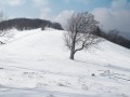
This hike will take you to the Source de la Doller, which, contrary to what you might think, does not originate at the Ballon d'Alsace, but below the Schlumpf. During the hike, you will enjoy beautiful views of the Doller valley and have the opportunity to eat at one of the farmhouse inns along the route.
From Meroux to Charmois through the forest
4.92 mi
+197 ft
-167 ft
2h 25
Easy
Departure from Meroux (Territoire-de-Belfort)
A circular route starting from Meroux, crossing the wetlands before heading up to the heights of Charmois and through the woods of Meroux.
The path is stony for much of the route. Mainly flat, no difficulty.