Country:
 City:
City:


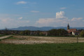

The car park is in the heart of the village, next to the church and the school.
(S/E) Start the route by walking round the church via the bell tower. Walk past the school, then take the path between the “La Vezeloise” sports hall and the village school to reach the main road (D13).
(1) With the town hall on your right, continue along the road for 200 m. At the junction, turn left onto Rue de Meroux and cross the bridge over the River Praille.
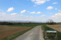
(2) Then continue left along Rue de Charmois. The housing estate gives way to a dirt track crossing the fields to the south of the village. Continue along this track to reach the eastern part of Vézelois. Continue left onto Chemin de Prairot.
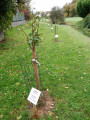
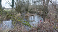
(3) At the wayside cross, turn right onto the D13 towards the end of the village for 200 metres, then take the path down to the left. Cross the Ruisseau de la Praille and follow the path back up, which crosses a road and passes in front of the municipal arboretum. Continue along the edge of the woodland on the dirt track, which takes you to the north-east of the village.
(4) At the junction (there is a hunting lodge on the right), continue to the left, turning your back on the woodland, then take the first path on the right which runs alongside a fenced-off meadow at a place called ‘la Barrière de Fontenelle’. This path then runs along the northern edge of the village. At the end of this path, you’ll come to a hedge of thuja trees; head down towards the houses and make your way to the junction with Rue de Chèvremont (D25).
(5) End of the first circular loop: head up to the left along the Chemin de la Cure to join the (S/E). Alternatively, cross the road and turn right onto Rue des Chenevières for the long circular loop. 250 metres further on, take the path heading north, which runs along the edge of the Bois du Pendu at its highest point. Carry on and head down the Chemin Stratégique (tarmac path).
(6) Head back up the track to the left to re-enter Vézelois. Continue along this track for 1 km, crossing the D13. At the end of the straight stretch at a place called ‘Les Patheret’, you’ll find a junction and a small wood. Leave the tarmac road and head up the dirt track to the left for 150 m.
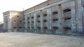
(7) A sign points towards Fort Ordener. Turn right.
(8) From the fort, turn back to return to the previous junction.
(7) Back at the signposts, head down to the right through the housing estate via Chemin du Chatus, then turn left onto Rue des Longerois. Leave the housing estate and follow the dirt track uphill to rejoin the main road.
(9) Turn right, heading east towards the village centre for 270 m. At the ‘La Praille’ bus stop, turn left and head up Rue Traversière to reach the junction with Rue de Chèvremont.
(5) Then turn right onto Chemin de la Cure to complete the route, which takes you back to the starting car park (S/E).

 Visorando Member
 Easy
Easy