Circular route of La Madeleine from the Étang du Moulin des Bois

Starting from the Étang du Moulin car park, explore the villages of Phaffans and Lacollonge on an easy circular route around the River La Madeleine, offering beautiful views of the Southern Vosges from the Planche des Belles Filles to the Grand Ballon.

Details

18940881
Creation:
Last update:
Last review:
  • Walking
    Activity: Walking
  • ↔
    Distance: 4.52 mi
  • ◔
    Average duration: 2h 10 
  • ▲
    Difficulty: Easy

  • ⚐
    Back to start: Yes
  • ↗
    Ascent: + 69 ft
  • ↘
    Descent: - 69 ft

  • ▲
    Highest point: 1,230 ft
  • ▼
    Lowest point: 1,148 ft
  • ⚐ Country: France
  • ⚐ City: Bessoncourt (90160)
  • ⚑
    Start/End: N 47.651799° / E 6.960379°
  • ❏
    IGN map(s): Ref. 3621OT
  • Hour-by-hour weather

Description of the walk

Start from the car park at Étang du Moulin des Bois, alongside the D419.

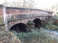
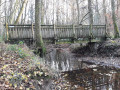
(S/E) Head west, follow the D419 and cross the bridge over the Madeleine. Turn left immediately afterwards, following the signposted path. Cross a footbridge over a stream and follow the winding path, keeping close to the road. At the first junction with a signposted path, turn right.

(1) Cross the D419 with care and continue straight ahead into the forest along the Chemin des Romains. Cross the D31 with care and continue straight on between the fields along a path marked with the Blue Ring and Yellow Ring symbols. Go over the A36 and enter Phaffans via Rue du Bourbet. You’ll come out onto Rue de Bessoncourt; follow it to the right.

(2) At the junction with the Grande Rue (on the left-hand side), turn right onto Rue de Lacollonge. Continue straight ahead on the tarmac road until you reach an orientation board.

(3) Continue along the road and cross the A36 again.

(4) After about a hundred metres, turn left onto a path marked with a Yellow Ring. Walk through a wooded area, past a farm on your right, and reach Rue des Vosges in Lacollonge.

(5) First turn right then left onto Rue d’Alsace. Cross the Madeleine again and continue along the road.

(6) Just before a car park with recycling bins, turn right onto an unmarked path. Go straight on (south) between the fields. Pass the old hunters’ bar, enter the forest following a relatively faint path and you’ll soon reach a junction.

(7) Turn right here, then immediately left. Cross a stream and arrive at a T-junction.

(8) Follow a well-marked forest track to the left. After about a hundred metres, turn right.

(9) At the next junction, turn right onto a path marked with a Yellow Disc and a Blue Ring. You’ll reach the edge of the Étang du Moulin des Bois.

(10) Turn left and walk along the edge of the pond on your right. At the far end of the pond, continue straight ahead, cross the D419 with care and return to the car park where you started (S/E).

Waypoints

  1. S/E : mi 0 - alt. 1,161 ft - Car park – D419 road - Madeleine (rivière) - Affluent de la Bourbeuse
  2. 1 : mi 0.44 - alt. 1,204 ft - Route along the D419
  3. 2 : mi 1.48 - alt. 1,191 ft - Rue de Bessoncourt x Rue de Lacollonge
  4. 3 : mi 2.17 - alt. 1,230 ft - Orientation map
  5. 4 : mi 2.31 - alt. 1,220 ft - Start of the trail
  6. 5 : mi 2.74 - alt. 1,181 ft - Rue des Vosges
  7. 6 : mi 3.12 - alt. 1,188 ft - Start of the trail
  8. 7 : mi 3.66 - alt. 1,181 ft - Junction
  9. 8 : mi 3.86 - alt. 1,171 ft - T-junction
  10. 9 : mi 4.04 - alt. 1,191 ft - Junction
  11. 10 : mi 4.35 - alt. 1,152 ft - Étang du Moulin des Bois
  12. S/E : mi 4.52 - alt. 1,161 ft - Car park – D419 road

Notes

As there are usually several wet sections in the woods you’ll be passing through, make sure you wear suitable footwear and bring walking poles.

Caution: you will need to cross the very busy D419 twice.

Reviews and comments

4.8 / 5
Based on 2 reviews

Reliability of the description
5 / 5
Ease of following the route
5 / 5
Route interest
4.5 / 5
christian90
christian90

Overall rating : 4.7 / 5

Date of your route : Apr 23, 2025
Reliability of the description : ★★★★★ Very good
Ease of following the route : ★★★★★ Very good
Route interest : ★★★★☆ Good
Very busy route : No

A walk undertaken by 12 people, all of whom were satisfied with the route.
The route description is well written and easy to follow.
We’re familiar with it, but in other forms.
The steep sections are always near the Moulin des Bois pond, but this is well known to regulars.
Instead of setting off from the Moulin des Bois car park, we set off from the central car park in Phaffans.
The route passes through there at point 2.
We did this because there are risks to cars at Moulin des Bois.
The car park was as crowded as yesterday, with four cars and a lorry driver taking a nap there.
Or cluttered with piles of materials for road or forest track repairs, etc...
A while ago, there were bullet casings lying on the ground.
In short, it’s a lovely, easy walk.
Christian 90.

Machine-translated

le saut de bonneille

Overall rating : 5 / 5

Date of your route : Apr 13, 2025
Reliability of the description : ★★★★★ Very good
Ease of following the route : ★★★★★ Very good
Route interest : ★★★★★ Very good
Very busy route : No

A lovely route with no difficulty at all

The little paths through the forest are really lovely, and we were able to stop for a bit by the lake as there are tables there

Machine-translated

Other walks in the area

For more walks, use our search engine .

The GPS track and description are the property of this route's author. Please do not copy them without permission.