Fennematt pasture and Baerenkopf refuge

A lovely walk that follows a pleasant forest track to the Fennematt hut, then a short circular route to the Refuge de la Tête de l’Ours (Baerenkopf) between Haut-Rhin and the Territoire de Belfort.
Return via the same route as the outward journey, with a short detour via the Col des Sept Chemins. This route is the least strenuous way to reach the Fennmatt hilltop or the nearby Lochberg inn.

Details

n°15808189
Creation:
Last update:
Last review:
  • Walking
    Activity: Walking
  • ↔
    Distance: 6.29 mi
  • ◔
    Average duration: 4h 05 
  • ▲
    Difficulty: Moderate

  • ⚐
    Back to start: Yes
  • ↗
    Ascent: + 1,365 ft
  • ↘
    Descent: - 1,365 ft

  • ▲
    Highest point: 3,520 ft
  • ▼
    Lowest point: 2,139 ft

Description of the walk

In the village of La Madeleine, park just past the town hall. Do not obstruct traffic.
There is another car park at the town hall or further on, on the way out of the village.

(S/E) Head due west along thePR®® path, signposted with a Blue Ring and a Yellow Ring, for 900 m. You will then reach a fork in the path.

(1) Turn right, leaving thePR®® trail, and stay on a forest track for 500 m, until you reach another fork (barrier).

(2) Carry on straight ahead for 1 km until you reach another fork in the tracks.

(3) Turn left towards the Col du Chat, 200 m away.

(4) Continue to the right along the track marked with a Blue Ring to the Col du Lochberg, which is 1.5 km away. Continue for a few metres straight ahead.

(5) Turn right at a 90° angle onto the path marked with a Red Rectangle. Pass a memorial stone and carry on for about a hundred metres.

(6) Turn right, uphill, towards the refuge. Ignore the first fork to the left.

(7) At the next fork, turn right towards the BaerenKopf mountain hut.
From the refuge, return to the Col du Lochberg (900 m) via a path marked with a Blue Ring and a Red Rectangle.
Turn left and return to the Col du Chat via the path, marked with a Blue Ring, which you took on the way there, but in the opposite direction.
(4) Continue straight ahead on the path marked with a Blue Ring for 300 m.

(8) Turn right onto the path marked with a Red Ring, heading towards the Col des Sept Chemins.

(9) Head left along thePR®® marked with a Blue Ring, then rejoin the fork from the outward journey.

(1) Continue to the right, in the opposite direction, along the path marked with a Blue Ring and a Yellow Ring, to the village of La Madeleine and its car park (S/E).

Waypoints

  1. S/E : mi 0 - alt. 2,156 ft - Car park. Towards the bridge at - Madeleine (rivière) - Affluent de la Bourbeuse
  2. 1 : mi 0.59 - alt. 2,369 ft - Junction for both outward and return routes
  3. 2 : mi 0.95 - alt. 2,536 ft - Junction (barrier raised)
  4. 3 : mi 1.53 - alt. 2,759 ft - Hairpin bend
  5. 4 : mi 1.64 - alt. 2,841 ft - Col du Chat (867m)
  6. 5 : mi 2.62 - alt. 3,209 ft - Col du Lochberg (979m) - Ferme-Auberge du Lochberg
  7. 6 : mi 3.25 - alt. 3,353 ft - Junction to the right - Lachtelweiher
  8. 7 : mi 3.37 - alt. 3,517 ft - Junction and Refuge de - Baerenkopf
  9. 8 : mi 5.12 - alt. 2,687 ft - Junction to the right
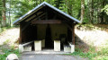
  10. 9 : mi 5.38 - alt. 2,428 ft - Shelter at the - Col des Sept Chemins (739m)
  11. S/E : mi 6.29 - alt. 2,156 ft - Car park

Notes

Always be cautious and plan ahead when you're outdoors. Visorando and the author of this route cannot be held responsible for any accidents occurring on this route.

The GR® and PR® markings are the intellectual property of the Fédération Française de Randonnée Pédestre.

Reviews and comments

4 / 5
Based on 2 reviews

Reliability of the description
4 / 5
Ease of following the route
4 / 5
Route interest
4 / 5
jenny2
jenny2
• Edited:

Overall rating : 4 / 5

Date of your route : Apr 09, 2026
Reliability of the description : ★★★★☆ Good
Ease of following the route : ★★★★☆ Good
Route interest : ★★★★☆ Good
Very busy route : No

A route that alternates between shaded and sunny sections. Perfect for a spring day.
The clearing in front of the Vosges Club chalet just before the summit of Baerenkopf is a lovely spot for a picnic, complete with a table.
Please note: the signposting between points 5 and 6 has been changed. The Red Rectangle is no longer there; it has been replaced by the red-white-red GR sign, which no longer goes through the pasture but through the woods before the fence crossing. Consequently, the route between point 5 (the wayside shrine to the Virgin Mary at the Col du Lochberg) and the Baerenkopf is now a round trip. And so there is no longer any ‘pasture’ on the route!

We had mistakenly taken the route in the wrong direction, but in the end this turned out to be just right for our fragile knees: the section between points 3 and 1 proved easy, with a gentle descent avoiding steep gradients.

Machine-translated

bouledjouidja rabah
bouledjouidja rabah

Hello
I’m glad you enjoyed this song

Machine-translated

cook
cook

Overall rating : 4 / 5

Date of your route : Apr 25, 2022
Reliability of the description : ★★★★☆ Good
Ease of following the route : ★★★★☆ Good
Route interest : ★★★★☆ Good
Very busy route : No

A lovely walk along the forest track and through the Fennematt stubble fields

Machine-translated

Other walks in the area

For more walks, use our search engine .

The GPS track and description are the property of this route's author. Please do not copy them without permission.