Country:
 City:
City:


The starting point is in front of Soppe-Le-Haut Town Hall. You can park in the street running alongside it on the left, Rue du Soultzbach.
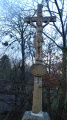
(S/E) With your back to the town hall, carefully cross the road at the pedestrian crossing directly in front of you to reach a fountain and a bus stop, then turn left. At a wayside cross, ignore Rue des Vergers, which climbs to the right. Walk past a second fountain and a second wayside cross, then, after house number 7B, turn right into Rue du Rankweg and follow the ‘Red Ring’ signposting. Enter the forest.
(1) Ignore the Chemin du Haut Bois, which climbs to the right; walk past a fountain and two private gates, then cross the Soultzbach stream. During the climb, ignore a four-way junction and carry on straight ahead. Leave the woodland. A little further on, turn left and follow the ‘Yellow Ring’ signposts towards the church at Soppe-le-Haut via Herrenwald. The path, which initially runs along the edge of the forest, veers slightly to the left before entering the forest. Stay on the main path, following the same signposts, until you emerge from the forest.
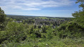
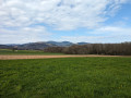
(2) When the path emerges from the woods, turn left at the first T-junction. Walk downhill until you reach the road, taking in the lovely view as you go. Turn left and enter the village of Soppe-le-Haut via Rue de Belfort. Ignore Rue des Horizons on your left and turn into the second street on the left, Rue Bellevue. At the corner, you’ll find a wayside cross and a bench. At the bottom of the street, at the ‘Stop’ sign and the T-junction, turn right, then carefully cross the D14b at the pedestrian crossing.
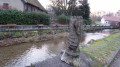
(3) Opposite the town hall and the village library, at a bus stop, turn left into the street and head towards the bell tower. Facing the church and its cemetery, go down to the right to go round it. At the bottom, turn right to cross the Soultzbach stream via a small metal bridge. After the bridge, at the T-junction, leave the ‘Yellow Ring’ signposting on your left and turn right towards the Sentier du Soultzbach. From here, follow the ‘Green Ring’ signposting. Walk alongside the stream. About 200 metres further on, the path branches off to the left. At the next T-junction, leave the entrance to a farm on your left and turn right.
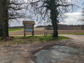
(4) At the junction with the county road, leave a bridge and the entrance to the village on your right and head up to the left, along the winding road, on the Sentier des Trois Pays. After the first bend to the left, cut across the fields to reach the edge of the second bend in the road, where you’ll find a wayside cross and a bench. Continue your ascent.
(5) Just before the summit, ignore the Green Ring signpost and turn left – where you’ll find a ‘No Entry’ sign issued under the local by-law of 30 July 2009 – and follow the Blue Rectangle signposts from here on.
(6) Ignore the first path on the right marked with a Yellow Ring. Ignore the sign for the Notre-Dame des Bouleaux Chapel and carry straight on towards Lauw and Masevaux. Once you reach the edge of the forest, ignore three paths leading into the forest on the right (there is a bench at the third path), as well as the Blue Cross signpost, which heads down to the right towards Soppe-le-Haut. At the end of the path, at the T-junction, turn right. The path immediately turns left.
(7) When the county road bends to the right, head straight up the small path through the grass and continue along this narrow track which runs between two fields before entering a small copse. Leave the copse and head straight down. At the bottom, ignore a path leading to a pond on the left and carry on until you reach the county road.
(8) When you reach the T-junction, ignore all signposting and head down to the left. Cross the Soultzbach Stream one last time and ignore a path that turns left. Enter the village. At the end of the street, at the stop sign where there is a fountain, turn left into Rue Principale. Ignore Rue des Vergers and Chemin Morand, which both lead uphill to the right. At the junction with Rue du Soultzbach, you’ll find the village town hall and your starting point (S/E).



 Visorando Member

 Difficult
  Moderate