Country:

 City:


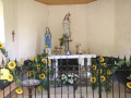
Head to Lamadelaine-Val-des-Anges, a small village in the north of the Territoire de Belfort. At Étueffont, at the ‘Forge’ roundabout, follow the RD55 (dead-end sign). After 5 km, park in the car park next to the chapel opposite the town hall.
(S/E) Continue along the tarmac road for 150 m due north and turn left onto Rue de Riervescemont towards Col des Sept Chemins (marked with Blue Ring and Yellow Ring signs). The stony path climbs through the woods and joins a forest track. Turn left. At a hairpin bend, turn left again to reach the Col des Sept Chemins and its shelter.
(1) Head up to the right towards Col du Chat and Col de Lochberg (marked with Red Ring and Blue Ring signs). The climb is quite steep before you reach a good path. Turn left for a few dozen metres, then right to climb the slope (Blue Ring only) and arrive at Col du Chat.
(2) Then follow the lovely forest track which climbs gently up to the Col du Lochberg and its statue of the Virgin Mary.
(3) Cross the fence via the designated gap and head down towards the Fennematt farm along theGR®5(marked with a Red Rectangle). To do this, take the path on the left through the middle of the meadow and follow it to the fence, taking care not to crush the many ‘Small Tortoiseshell’ (Aglais urticae) butterflies. Do not go through the fence, but head down to the right to rejoin the lovely path leading to the Fennematt farm. Turn left, go through the gate and follow the Blue Rectangle markings ofthe GR®531towards Sewen.
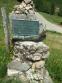
(4) A little further on, on the left, there is a short round trip to the source of the Doller (46 km further on, it flows into the Ill at Mulhouse). One hundred metres further on, on the right, take a second short round trip of a few metres to the memorial stone in honour of Xavier Langlois (see: During the hike).
Walk past the modern Fennematt building (see: Practical information). Continue for about 200 m until you find the start of a path on the right.
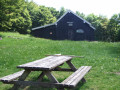
(5) TheGR®531path climbs through the broom towards “l’Auberge Graber-Sewen”. This pleasant path winds through the woodland, crosses a footbridge and emerges onto a pasture. Once you’ve crossed the fence, turn immediately left to climb up the rocks and reach the Graber-Breitenstein Refuge, recognisable by its thatched roof. Well-equipped both inside and out, this is a good spot for a first break whilst taking in the first view.
(6) Retrace your steps back to the fence and follow the so-called ‘panoramic’ path (marked with blue/white/blue Blue Rectangles), which climbs across the pasture and indeed offers a superb view of the valley and the peaks, from the Ballon d’Alsace on the left to the Rossberg on the right. In the background stands the ever-present Grand Ballon, recognisable by the sphere on its summit. Pass beneath a well-equipped picnic area, protected from livestock by a fence, then past a large boulder. The path continues through a field of yellow flowers. On the left, you’ll cross the path leading up from Sewen; pass beneath the Schlumpf ski lift and then head towards an unmarked stone cross. Approach the fence.
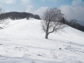
(7) At the fence, do not cross it; instead, leave the path leading straight down to Fennematt (Red Ring) to your right and follow the fence to the left (Blue Triangle) towards Lochberg. Here are a few trees struggling to withstand the harsh climatic conditions of this summit. At the far end of the mountain meadow, you’ll emerge near the Sommerseite shelter. For your picnic, it’s best to stay in the pasture on the tree stump provided for this purpose and enjoy the view.
(8) Cross the fence with care; the cattle gate isn’t ideal for pedestrians. Walk round the chalet.
A lovely path descends gently alongside a low wall marking the boundary between the municipalities of Kirchberg and Dolleren. Continue along this ridge path to the next junction (elevation 955).
(9) Leave the Blue Triangle markings and continue down to the right along the path (Blue Ring markings) towards Le Lochberg. It soon comes into view at the bottom of the valley with its beautifully renovated farmhouse inn, where you may be able to stop for a bite to eat (see “Practical Information”).
(10) Opposite the farmhouse, head down into the pasture (Blue Rectangle markings forthe GR®531). Take particular care not to get cow dung stuck to the soles of your shoes. The path leads onto a tarmac road which goes round the Étang de Lachtelweiller
(11) Opposite the first house, continue to the right on theGR® (Blue Rectangle). At a bend, leave theGR®531, which continues straight ahead, and head up to the right onto the path marked Red Rectangle/White Rectangle/Red Rectangle (a variant ofthe GR®5).
(12) This marks the start of a 2 km climb with an average gradient of 15 per cent and a fairly steady incline. On a flat stretch at the junction with signposts, take the unmarked path to the left. 150 m further on, turn right onto the flat path that winds its way through the grass in the woodland. Once past the gate marking the boundary of the state-owned forest, turn left onto the path which climbs steeply (still marked Red/White/Red) to reach the summit of the Baerenkopf, the highest point of our journey at 1,074 m, but which, unfortunately, offers no views.
(13) Join theGR®5, marked with a Red Rectangle. Turn right, heading north, and descend to the Ski Club chalet to make use of the picnic area for a coffee break. (Please note: in bad weather, there is nowhere to take shelter; the refuge is closed and there is no canopy to provide cover). Climb back up to the summit of the Barenkopf and descend the southern slope, staying on theGR®5until the next junction of signposted paths.
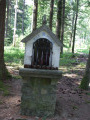
(14) At the junction, leave theGR®5, which heads off to the left, and follow the path slightly to the right towards the south – the lovely Blue Ring-marked trail leading to the Trou du Loup and its small wayside shrine.
(15) Then turn right (Blue Ring and Yellow Ring). The track descends gently. Recent tree felling has created a few clearings looking south. The track turns north and comes to a gate.
(16) After the gate, rejoin the tarmac road and then the chapel near the car park where you started (S/E).
A visit inside the chapel is a must before setting off again.

 Local authority
 Very difficult

 Visorando Member
 Moderate
 Tourist office