Country:
 City:




This walk is signposted with a Green Ring.
There is a bus stop and car park near the town hall at 8 Rue du Lavoir, 90150 Vauthiermont.
(S/E) Take Rue de l’École northwards opposite the town hall. After 100 metres, turn right onto Rue Principale, which you leave 100 metres further on by turning left onto Rue du Haut Bois.
(1) Carry on straight ahead into the forest. At the next junction, turn right onto the track. Pass by the water tower.
(2) Turn left immediately afterwards. At the crossroads, 300 metres further on, carry straight on. The path crosses cultivated fields.
(3) When you reach the D32.4 road, go down the steps. Take the road on the left and cross over the A36 motorway. After 200m, turn left. The path runs alongside the forest.
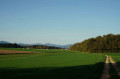
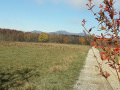
(4) Cross the Ruisseau la Rapène stream, then pass through farmland. To the north, there’s a lovely view of the Vosges. Cross the River Saint-Nicolas to reach Angeot at a place called La Noue.
(5) Turn left, heading south, onto the D11 and walk through the whole village. Take a moment to admire the church as you pass.
Carry on straight ahead, passing the Rue du Moulin (D27) on your left, which leads to Vauthiermont. Continue for a further 200 metres until you reach the junction with the Rue du Bois Zelin.
(6) Turn right onto it, heading north-west. 150 metres further on, ignore Rue de la Combe on the right and continue left along Rue du Bois Zelin. The ‘Green Ring’ signposting is very helpful on this section. The route leaves Angeot and crosses a cultivated area where you can enjoy a beautiful view of the Vosges.
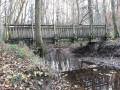
(7) Head into the forest to the left. Just before the footbridge (which you do not cross), turn left, then right to join the Lagrange nature trail (see Practical Information). Make the most of this section of the route to explore the information boards about the trees in our forests.
(8) As you leave the forest, carry on straight ahead. After 500m, turn left. Then, at the crossroads, turn right just after crossing the Ruisseau de l’Étang Virgie. Pass under the A36 motorway and arrive in Larivière.
(9) Turn left onto the D11, then, 100 metres further on, turn right onto the Chemin du Moulin and continue to the D31.
(10) First turn left then right onto a path through the Bois du Pommier. Admire the beautiful cross at the crossroads, then continue to the left. On the footbridge, cross the La Loutre stream and carry on straight ahead.
(11) Cross the D27. The path curves slightly to the left and runs alongside a farm. Turn left before the forest.
Shortly before reaching Vauthiermont via Rue de l’Église, there is an information board identifying the peaks of the Vosges. It also provides information on the Fontaine Aerial Park.
Carry on straight ahead, pass the church in Vauthiermont and arrive at the starting car park (S/E).

 Visorando Member

 Easy
 Local authority