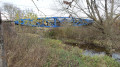
The Bois de Bessoncourt, Fort Route

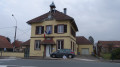
A lovely circular walk 10 km east of Belfort. It will take you through Bessoncourt with its fort, Phaffans, its church and its former presbytery, and Denney with its superb town hall and a perfectly preserved wash house. Not to mention beautiful countryside scenery and a lovely view of the Vosges mountain range.
This walk is signposted.

Details

n°1643784
Creation:
Last update:
Last review:
  • Walking
    Activity: Walking
  • ↔
    Distance: 8.67 mi
  • ◔
    Average duration: 4h 10 
  • ▲
    Difficulty: Moderate

  • ⚐
    Back to start: Yes
  • ↗
    Ascent: + 203 ft
  • ↘
    Descent: - 200 ft

  • ▲
    Highest point: 1,247 ft
  • ▼
    Lowest point: 1,125 ft
  • ⚐ Country: France
  • ⚐ City: Bessoncourt (90160)
  • ⚑
    Start/End: N 47.651518° / E 6.960993°
  • ❏
    IGN map(s): Ref. 3621OT
  • Hour-by-hour weather

Photos

Description of the walk

Start at the Moulin des Bois car park, 90160 Bessoncourt. The route is signposted with a Blue Ring.

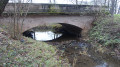
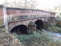
(S/E) Start the walk heading west, cross La Madeleine and, immediately afterwards, turn off onto a path on the left. Admire the pretty bridge with its sandstone piers.
Cross a stream via a footbridge; there is a climb with steps. The path appears to run alongside the D419 before veering away from it slightly.

(1) At the stony track, take the hairpin bend to the right, heading north-north-west. 100 metres further on, cross the D419 with care, then follow the path opposite.

(2) Cross the D31 with care, then, immediately afterwards, follow the signposting closely to avoid heading down what looks like a wide track but ends in a stream. The locality is known as “Bourbet” (similar to the French word for “quagmire”). The path passes over the A36 motorway and arrives in Phaffans.

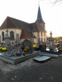
(3) At Rue de Bessoncourt, turn right and, 50 metres further on, turn left onto Rue de la Mairie. Admire the church known as “La Baroche” and the vicarage at the end of Rue du Presbytère. Head towards the Grande Rue.

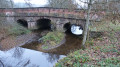
(4) Follow it to the left, heading generally west. Admire the pretty sandstone well. Cross the River Autruche at the entrance to Denney, over a pretty sandstone bridge. A lovely spot set aside for a picnic.

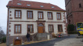
(5) At the crossroads, take a moment to admire the town hall. Head to the wash house by continuing for 30 metres along the Grande Rue and turning right onto Rue du Vieux Lavoir. Return to the crossroads by the town hall.

(5) Turn right at the corner by the town hall, then right again behind the building, and follow Rue des Acacias for 300 metres.

(6) At the crossroads, head up to the left. The signposting is very helpful. Turn left onto the path, climb the steps and continue to the right, passing over the A36 motorway. Leave the road on your left and arrive at Bessoncourt Fort. Continue along this road until you reach the D419.

(7) Cross the road and continue left along the pedestrian crossing, which is separated from the road. 100 metres further on, turn right onto Rue des Lys, then head down Rue des Bleuets to the end.

(8) Admire the pink sandstone fountain. On the left, follow Rue des Lilas for 30 metres, then turn right onto Impasse des Pervenches, which becomes a path cutting through the housing estate. Cross two streets and you’ll reach the stadium. Cross the River Autruche via a footbridge and you’ll come to a stony path.

(9) Follow this track to the right. At the next junction, carry straight on. Keep a close eye on the signposts to take a path on the left. During wet weather, the path may be muddy. Walk past an area of hydrocarbon storage tanks on your right. Cross the Madeleine via a footbridge and arrive at a turning area for forestry vehicles. Follow the forest track to the left.

(10) After 150m, leave the track and turn right. At the top of the climb, you’ll come to a forest shelter. 100m further on, turn left. Pass a path on your right.

(11) Turn left onto the D419 for 100m and turn right into the forest.

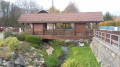
(12) Keep an eye out for the signposts and turn left onto a footpath. You’ll arrive at the Étang du Moulin des Bois. You can have a picnic here, provided you respect the fishermen’s peace and quiet. Continue along the path back to the Moulin des Bois car park (S/E).

Waypoints

  1. S/E : mi 0 - alt. 1,158 ft - Moulin des Bois car park in Bessoncourt. Cross - Madeleine (rivière) - Affluent de la Bourbeuse
  2. 1 : mi 0.4 - alt. 1,201 ft - Gravel path.
  3. 2 : mi 0.68 - alt. 1,214 ft - Crossing the D31
  4. 3 : mi 1.47 - alt. 1,194 ft - Rue de Bessoncourt
  5. 4 : mi 1.72 - alt. 1,178 ft - Turn left onto Grande Rue
  6. 5 : mi 2.6 - alt. 1,161 ft - Town Hall crossroads
  7. 6 : mi 3 - alt. 1,188 ft - Crossroads after Rue des Acacias
  8. 7 : mi 4.1 - alt. 1,201 ft - D419 road
  9. 8 : mi 4.56 - alt. 1,148 ft - Pink sandstone fountain on Rue des Bleuets
  10. 9 : mi 4.98 - alt. 1,132 ft - Gravel path - Autruche (rivière) . Affluent de la Madeleine
  11. 10 : mi 6.69 - alt. 1,138 ft - Path on the right
  12. 11 : mi 7.46 - alt. 1,247 ft - D419 road
  13. 12 : mi 8.04 - alt. 1,227 ft - Path on the left
  14. S/E : mi 8.67 - alt. 1,158 ft - Moulin des Bois car park in Bessoncourt

Notes

The route is signposted with a Blue Ring.
The walk starts from the car park at Moulin des Bois, 90160 Bessoncourt, situated on the D419, approximately 1 km after leaving Bessoncourt on the road towards Frais and Dannemarie.

Visorando was provided with information by Mr Chevalley, a volunteer member of Balisage90.
This walk was created by the Tilleul Community of Communes, which is now part of Greater Belfort.

Worth a visit

Between (S) and (1) lies the River Madeleine.
The Madeleine is a river that rises at an altitude of 780 metres at the foot of the Baerenkopf, in the commune of Lamadeleine-Val-des-Anges. A torrential river, it can vary from a trickle to rapids that look as though they are about to burst their banks. It flows through the ‘Ponds and Valleys’ Natura 2000 site.

(3) Phaffans.
A small village nestled in lush greenery welcomes you and invites you to admire the Church of Notre-Dame de l’Assomption, known as ‘La Baroche’ from the Latin word ‘parochia’, meaning parish. It is a magnificent monument listed in the inventory of historic monuments for its rich sacred architecture: a 17th-century altarpiece, statues, a console and organs crafted by the famous organ builder Verschneider. Situated within the churchyard, it stands on the edge of a ridge overlooking the valley of the Ermite stream, which joins the River Autruche a little further downstream.
The Way of St James stops off at Phaffans.
You can also admire the former presbytery, built in 1701 by Jacques Moureau and once occupied by Marc Antoine Berdelet, who went on to become Bishop of the Haut-Rhin and later of Aachen.
You’ll also discover magnificent wells made of Vosges sandstone and an inn renowned for its frog dishes.
The origin of the name Phaffans is linked to its German name Pfeffingen (derived from the Germanic male name Pafo or Fafo and the Germanic suffix ‘ing’, rather than from the German ‘Pfaff’, meaning ‘priest’, and ‘Haus’, meaning ‘house’).

(5) Denney.
The earliest mention of the village in the archives dates from 1344. In 1347, Thiengen – the Germanised form of Denney (also spelt Duringen) – was already part of the parish of Phaffans and the seigneury of Belfort. A few years later, the village became part of the county of Ferrette.
Place names: Doroangus (7th century), Tueringen (1347), Tyringen (1533), Diring (1576), Thaney (1615), Diringen (1628), Derney (1655), Dieringe (1662), Danney (1793), Denney (1801). In German: Düringen

(7) Bessoncourt Fort
Built from 1883 onwards, it had a capacity of 800 men. Its purpose was to monitor the roads to Mulhouse and Basel. In 1914, once the front line had stabilised to the east of Belfort, it served as a field hospital.
During the occupation of 1940–1944, German troops stored ammunition there.

(8) Bessoncourt.
The grotto fountain, listed as a Historic Monument, is the remnant of the village’s old washhouse, of which only the water chamber remains.

Reviews and comments

4.2 / 5
Based on 2 reviews

Reliability of the description
4.5 / 5
Ease of following the route
4.5 / 5
Route interest
3.5 / 5
randodusamedi
randodusamedi

There is, in fact, a stretch of road. This stretch takes you past the villages of Phaffans and Denney.
I mentioned this picnic area because I thought it looked lovely. Along the walk there are plenty of other spots that don’t have a nice table set up.
Thank you for sharing your thoughts.

Machine-translated

jackybois
jackybois

Overall rating : 3.7 / 5

Date of your route : Jul 14, 2020
Reliability of the description : ★★★★☆ Good
Ease of following the route : ★★★★☆ Good
Route interest : ★★★☆☆ Average
Very busy route : No

Hello. The route is well signposted but not particularly interesting. A good half of the route is on roads, which isn’t great. It would be better to avoid going through the villages. The picnic area at the entrance to Denney is poorly situated, between the road and the sewage treatment works.

Machine-translated

mamcath90
mamcath90

Overall rating : 4.7 / 5

Date of your route : Jan 28, 2019
Reliability of the description : ★★★★★ Very good
Ease of following the route : ★★★★★ Very good
Route interest : ★★★★☆ Good

a very well-signposted route

Machine-translated

Other walks in the area

For more walks, use our search engine .

The GPS track and description are the property of this route's author. Please do not copy them without permission.