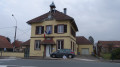
The natural areas of Lagrange and its arboretum

An invitation to explore and help preserve the forest’s fragile habitats and trees.
A short, easy walk 10 km east of Belfort.
It is signposted.

Details

1623178
Creation:
Last update:
Last review:
  • Walking
    Activity: Walking
  • ↔
    Distance: 1.78 mi
  • ◔
    Average duration: 0h 55 
  • ▲
    Difficulty: Easy

  • ⚐
    Back to start: Yes
  • ↗
    Ascent: + 69 ft
  • ↘
    Descent: - 66 ft

  • ▲
    Highest point: 1,234 ft
  • ▼
    Lowest point: 1,181 ft

Photos

Description of the walk

Park on Chemin du Pâturage, 90150 Lagrange, at the junction with Rue de l’Escarcette. The track is gravelled; you can drive along it for a few metres and park at the side.
The route is marked with a yellow and white stripe and a symbol depicting two walkers.

(D//A) Set off northwards along Chemin du Pâturage.
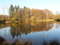
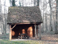
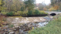
After 200 metres, turn right at the fork. The path slopes down slightly and leads to a pond. A lovely spot for a picnic. There’s even a shelter.

(1) Walk alongside the ponds on the left. Look out for the first information board. There will be several along the route.
The path curves to the right and then enters the Bois de la Grange.

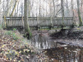
(2) Ignore the lovely stony path branching off to the left; carry on straight ahead through the woodland and cross a footbridge over the Margrabant.

(3) Turn right after the footbridge and continue through the woodland, following the yellow and white markings. Turn right, still in the woodland. 500 metres further on, after a left-hand bend, cross another footbridge over the Margrabant to finally reach the first pond and the picnic area.

(1) Follow the same path you took on the way out to return to the starting point (S/E).

Waypoints

  1. S/E : mi 0 - alt. 1,214 ft - Car park: Chemin du Pâturage
  2. 1 : mi 0.21 - alt. 1,194 ft - Crossroads of the circular loop
  3. 2 : mi 0.47 - alt. 1,220 ft - Entrance to the woods
  4. 3 : mi 0.67 - alt. 1,184 ft - Junction after the footbridge
  5. S/E : mi 1.78 - alt. 1,214 ft - Car park: Chemin du Pâturage

Notes

Visorando was provided with information by Mr Chevalley, a volunteer member of Balisage90.
This walk was created by the Tilleul Community of Communes, which is now part of the Greater Belfort area.

Worth a visit

This route features a complex of three ponds teeming with abundant aquatic flora and fauna. Throughout the walk, you’ll enjoy a lush and peaceful setting.

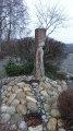
This educational route will enable you to discover and understand the natural habitats and environments of the Lagrange and Larivière forests.

From the role of the forest to life in the ponds and even the insects of the forest, you’ll find illustrations accompanied by informative texts on the following topics:

  • Pike and other predators.
  • Amphibians.
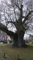
  • The sessile oak.
  • Forest insects.
  • The hornbeam.
  • The beech.
  • The roles of the forest.
  • Invasive plants.
  • Life in the ponds.

Reviews and comments

4.3 / 5
Based on 3 reviews

Reliability of the description
4.7 / 5
Ease of following the route
4.7 / 5
Route interest
3.7 / 5
bonpied bonoeil
bonpied bonoeil

Overall rating : 4.7 / 5

Date of your route : Jul 21, 2026
Reliability of the description : ★★★★★ Very good
Ease of following the route : ★★★★★ Very good
Route interest : ★★★★☆ Good
Very busy route : No

A lovely, shaded route, perfect for an afternoon with an elderly person (aged 92) who is still in good health. It took us nearly two hours to complete the route, and we made the most of the benches to have a rest.

Machine-translated

chevalley@wanadoo
chevalley@wanadoo

Hello, hiker Hibou

First of all, thank you for posting a message on this site. It shows just how important walking is.
It’s true that forest management has changed and that we’re seeing far more ‘dead’ trees.
We’re not currently experiencing a ‘drought’. It’s no surprise that there’s a bit of mud. I walked this route two weeks ago. With good walking boots, it’s perfectly manageable.

I’d also like to point out that Grand Belfort has just had the information boards in the arboretum repaired. I’m surprised by your description of it as ‘poorly maintained’. If you have any suggestions for improving it, please send me a private message.

Kind regards

Machine-translated

Hibou 🦉
Hibou 🦉

Overall rating : 3.7 / 5

Date of your route : Feb 26, 2024
Reliability of the description : ★★★★☆ Good
Ease of following the route : ★★★★☆ Good
Route interest : ★★★☆☆ Average
Very busy route : Yes

A muddy path in places, a poorly maintained arboretum, a forest in a deplorable state full of dead trees

Machine-translated

m.hautin90@free.fr
m.hautin90@free.fr

Overall rating : 4.7 / 5

Date of your route : Nov 23, 2018
Reliability of the description : ★★★★★ Very good
Ease of following the route : ★★★★★ Very good
Route interest : ★★★★☆ Good

An interesting educational route and a lovely spot for a picnic. It’s a shame the signposts aren’t kept in better condition. Michel

Machine-translated

Other walks in the area

For more walks, use our search engine .

The GPS track and description are the property of this route's author. Please do not copy them without permission.