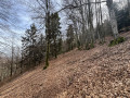
The storks’ passage through Petitefontaine via the ponds

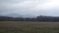
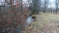
A lovely walk that takes you through countryside and woodland, dotted with some very pretty ponds. There are plenty of footpaths and very little tarmac along this route.
The circular route is signposted with a Red Ring.

Details

1725239
Creation:
Last update:
Last review:
  • Walking
    Activity: Walking
  • ↔
    Distance: 3.50 mi
  • ◔
    Average duration: 1h 40 
  • ▲
    Difficulty: Easy

  • ⚐
    Back to start: Yes
  • ↗
    Ascent: + 98 ft
  • ↘
    Descent: - 98 ft

  • ▲
    Highest point: 1,391 ft
  • ▼
    Lowest point: 1,293 ft

Photos

Description of the walk

Park along Rue du Château d’eau near the pumping station on the outskirts of Petitefontaine on the D15 towards Rougemont-le-Château.

The circular route is signposted with a Red Ring.

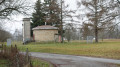
(S/E) Continue along Rue du Château d’Eau, which is actually a wide track. When you reach the water tower, turn right. Cross a stream and ignore a path on the left immediately afterwards.

(1) Walk alongside the Étang Bouchon, continuing straight on and passing a path on your left.

(2) The path widens. It has recently been renovated with European funding. A ford has been built in the middle of the path to allow a stream to flow through. It can be crossed quite easily even after heavy rain. It is dry the rest of the time. Carry on straight ahead, keeping an eye on the signposts.

(3) Turn left onto a small path. Continue through the forest until you reach a wide track.

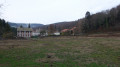
(4) Turn left at the junction with a main track. There’s a lovely little meadow opposite. After 300m, turn right. Carry on straight ahead, passing several ponds.

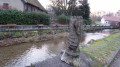
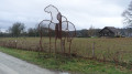
(5) Turn left when you reach the D15 and follow it carefully towards Petitefontaine. Admire the pretty cross at the crossroads.

(6) At the water tower, turn left, then, 50 metres further on, turn right to return to the starting point (S/E).

Waypoints

  1. S/E : mi 0 - alt. 1,293 ft - Rue du Château d’eau
  2. 1 : mi 0.78 - alt. 1,342 ft - Étang Bouchon
  3. 2 : mi 0.97 - alt. 1,345 ft - Widening of the path
  4. 3 : mi 1.21 - alt. 1,358 ft - Junction
  5. 4 : mi 1.61 - alt. 1,391 ft - Crossroads with a small meadow opposite
  6. 5 : mi 2.78 - alt. 1,345 ft - Road D15. Follow the - Saint-Nicolas (rivière) - Affluent de la Bourbeuse
  7. 6 : mi 3.38 - alt. 1,299 ft - Pumping station
  8. S/E : mi 3.5 - alt. 1,293 ft - Rue du Château d’eau

Notes

Bus route no. 32, with 3 services a day. The ‘Étang des Charmottes’ bus stop is at point (5). For further details, visit the Optymo website:

Visorando was provided with this information by Mr Chevalley, a volunteer at Balisage90.
This walk was created by the Southern Vosges Community of Communes.

Worth a visit

Petitefontaine.

Place names: Brun (1576), Dz dorff Brun (1628), Petite Fontaine (1793), Petite-Fontaine (1801), Petitefontaine (1962). In German: Klein-Brunn
The village’s name was first recorded in 1388. At that time, it was likely already part of the parish of Angeot and belonged to the seigneury of Rougemont. Following the war of 1871 and the implementation of the Treaty of Frankfurt, Petitefontaine was separated from the canton of Masevaux along with the other municipalities: Rougemont, Leval and Romagny.
Source: Wikipedia:

Storks

With its numerous ponds and marshes, the region is ideal for observing storks. In 2017, there were 29 hatchlings in the Territoire de Belfort.

Reviews and comments

4.2 / 5
Based on 4 reviews

Reliability of the description
4.8 / 5
Ease of following the route
4.8 / 5
Route interest
3 / 5
chamane7
chamane7

Overall rating : 3.7 / 5

Date of your route : Apr 06, 2026
Reliability of the description : ★★★★☆ Good
Ease of following the route : ★★★★☆ Good
Route interest : ★★★☆☆ Average
Very busy route : No

A nice little walk – be careful, though, as there’s a lot of damage in the forest after the first pond. I didn’t spot the path, which was submerged and blocked by a tree trunk, but after following a track I retraced my steps and found the right path, which was very muddy…
I didn’t see a soul, which suits me fine 🙃🙂.
It’s true that the return journey by road is a bit of a slog and, all things considered, quite dangerous.
Like another user, I checked if there was a shortcut, but there’s no alternative.
It’s tricky with the dog.
But I enjoyed it all the same… it’s a lovely spot.

Machine-translated

Cicindèle
Cicindèle

Overall rating : 4 / 5

Date of your route : Jun 21, 2022
Reliability of the description : ★★★★★ Very good
Ease of following the route : ★★★★★ Very good
Route interest : ★★☆☆☆ Disappointing
Very busy route : No

We went on this walk in June. As soon as we entered the forest, we were swarmed by swarms of insects that saw us as nothing more than walking meals. It was impossible to walk normally, so we had to quicken our pace, waving our arms about to keep the insects at bay.
The final stretch of the route follows a fairly busy road; it’s not very pleasant.
However, this route is probably quite pleasant in winter.

Machine-translated

Tchaiky
Tchaiky

Overall rating : 4.3 / 5

Date of your route : Apr 15, 2021
Reliability of the description : ★★★★★ Very good
Ease of following the route : ★★★★★ Very good
Route interest : ★★★☆☆ Average
Very busy route : No

The return journey along the road (Leval + D15) seems rather long and spoils the enjoyment of the rest of the walk a little.
I’d hoped to take a shortcut between points 4 and 5 to avoid the road (on the map you can see a path running alongside the lakes), but these are private paths leading to fenced-off lakes, so it’s impossible to avoid the road.
I won’t be doing that again.

Machine-translated

nènène
nènène

Overall rating : 4.7 / 5

Date of your route : Mar 22, 2021
Reliability of the description : ★★★★★ Very good
Ease of following the route : ★★★★★ Very good
Route interest : ★★★★☆ Good
Very busy route : No

A very pleasant and easy walk, very well signposted. Lots of ponds. We weren’t lucky enough to see any storks.
The end of the route (point 5) on the D15 is dangerous. Cars drive fast there. Is there any possibility of changing this section at the end of the route?

Machine-translated

Other walks in the area

For more walks, use our search engine .

The GPS track and description are the property of this route's author. Please do not copy them without permission.