Country:
 City:
City:


Park at Montreux-Vieux station.
(S/E) Leave the railway line behind you and turn left onto Rue de la Gare. Then continue straight ahead at the bend to take the cul-de-sac. At the junction with the D32, follow this road to the right. At the next junction, keep right onto Rue des Vergers and look for a small path on the left (Sentier de la Reppe).
Red Ring markings
(1) Take this path, which runs between houses. Then cross the stream and, at the next junction, take the track on the right. At the end, you’ll arrive at Les Grands Champs.
Yellow Ring markings
(2) Turn right onto the wooded track. Then ignore a track on the left and arrive at another Fork in the road at La Grommerie.
(3) Head right. Ignore a path coming from the right and continue to the next Fork in the road.
Blue Ring Markings
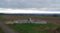
(4) Continue straight ahead. At the houses, go straight on twice, keeping to the left of them. Then take a sharp right-hand bend and ignore a junction. You will then arrive at the Maldiny Monument.
(5) Follow the path to the main road. Turn left, then keep left at the junction to take the Chemin de la Gasse. Continue along the path and, at the Y-junction, keep right to reach Rue d’Alsace.
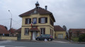
(6) Follow this street to the left, pass the town hall and immediately turn right after it onto a small path. This path leads to Rue des Vosges. Turn left onto this street and you will reach the Sainte-Anne Chapel.
(7) Turn right onto Rue de la Marnière. At the Y-junction, turn left onto a path through the woods. Pass a few steps and some marshy areas. At the Fork in the road, keep left to reach a wider junction near Étang de la Marnière.
(8) Head right along the pond. The path then turns right to climb a slope and emerge into the countryside. Once in the countryside, head left before making a sharp right-hand bend and reaching a house.
Red Ring markings
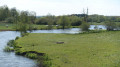
(9) Turn left, walk past the house and take the path that winds its way to the right of the Étang de Belle Île. You will then return to open countryside and continue straight on until you reach the road.
(10) Cross the road to enter the Bois des Boulats. On leaving the woods, keep to the right and reach the D32, continuing straight ahead.
(11) Cross the road and take the path through the forest. When you reach the track, continue to the left. As you leave the forest, follow the edge of the woods to the right until you reach a T-junction.
(12) Turn left. Back at the entrance to the woods, near a private property, turn left.
Green Disc markings
At the corner of the woodland, take the grassy path on the left before rounding a few bends and reaching a discreet Fork in the road.
(13) Head straight ahead and cross the D32. Immediately afterwards, pass a track on the left. At the next fork in the road, ignore the path on the left, then at the following fork in the road, turn left. You will then reach a track (very muddy in wet weather): stay on the path on the right. Also ignore a path coming from this side and reach the edge of the forest. Continue to the right until you reach a track.
(14) Continue along this track and join the road on the right. Then take the first track on the left towards the Chapel of Notre-Dame de Bellefontaine.
Red Ring markings
(15) Just after the chapel, ignore the path on the right and head straight ahead. At the edge of the woods, ignore the track coming in from the right. At the next junction, turn right and reach the D26.
(16) Follow it to the left towards Reppe. At the first junction, keep right onto Rue de Dannemarie.
Yellow Ring markings
At the second junction, turn left onto Grande Rue and head towards Saint-Blaise Church.
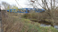
(17) Turn right twice onto Impasse de la Loutre. At the end, continue straight on and cross the river via a bridge.
(18) When you reach the aéroparc area, turn left along Avenue de la Grande Piste. At the next roundabout, take the first exit onto Rue Pagoud. At the next roundabout, head towards Fontaine opposite. Continue to Rue du Tilleul.
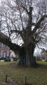
(19) Turn left onto Rue du Tilleul and continue to the Tilleul de Turenne.
(20) Just before the lime tree and the church, take the small street on the right. Then go straight on to cross Rue Saint-Nicolas and reach a crossroads at Les Grands Champs. Ignore the various crossroads on the left and go straight on to reach the entrance to the forest.
(21) Continue straight on and enter the woodland. Follow the track to the end.
(22) Turn left, then straight ahead to stay on this track before taking the path on the right for 50 m.
Red Ring markings
Then follow the first path on the left to reach the D419.
(23) Cross the road and turn left before taking the path on the right. At the crossroads, go straight on until you reach the one with the sign indicating a shelter on the right.
(24) Continue straight ahead and, at the end of the path, turn left for 100 m.
Green Disc markings
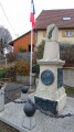
Take the first track on the right and continue straight ahead at the next fork. Do the same at the following forks until you reach the junction at the edge of the woods, near a war memorial.
(25) Turn right and, after two hairpin bends, stay on the track straight ahead before reaching another Fork in the road.
Red Ring Markings
(26) Turn left and take the track straight ahead at the D29. Follow the track to the end, onto Rue des Champs. Continue straight on to reach Grande Rue.
No signposting
(27) Turn right onto this street. Pass a junction on the left and then keep left to reach the Church of the Nativity of Our Lady and its cemetery.
(28) Return to the junction you passed earlier.
Blue Disc signposting
(27) Then turn right onto Rue du Coudra. Cross the railway line and immediately turn left. After passing through several woods, you will arrive at a place called Gros Etang.
Red Ring signposting
(29) Turn left to reach Montreux-Château and its cemetery.
(30) Continue along Rue du Maréchal Leclerc to the Intermarché and its car park. Cross the car park to reach Rue du Général Charles de Gaulle.
(31) Turn right, then immediately left onto Rue de l'Ancienne Église. Then pass the junction with Rue Curiale.
Sign for Sainte-Catherine Chapel
At the next junction, turn right, then left to see the Chapelle Sainte-Catherine and the motte-and-bailey castle.
(32) Then return to Rue de l'Ancienne Église.
Red Ring signpost
Go down this street on the right and follow it to the end, onto Rue d'Alsace.
(33) Take this street on the right.
(34) Just before a small bridge, take the path on the right. At the Fork in the road, keep left and follow an abandoned track along the edge of the forest. Turn sharply left to reach another crossroads.
(35) Head off to the right. Then ignore a path leading off to the right to reach the railway line.
(36) Continue along the road that runs alongside the track. At the two junctions, keep left to cross the railway line and rejoin the path you took on the way out. Then turn immediately right after the bridge and head for Montreux-Vieux station and its car park (S/E).
 Visorando Member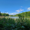
 Easy
Easy 
 Moderate