Country:
 City:


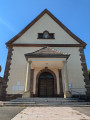
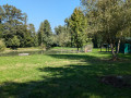
The walk starts at the church in Aspach-le-bas, on Rue de la Station. There are a few parking spaces right next to the church, by house number 7.
(S/E) With your back to the church, head off to your left. Cross the road carefully at a zebra crossing and continue along the opposite pavement. Walk past the village hall and the village school. At the four-way junction, use the zebra crossing in front of the village town hall, then turn left. Then take the first street on the right, Rue de la Libération, towards the stadium. Cross the Michelbach stream and continue for about 300 metres.
(1) Ignore Chemin du Trubbach and Rue des Iris. Walk past a tarmac sports ground and then the football pitch. At the next junction, turn right onto Rue des Prés. From here, follow the Red Triangle markings. At the end of the street, at the junction with a Stop sign, turn left onto Rue de Belfort, heading towards the Cernay lake. Cross the road carefully and walk along the right-hand side of the D483. Leave the village. After 150 m, follow the D83, heading diagonally down to the right towards the underpass beneath the motorway.
(2) Just after the bridge, turn right. As indicated by the walking sign, ignore the first small junction and then turn left after about a hundred metres. At the next junction, turn right. Continue straight on for a few hundred metres until you reach the next crossroads.
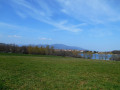
(3) Ignore the Red Triangle markings continuing straight ahead and turn right. From here, follow the Red Saltire markings towards Schweighouse. Carry on straight ahead along this path, which alternates between ascents and descents and regularly offers lovely views of the surrounding villages, the Alsace plain and the Vosges. Ignore the various unmarked paths until you reach a large wayside cross and a T-junction near a bridge.
(4) Turn right and cross the Baerenbach. Just after the bridge, carefully cross the road and follow it on the other side along a path running alongside the carriageway. Enter the village of Schweighouse; at the roundabout, carry on straight ahead. Then ignore Rue du Château on your right. After passing the town hall and school and the village church, turn left, walk past the war memorial, then walk alongside the church and its cemetery on your left, followed by a playground with picnic tables on your right. You’ll reach a T-junction at number 4.
(5) Turn right. At the end of the street, at the junction where the fire station is located, carry on straight ahead towards the 300-year-old oak tree on Rue du Moulin. Walk past a bench and leave the village, then go round a large farm on the right. Once you’ve passed the farm, ignore the first path that turns right at the edge of the forest, but a few metres further on, take the next one that leads into the forest.
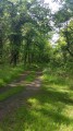
(6) From here, follow the Red Disc markings, passing a picnic area and the entrance to the fitness trail. On this forest path, continue to follow the same markings, ignoring any unmarked paths. Your path takes you past a remarkable tree with information boards, as well as a pond with a picnic table and benches. At a junction of five small paths, turn right, still following the same markings and the Fitness Trail. The path then runs along the edge of the forest
(7) The path takes a right-angled left turn at Sign No. 2 of the Fitness Trail. Pass Sign No. 1 and continue to the D20.1 county road behind a barrier. Cross the road and turn left. Leave the village of Schweighouse. Follow the Departmental Road and pass under a bridge. At the T-junction just after the bridge, cross the road carefully to walk along the opposite side, then turn right.
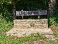
(8) After about a hundred metres, turn left onto a dirt and stony track, heading towards Aspach-le-Bas. Walk past a stone bench and enter the forest. Walk past a large aerial, then turn right immediately afterwards, and then right again a little further on to join a wider path, heading towards Aspach-le-Bas. Continue along this path until you reach a T-junction where the Eugène de Clercq playground and the entrance to the village are located.
(9) At the T-junction, turn left onto Rue du Calvaire. Ignore, in turn, Rue de la Forêt, Rue Saint-Pierre, Rue du Paradis, Sentier du Moulin and Rue de la Croix. At a Y-junction, where there is a bench and a wayside cross, let the Red Disc signposting continue to the left and carry on slightly diagonally to the right towards the bell tower. Ignore Rue Malakoff, which turns right, and return to your starting point in front of the village church (S/E).

 Visorando Member

 Moderate
 Association / Club / Walk leader

 Difficult