Les Terres Rouges: Petitmagny – Étueffont

A lovely walk through woodland and countryside.
Two charming villages to explore: Petitmagny and Étueffont.
An easily accessible walk at the foot of the Vosges, 15 km from Belfort.
The walk is signposted with a Green Ring.

Details

1744828
Creation:
Last update:
Last review:
  • Walking
    Activity: Walking
  • ↔
    Distance: 3.72 mi
  • ◔
    Average duration: 2h 15 
  • ▲
    Difficulty: Easy

  • ⚐
    Back to start: Yes
  • ↗
    Ascent: + 620 ft
  • ↘
    Descent: - 610 ft

  • ▲
    Highest point: 2,001 ft
  • ▼
    Lowest point: 1,476 ft

Photos

Description of the walk

Car park in Étueffont near the chemist’s, at the junction of Rue du Fayé and Rue de Giromagny.
Access by bus is possible (see Practical Information).
The walk is signposted with a Green Ring.

(S/E) Walk up Rue du Fayé. It overlooks the Madeleine valley.

(1) Turn left onto Rue du Châtelat. When you reach the last house, follow the path on the right which leads into and up through the forest. Follow the signposts and turn left at the second junction.

(2) 150 metres further on, turn left onto a path that descends steeply. In wet weather, it turns into a small stream and can be slippery. At the next junction, turn left, then 200 metres further on, turn right. When you reach the first houses in Petimagny, continue downhill.

(3) At the junction, there is a picnic table and a lovely view.
Take the second left: Rue de la Brosse. Do not take Rue des Breuleux.
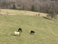
Carry on downhill past the pastures where magnificent horses are grazing. Walk past the community hall and you’ll reach the junction near the school.

(4) Turn left onto the Grande Rue. Cross the D12 with care and take Rue du Montanjou opposite.

(5) Pass Rue des Champs du Boule on your right and continue along Rue du Montanjou. As you enter the forest, the road turns into a track. Carry on uphill, passing a track on your right and another on your left.

(6) Keep a close eye on the signposts to turn left and head down a steep slope. Continue straight on along Rue de la Combe. At the D12, turn right and head back to the starting car park (S/E).

Waypoints

  1. S/E : mi 0 - alt. 1,493 ft - Rue du Fayé in Étueffont. Passing close to the - Madeleine (rivière) - Affluent de la Bourbeuse
  2. 1 : mi 0.62 - alt. 1,647 ft - Rue du Châtelat
  3. 2 : mi 1.25 - alt. 1,965 ft - Path on the left
  4. 3 : mi 1.86 - alt. 1,703 ft - Junction of Grande Rue and Rue de la Brosse
  5. 4 : mi 2.32 - alt. 1,572 ft - Petitmagny School
  6. 5 : mi 2.51 - alt. 1,578 ft - Junction of Rue du Montanjou and Rue des Champs du Boule
  7. 6 : mi 3.3 - alt. 1,722 ft - Head down to the left
  8. S/E : mi 3.72 - alt. 1,493 ft - Rue du Fayé in Étueffont

Notes

There are also parking facilities right next door, on Rue de l’Usine.

Access is possible via the Optymo bus service. Visit the website
Bus route 22, alight at the ‘Forge Musée’ stop in Étueffont, or bus route 40, alight at the ‘Étueffont’ stop.
Or line 31, alight at the ‘Petitmagny’ stop. In this case, start at the point (5).

Visorando was provided with information by Mr Chevalley, a volunteer member of Balisage90.
This walk was created by the South Vosges Community of Communes.

Worth a visit

Étueffont
Its inhabitants are known as the Taffions (from the local dialect).
Place-name etymology: Étueffont-Bas: Estuefon (1260), Eytauffen (1296), Eitufun (1316), Stauffen prope Rotenburg (1337), Stoffen/Eisthoffan (1427), Nider Stauffen (1579), Estueffond (1779). In German: Nieder Stauffen.
Étueffont-Haut: Ober Stauffen (1579), Estueffon-Dessus (1620), Stueffon/Stouffont/Stueffont (1533), Étuffont le Haut (1793), Étueffont-Haut (1801). In German: Ober Stauffen.
In ancient times, a fortified Gallo-Roman camp was established at the summit of Le Fayé.
1188: First mention of the name Étueffont in a papal bull issued by Pope Clement III.
1296: Thiébaud, Count of Ferrette, ceded the right of patronage over the church to Lucelle Abbey.
1354: Étueffont is recognised as the administrative centre of a parish attached to the seigneury of Rosemont.
From the end of the Middle Ages onwards, the village turned its attention to emerging industries: a forge processing iron produced by the Bethonvilliers blast furnace; the mining of silver-bearing lead in the nearby Vosges mountains (the peak known as Tête du Mineur serves as a reminder of this); forestry; and the production of charcoal. Subsequently, a mill was built on the river and ponds were dug. From the early 19th century, hand-powered weaving developed, followed in the mid-century by the Boigeol-Japy mechanical weaving mill.
In 1879, the Zeller brothers, originally from Oberbruck (Haut-Rhin), set up weaving mills and a spinning mill in Étueffont. These factories flourished for half a century (1880–1930), providing work for several hundred workers. However, the 1929 crisis marked the beginning of the decline of the textile industry, which ceased operations in Étueffont around 1960. René Zeller’s former château now houses the Thérèse-Bonnaymé vocational training centre.
Source: Wikipedia:

Petitmagny
Place-name etymology: Gnalmaigni and Gnamaigni (1427), Bittmeni (1579), Petit-Maingni (1627), Petit Magny (1793), Magny-Petit (1801). Its inhabitants are known as the Borboillots.
The village’s name is first recorded in 1417, but in the preceding century the fiefdom passed from the lordship of Rougemont to that of Rosemont. The village was built on the sunny slope of the Vosges mountains, on a road that was originally a Roman road linking Langres to Strasbourg, bypassing the mountains to the south.
The walk is situated in the foothills of the Vosges. The rock is red, hence the name ‘Les terres rouges’ (The Red Lands) for this walk.
Source: Wikipedia:

Reviews and comments

4.3 / 5
Based on 3 reviews

Reliability of the description
4.3 / 5
Ease of following the route
4.3 / 5
Route interest
4.3 / 5
laurentdomi
laurentdomi

Overall rating : 4.7 / 5

Date of your route : Mar 20, 2026
Reliability of the description : ★★★★☆ Good
Ease of following the route : ★★★★★ Very good
Route interest : ★★★★★ Very good
Very busy route : No

This very peaceful route is well worth a visit. The landscape is undulating and full of flowers at the start of spring. However, don’t go looking for the chemist’s – it’s moved!

Machine-translated

gentiled
gentiled

Overall rating : 4.3 / 5

Date of your route : Mar 12, 2021
Reliability of the description : ★★★★★ Very good
Ease of following the route : ★★★★☆ Good
Route interest : ★★★★☆ Good
Very busy route : No

I’d like to point out a signposting error on the route at point 5. The signs have been put in the wrong places. The ‘Balade sous le Fayé’ walk is signposted for Rue de Montanjou, and the ‘Balade des Terres Rouges’ walk is signposted for Rue des Champs du Boule. However, it’s the other way round. Fortunately, the route descriptions are correct, which means you can quickly find the right turn.
The walk is really lovely. It’s quite a climb at the start.

Machine-translated

Jacqueline11
Jacqueline11

Overall rating : 4 / 5

Date of your route : Sep 13, 2020
Reliability of the description : ★★★★☆ Good
Ease of following the route : ★★★★☆ Good
Route interest : ★★★★☆ Good
Very busy route : No

It’s a shame that the start involves walking along a tarmac road for quite a while, but this easy and interesting walk takes place largely in the forest, which is lovely when the heat is bearing down.

Machine-translated

Other walks in the area

For more walks, use our search engine .

The GPS track and description are the property of this route's author. Please do not copy them without permission.