Discovering the heritage around Dannemarie

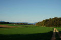
You’ll discover Dannemarie’s monuments and the surrounding countryside, with a beautiful view of the Ballersdorf viaduct and, further afield, the Sundgau and the Vosges. At the end of the walk, you’ll admire the Relais Nautique along the Rhône–Rhine Canal, followed by the former Gilardoni tile works.

Details

31460903
Creation:
Last update:
Last review:
  • Walking
    Activity: Walking
  • ↔
    Distance: 9.64 mi
  • ◔
    Average duration: 4h 40 
  • ▲
    Difficulty: Moderate

  • ⚐
    Back to start: Yes
  • ↗
    Ascent: + 315 ft
  • ↘
    Descent: - 318 ft

  • ▲
    Highest point: 1,181 ft
  • ▼
    Lowest point: 968 ft
  • ⚐ Country: France
  • ⚐ City: Dannemarie (Haut-Rhin) (68210)
  • ⚑
    Start/End: N 47.630688° / E 7.119608°
  • Accessible from the train station Gare de Dannemarie.
  • ❏
    IGN map(s): Ref. 3621ET
  • Hour-by-hour weather

Description of the walk

The route starts at Dannemarie Town Hall, 1 Place de l’Hôtel de Ville in Dannemarie, where there is a car park.
You can also come by train

(S/E) Set off along Rue du Marché and turn left to walk past the church. Cross Rue de Bâle (D419) and take the Passage des Anciens Combattants opposite – a pedestrian-only street – until you reach a roundabout.

(1) Turn right onto Rue des Tilleuls, cross over the railway line (take a moment to admire the station, which was renovated in 2010, and the cultivated fields to the south). At the end of the bridge, at the T-junction, turn right. Walk past a factory on your right and you’ll soon reach a crossroads.

(2) Turn right onto the Voie Verte, then turn left as you follow it. You’ll come out onto Rue du Réservoir; follow this, veering slightly to the left. Walk past a wooded area on your right and you’ll reach a crossroads.

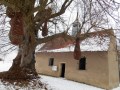
(3) Turn right for a 100-metre round trip to admire the Sainte-Barbe Chapel.

(4) Return to the junction. Turn right, heading south, for another, slightly longer, round trip to the Maison de la Nature, which you’ll reach after a hairpin bend to the right. Return to the junction.

(3) Turn right, heading east, and climb up to the next junction, the highest point at 360 m.Magnificent views over the Sundgau and the Vosges, with a survey table.

(5) Turn left and, at the next crossroads, turn right. The path winds through a field.

(6) At the crossroads, near the viaduct, turn right and follow the railway line, keeping a few hundred metres away from it. The path then draws closer to the line, passes under the Ballersdorf viaduct and turns right.

(7) At the junction, turn left, then left again at the next one to join the D419.

(8) Cross the road carefully, continue along the road opposite and walk past the gas installation.

(9) At the fork in the road, turn right onto Rue de Ballersdorf (note the half-timbered houses).

(10) Turn left onto Rue de Cernay (D103). Take the first street on the right and head towards the Sainte-Marguerite Chapel.

(11) Continue northwards along a path. You’ll come out onto a road; follow it to the left. Pass a sewage treatment plant and head for the bank of the Rhône–Rhine Canal.

(12) Take the hairpin bend to the left and follow the canal on your right-hand side. Pass a lock. Further on, stop in front of the nautical centre, a real little marina with its open-air café. Then pass under a road bridge and continue along the canal.

(13) Turn slightly left before lock no. 15 and continue along Rue du Canal to pass through the Gilardini workers’ housing estate. Then turn left onto Rue de Belfort (D419).

(14) Turn left onto Rue des Lilas, then left again to go round Étang Lattloch, which used to be a marl quarry for the tile works. Turn left onto Rue des Lilas.

(15) At the junction, turn right into Rue du Bassin and follow this street to the town hall (S/E).

Waypoints

  1. S/E : mi 0 - alt. 1,040 ft - Dannemarie Town Hall
  2. 1 : mi 0.16 - alt. 1,050 ft - Roundabout
  3. 2 : mi 0.51 - alt. 1,037 ft - Junction
  4. 3 : mi 1.76 - alt. 1,148 ft - Crossroads. Towards the - Largue (rivière) - Affluent de l'Ill
  5. 4 : mi 2.21 - alt. 1,053 ft - Chapelle Sainte-Barbe (Altenach)
  6. 5 : mi 2.9 - alt. 1,181 ft - Point de vue de Herrenweg
  7. 6 : mi 4.18 - alt. 1,030 ft - Railway embankment
  8. 7 : mi 5.03 - alt. 974 ft - Junction
  9. 8 : mi 5.43 - alt. 1,001 ft - Cross the D419
  10. 9 : mi 5.89 - alt. 1,033 ft - Fork in the road – Rue de Ballersdorf
  11. 10 : mi 6.34 - alt. 997 ft - D103 road
  12. 11 : mi 6.46 - alt. 1,007 ft - Chapelle Sainte-Marguerite (Gommersdorf)
  13. 12 : mi 6.9 - alt. 971 ft - Canal Greenway - Canal du Rhône au Rhin
  14. 13 : mi 8.23 - alt. 1,001 ft - Lock No. 15 and Rue du Canal
  15. 14 : mi 8.79 - alt. 994 ft - Rue de Belfort x Rue des Lilas - Étang communal du Lattloch
  16. 15 : mi 9.35 - alt. 991 ft - Rue des Lilas x Rue du Bassin
  17. S/E : mi 9.64 - alt. 1,040 ft - Dannemarie Town Hall

Notes

The route starts at Dannemarie Town Hall, 1 Place de l’Hôtel de Ville, where there is a car park.
You can also come by train; in this case, turn left as you leave the station onto Rue de la Gare, continue to the roundabout and follow the directions given in point (1)
Food is available at the water sports centre.

Worth a visit

At the river rest stop, there’s a lovely open-air café serving food and drink. (between (12) and (13))

Numerous traces of the former Gilardini tile works: the Lattloch pond, the Gilardini estate and the ruins of the tile works.
Along the D419, after the point (13), there is a former ice house built by the wine merchants of Dannemarie.

Dannemarie Town Hall and church.

Reviews and comments

3.9 / 5
Based on 4 reviews

Reliability of the description
4 / 5
Ease of following the route
4 / 5
Route interest
3.8 / 5
dbaegser
dbaegser

Overall rating : 4.3 / 5

Date of your route : Mar 16, 2025
Reliability of the description : ★★★★★ Very good
Ease of following the route : ★★★★★ Very good
Route interest : ★★★☆☆ Average
Very busy route : No

A lovely route, though there’s a lot of tarmac

Machine-translated

rossin
rossin

Overall rating : 3.3 / 5

Date of your route : Apr 24, 2023
Reliability of the description : ★★☆☆☆ Disappointing
Ease of following the route : ★★★★☆ Good
Route interest : ★★★★☆ Good
Very busy route : No

The map isn’t very up to date; Rue des Anciens Combattants doesn’t exist in Dannemarie. There are three interesting attractions: the viaducts and their history, the Chapel of St Barbe, and the viewpoint overlooking the Sundgau and the Vosges.

Machine-translated

jmpc
jmpc

Overall rating : 3.7 / 5

Date of your route : Apr 08, 2023
Reliability of the description : ★★★★☆ Good
Ease of following the route : ★★★☆☆ Average
Route interest : ★★★★☆ Good
Very busy route : No

We really enjoyed St Barbe’s Chapel, the little marina and Lattloch Pond.
It’s a shame this route isn’t signposted.
The highest point, with its orientation board, isn’t where you’d expect it to be. We found our way there by trial and error, keeping the viaduct in our sights.

Machine-translated

magory
magory

Overall rating : 4.3 / 5

Date of your route : Apr 03, 2023
Reliability of the description : ★★★★★ Very good
Ease of following the route : ★★★★☆ Good
Route interest : ★★★★☆ Good
Very busy route : No

An easy walk with magnificent views of the Vosges mountain range, not to mention the superb half-timbered houses in Gommersdorf.

Machine-translated

Other walks in the area

For more walks, use our search engine .

The GPS track and description are the property of this route's author. Please do not copy them without permission.