Country:
 City:
City:


Start and finish at the car park of the Traubach-le-Haut village hall, accessible by car via Rue des Sources.
(S/E) From the car park, walk down Rue de la Source, then continue straight on along Rue de Bréchaumont. Follow this road until No. 11A.
(1) Opposite No. 11A, turn left into the passage between the houses to join Rue de la Forêt. Turn right and continue to Rue de Masevaux. Follow this road to the left for about fifty metres. Walk up Rue du Réservoir and turn right as soon as possible to rejoin Rue de Masevaux. Follow Rue de Masevaux, turning left until you reach a path that veers to the left, just before the town limits.
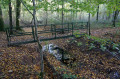
(2) Leave the street on the left to enter the forest via this well-maintained path. After about 300 metres, take thefirst path on the left.
(3) This leads to the hillock where the Château du Hohburg once stood long ago. Retrace your steps to rejoin the forest track.
(3) Turn left again. Shortly afterwards, at the Fork in the road, take the left-hand path. Continue straight on along this path until you emerge onto the D14b at the entrance to Guevenatten. Cross the road (take care) and take the Chemin des Près almost directly opposite, continuing straight on until you reach a Fork in the road.
(4) Turn left onto the Chemin du Kichweg;you’ll see Gildwiller-sur-le-Mont church in the distance. Follow it until you reach the village’s Rue Principale. Turn left, pass by a covered well (which cannot be visited), and follow the street to the bend after the Town Hall and School.
(5) Turn right onto the Chemin du Moulin. It runs behind the Town Hall and School (marked with a Green Triangle). It turns left immediately; follow it downhill, passing a well-fountain, cross the bridge over the river, and continue to the right-angled bend in the path. Continue straight on along a forest path marked with a Green Ring. Follow these markings, keeping to the right, passing two ponds before reaching the Main Street of Saint-Cosme. Head right towards the clearly visible church. At the crossroads, turn left for a few metres until you reach the Fork in the road opposite the Calvary.
(6) Leave the church and Rue de l’Église on your right and take the path on the left. At the end of the climb, take a path on the left (marked with a Yellow Rectangle and a White Rectangle, a variant ofthe GR®532), and follow it due south to the entrance to Bréchaumont.
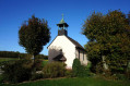
(7) At the crossroads (Calvary), turn right onto the path marked with a Red Ring, which leads into a small wood. Follow it to the D26. Continue to the right along the D26; at the crossroads, turn left towards Chavanne-sur-l’Étang. After about a hundred metres, leave the road and take the path on the right (Red Ring) which leads to Notre-Dame de Bellefontaine.
(8) Continue along the path marked ‘Green Disc’ until you reach the D26.1. Turn right onto the road, then leave it after about 200 metres to take a path on the left. Follow the Green Disc markings, first along the edge of the woodland, then, once in the forest, along a path on the right which follows the markers of the former Franco-German border. Follow it southwards until you reach the D32.
(9) Cross the road (take care) and continue along the path. It leads out onto a field; continue left along the edge of the field to reach a T-junction.
(10) Leave the Green Disc markings and turn left, at a right angle, onto the Green Ring-marked path which enters the forest. Follow it to the forest track, where you turn right. Leave this track by turning left onto a path on the left, still following the Green Ring markings, until you reach the Étang du Milieu.
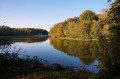
(11) Walk round the pond on the right along a path on the eastern bank. Shortly afterwards, at the junction with a path coming from the right, the markings change to the Green Disc; continue to the northern end. Just before the embankment, turn right and follow the forest track up to the D26.1. Turn left and, before leaving the forest, take another forest track on the right. Follow this track and the Green Disc signposts. It crosses the entire length of a wood, then a field, before soon reaching another wood; continue straight on for a few metres until you reach the junction.
(12) Ignore the paths straight ahead and to the left; take a path on the right (unmarked), which enters the woodland, passes a pumping station and becomes a track. At the crossroads, carry on straight downhill and, as you emerge from the woodland, follow the path on the right which winds through the pastures and eventually leads to the first houses in Bréchaumont. Carry on straight ahead until you reach a left-hand bend and a crossroads.
(13) At the junction, take the road on the right; it goes downhill and becomes a track. Follow this track to the crossroads (oratory).
(14) Turn left and you’ll soon reach the car park for the village hall (S/E).


 Visorando Member
 Easy
Easy 
 Very difficult