The Grand Tour of Riervescemont, Lamadeleine and Val des Anges

A long walk starting from Lamadeleine Val des Anges, 20 km north-east of Belfort.
Along the way, you’ll enjoy the coolness of the forest and superb views from the heights. You’ll pass the shelters at the Col des Sept Chemins and the Col de Chantoiseau. On the ridge, just after the Refuge du Baerenkopf, you’ll be treated to a superb view of the Vosges mountains.

Details

n°2193471
Creation:
Last update:
Last review:
  • Walking
    Activity: Walking
  • ↔
    Distance: 11.26 mi
  • ◔
    Average duration: 7h 15 
  • ▲
    Difficulty: Moderate

  • ⚐
    Back to start: Yes
  • ↗
    Ascent: + 2,385 ft
  • ↘
    Descent: - 2,365 ft

  • ▲
    Highest point: 3,520 ft
  • ▼
    Lowest point: 1,755 ft

Photos

Description of the walk

Parking is available at the Route de la Chapelle car park (D55), opposite the Lamadeleine-Val-des-Anges Town Hall.

(S/E) From the car park at the Sainte-Marie-Madeleine Chapel, head left for about 150 metres, southwards along the road from Étueffont, following the Blue Ring and Yellow Ring signposts.

(1) At the right-hand bend, leave the road and head up a forest track to the left. Just after a Fork in the road, pass the statue of the Virgin of the Trou du Loup and reach a crossroads.

(2) At the crossroads, turn left, then left again onto the path, following the Blue Ring markings. After a few hairpin bends, the path passes Tête Haquin (alt. 835m), descends slightly and arrives at a junction of paths.

(3) Take the second path on the right and continue along the boundary between the municipalities.

(4) Once you reach the ridge, join theGR®5coming from the right and continue straight on, following the Blue Ring and Red Rectangle markings. Ignore the paths branching off to the right and carry on to the summit of the Baerenkopf (alt. 1,074 m, pronounced ‘Bérenkopf’).

(5) After the summit, the path descends slightly and passes in front of the Refuge du Club Alpin Français. Cross the stubble fields, then enter the forest and reach the Col du Lochberg (alt. 978m) with its very pretty wayside shrine.

(6) Turn right as you cross the pass on the Alsatian side and follow the red rectangle markings (do not follow the Blue Ring markings).
A little further on, turn left onto theGR®5path. It is signposted ‘Wissgrut – Ballon d’Alsace’. The path descends slightly.

(7) Pass the Source de la Doller on your right, then head slightly uphill. Continue straight on along theGR®5.

(8) Once past the Col du Hirtzelach, carry on straight ahead, still following theGR®5. Pass the Col Sans Nom. A little further on, turn left for a few dozen metres, then right until you reach the next junction.

(9) Ignore theGR® which branches off to the right and follow the Red Triangle markings leading to Chantoiseau (take great care not to miss it; it is indicated by a sign).
Pass two paths on the right and walk past the Roche du Serpent (a lovely view). 50 metres further on, continue straight ahead and rejoin the forest track. You’ll reach the junction at the Col du Chantoiseau.

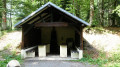
(10) Make the most of the shelter at the Col de Chantoiseau – ideal for a picnic or in case of rain.
At the crossroads, follow the path almost directly opposite, marked with a Red Ring (3rd path on the right or2nd on the left).
The forest track descends. After a hairpin bend, pass a path on the right and then another on the left. You’ll reach a crossroads just before the Goutte du Chantoiseau.

(11) Turn right, passing a path on the left. Further on, cross the Goutte Jean Rémiche, pass a path on the right and continue for about 300 metres.

(12) Keep an eye out for the signposts to take a path on the left. It runs alongside the forest road below and leads to the Route de Vescemont (D24) car park.

(13) At the car park, turn left and cross the River La Rosemontoise.

(14) Turn left below Rosemont Castle onto a wide forest road, which you follow for 3 km to the Col des Sept Chemins.
There are lovely views of the farms in the valley.

(15) At the junction at the Col des Sept Chemins, turn left. You’ll see a shelter, which will come in handy if it rains.
Turn right, following the Blue Ring signposts. After about 500 metres, take the path on the right downhill to the crossroads.

(16) At the crossroads, take thesecond path on the right (or thesecond on the left). This is the “old path”, which leads to the first houses in Lamadeleine-Val-des-Anges. After crossing the small stream known as La Madeleine, turn right to reach the car park at the Chapelle Sainte-Marie-Madeleine (S/E).

Waypoints

  1. S/E : mi 0 - alt. 2,139 ft - Car park at the Lamadeleine Val des Anges chapel. Nearby - Madeleine (rivière) - Affluent de la Bourbeuse
  2. 1 : mi 0.1 - alt. 2,139 ft - Forest track to the left
  3. 2 : mi 0.79 - alt. 2,379 ft - Our Lady of the Wolf’s Hole
  4. 3 : mi 1.31 - alt. 2,677 ft - Trail junction
  5. 4 : mi 2.06 - alt. 3,356 ft - Join the GR5 Red Rectangle
  6. 5 : mi 2.42 - alt. 3,448 ft - CAF mountain refuge at > - Baerenkopf
  7. 6 : mi 2.82 - alt. 3,219 ft - Col du Lochberg (979m)
  8. 7 : mi 3.14 - alt. 3,166 ft - On the right-hand side, the source of the > - Source de la Doller
  9. 8 : mi 4.46 - alt. 3,054 ft - Col du Hirtzelach (930m)
  10. 9 : mi 5.05 - alt. 3,281 ft - Red Triangle - Roche du Serpent
  11. 10 : mi 5.76 - alt. 2,982 ft - Covered shelter - Col de Chantoiseau (920m)
  12. 11 : mi 6.84 - alt. 2,592 ft - Goutte du Chantoiseau
  13. 12 : mi 7.68 - alt. 2,260 ft - Path to the left on a hairpin bend – Red Ring
  14. 13 : mi 8.37 - alt. 1,755 ft - Car park on Route de Vescemont? Cross the - Rosemontoise (rivière) - Affluent de la Savoureuse
  15. 14 : mi 8.4 - alt. 1,755 ft - Turn left. Near the - Château du Rosemont
  16. 15 : mi 10.23 - alt. 2,431 ft - Shelter - Col des Sept Chemins (739m)
  17. 16 : mi 10.79 - alt. 2,326 ft - At the junction, take the second right and then the second left
  18. S/E : mi 11.26 - alt. 2,142 ft - Car park

Notes

Start: Lamadeleine-Val-des-Anges, 20 km north-east of Belfort.
Car park: at the chapel or 200 metres further on as you enter the forest.

There are two shelters along the route, at Chantoiseau and at the Col des Sept Chemins.

(6) A 200-metre detour along the path leading downhill to the right takes you to the Ferme-Auberge du Lochberg, a great place to have a drink or a bite to eat.

Worth a visit

Lamadeleine-Val-des-Anges: the mines
Lamadeleine, a small village nestled in the mountains, has a population of around thirty, known as the Modeleinas. It was not until 1937 that it became Lamadeleine-Val-des-Anges, named after the valley in which the village is situated and perhaps after a former Benedictine convent. It was the opening of silver-lead mines in the early 16th century that fuelled the village’s development right up until the Thirty Years’ War.
In the Giromagny mining district, the extraction of silver-bearing lead veins began in the late 16th century, with total production reaching around one and a half tonnes per year. In the 17th century, 34 mines and adits were still in operation in the district. The forests in the area were then being intensively exploited to produce timber and, above all, the charcoal needed to smelt the ore.

The Chapel of St Mary Magdalene
There is evidence of a hermitage dating back to the 16th century. At that time, a chapel served as a place of worship for the valley’s miners. In the 17th century, the chapel became a place of pilgrimage before falling into disuse in the following century. The only surviving feature from the 16th century is the late-Gothic vaulted entrance.

The Baerenkopf
It rises to an altitude of 1,074 metres. Perched on its summit is a small traditional wooden chalet: this is the refuge of the same name, run by the French Alpine Club. At the summit, and along the ridge, you can enjoy a remarkable panoramic view.

Always be cautious and plan ahead when you're outdoors. Visorando and the author of this route cannot be held responsible for any accidents occurring on this route.

The GR® and PR® markings are the intellectual property of the Fédération Française de Randonnée Pédestre.

Reviews and comments

5 / 5
Based on 1 review

Reliability of the description
5 / 5
Ease of following the route
5 / 5
Route interest
5 / 5
User 3621075

Overall rating : 5 / 5

Date of your route : Jul 10, 2026
Reliability of the description : ★★★★★ Very good
Ease of following the route : ★★★★★ Very good
Route interest : ★★★★★ Very good
Very busy route : No

There were very few people on this lovely walk on a sweltering day.
It was pleasant, mostly through woodland, which, combined with the altitude, provided a bit of a cool breeze.
Thanks to Balisage 90 and the Club Vosgien for the high standard of the signposting.

Machine-translated

Other walks in the area

For more walks, use our search engine .

The GPS track and description are the property of this route's author. Please do not copy them without permission.